
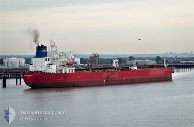
NAVE CASSIOPEIA
Crude Oil Tanker
Current Trip
| Time Travelled | 17 days |
|---|---|
| Remaining Time | 1 day |
| Distance Travelled | 5197.67 nm |
| Remaining Distance | 460.95 nm |
| AVG Speed | 12.4 Knop |
| MAX Speed | 16.6 Knop |
| AVG Wind | 12 knots |
| MAX Wind | 35 knots |
| MIN Temp | 16.7°C / 62.06°F |
| MAX Temp | 30.1°C / 86.18°F |
| Djupgående | 12.5 m |
| Position mottagen | 23 h, 39 m sen |
Current Position
| Longitud | 17.71229° |
|---|---|
| Latitude | -33.65689° |
| Status | Under way using engine |
| Fart | 12 Knop |
| Kurs | 298.1° |
| Område | South Atlantic Ocean |
| Station | T-AIS |
| Position mottagen | 23 h, 39 m sen |
Info
Information
The current position of NAVE CASSIOPEIA is in South Atlantic Ocean with coordinates -33.65689° / 17.71229° as reported on 2024-04-26 13:38 by AIS to our vessel tracker app. The vessel's current speed is 12 Knop and is heading at the port of WALVIS BAY. The estimated time of arrival as calculated by MyShipTracking vessel tracking app is 2024-04-29 05:20 LT
The vessel NAVE CASSIOPEIA (IMO: 9589932, MMSI: 636015776) is a Crude Oil Tanker that was built in 2012 ( 12 År gammal ). It's sailing under the flag of [LR] Liberia.
In this page you can find informations about the vessels current position, last detected port calls, and current voyage information. If the vessels is not in coverage by AIS you will find the latest position.
The current position of NAVE CASSIOPEIA is detected by our AIS receivers and we are not responsible for the reliability of the data. The last position was recorded while the vessel was in Coverage by the Ais receivers of our vessel tracking app.
The current draught of NAVE CASSIOPEIA as reported by AIS is 12.5 meters
Weather
| Temperature | 18.1°C / 64.58°F |
|---|---|
| Wind Speed | 11 knots |
| Direction | 292° WNW |
| Pressure | 1007.9 hPa |
| Humidity | 84 % |
| Cloud Coverage | --- |
Featured Company
Last Port Calls
| Port | Arrival | Departure | Time In Port |
|---|---|---|---|
| 2024-04-07 14:54 | 2024-04-10 05:27 | 2 d | |
| 2024-03-12 17:47 | 2024-03-14 09:29 | 1 d | |
| 2024-02-01 21:20 | 2024-02-02 18:22 | 21 h |
Last Trips
| Origin | Departure | Destination | Arrival | Distance | |
|---|---|---|---|---|---|
| 2024-03-14 16:29 | 2024-04-07 20:24 | 3888.35 nm | |||
| 2024-02-03 02:22 | 2024-03-13 00:47 | 9088.07 nm | |||
| 2024-01-20 16:08 | 2024-02-02 05:20 | 3574.86 nm |
Events
| Tid | Event | Detaljer | Position / Dest | Information |
|---|---|---|---|---|
| 2024-04-26 13:43 | Status ändrad | Default Under way using engine |
-33.64893 / 17.69076
NA WVB
|
Fart: 12 kn Kurs: 298.1° |
| 2024-04-26 13:38 | Status ändrad | Under way using engine Default |
-33.65689 / 17.71229
NA WVB
|
Fart: 12 kn Kurs: 291° |
| 2024-04-26 13:38 | UTANFÖR täckningsområde |
-33.65689 / 17.71229
South Atlantic Ocean
NA WVB
|
Fart: 12 kn Kurs: 298.1° |
|
| 2024-04-26 13:28 | Status ändrad | Default Under way using engine |
-33.67161 / 17.75059
NA WVB
|
Fart: 12.2 kn Kurs: 296.7° |
| 2024-04-26 13:21 | Status ändrad | Under way using engine Default |
-33.68063 / 17.77400
NA WVB
|
Fart: 12.3 kn Kurs: 298° |
| 2024-04-26 13:19 | Status ändrad | Default Under way using engine |
-33.68395 / 17.78227
NA WVB
|
Fart: 12 kn Kurs: 295.5° |
| 2024-04-26 12:53 | ETA ändrat | 2024/04/28 23:00 2024/04/28 10:00 |
-33.72308 / 17.88352
NA WVB
|
Fart: 12.5 kn Kurs: 294.6° |
| 2024-04-26 12:51 | Status ändrad | Under way using engine Default |
-33.72480 / 17.88799
NA WVB
|
Fart: 12.2 kn Kurs: 294° |
| 2024-04-26 12:43 | Status ändrad | Default Under way using engine |
-33.73686 / 17.91927
NA WVB
|
Fart: 12.1 kn Kurs: 293.6° |
| 2024-04-26 12:38 | Status ändrad | Under way using engine Default |
-33.74467 / 17.93853
NA WVB
|
Fart: 12.2 kn Kurs: 294° |