
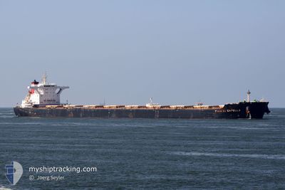
MSXT CAPELLA
Bulk Carrier
Current Trip
| Trip Time | 22 days |
|---|---|
| Trip Distance | 4413.28 nm |
| AVG Speed | 9.7 Knop |
| MAX Speed | 13.5 Knop |
| Djupgående | 18.3 m |
| AVG Wind | 9.9 knots |
| MAX Wind | 30.8 knots |
| MIN Temp | 17.8°C / 64.04°F |
| MAX Temp | 30.9°C / 87.62°F |
| Position mottagen | 6 d sen |
Current Position
| Longitud | 121.70711° |
|---|---|
| Latitude | 26.23661° |
| Status | Under way using engine |
| Fart | 10.5 Knop |
| Kurs | 35.7° |
| Område | Eastern China Sea |
| Station | T-AIS |
| Position mottagen | 6 d sen |
Info
Information
The current position of MSXT CAPELLA is in Eastern China Sea with coordinates 26.23661° / 121.70711° as reported on 2024-06-12 05:50 by AIS to our vessel tracker app. The vessel's current speed is 10.5 Knop and is currently inside the port of CAOFEIDIAN.
The vessel MSXT CAPELLA (IMO: 9603910, MMSI: 354326000) is a Bulk Carrier that was built in 2012 ( 12 År gammal ). It's sailing under the flag of [PA] Panama.
In this page you can find informations about the vessels current position, last detected port calls, and current voyage information. If the vessels is not in coverage by AIS you will find the latest position.
The current position of MSXT CAPELLA is detected by our AIS receivers and we are not responsible for the reliability of the data. The last position was recorded while the vessel was in Coverage by the Ais receivers of our vessel tracking app.
The current draught of MSXT CAPELLA as reported by AIS is 18.3 meters
Weather
| Temperature | 22.4°C / 72.32°F |
|---|---|
| Wind Speed | 14 knots |
| Direction | 185° S |
| Pressure | 1003.1 hPa |
| Humidity | 65.8 % |
| Cloud Coverage | 100 % |
Featured Company
Last Port Calls
| Port | Arrival | Departure | Time In Port |
|---|---|---|---|
| 2024-06-16 15:37 | |||
| 2024-05-19 07:20 | 2024-05-25 06:36 | 5 d | |
| 2024-04-10 04:20 | 2024-04-14 06:45 | 4 d |
Most Visited Ports (Last year)
| Port | Arrivals | |
|---|---|---|
| 2 | ||
| 2 | ||
| 2 | ||
| 2 | ||
| 1 | ||
| 1 |
Events
| Tid | Event | Detaljer | Position / Dest | Information |
|---|---|---|---|---|
| 2024-06-16 07:45 | STOPPAR förflyttning |
38.99513 / 118.45648
[CN] CAOFEIDIAN
|
Fart: 0.3 kn Kurs: 356° |
|
| 2024-06-16 07:37 | ANLÄNDER HAMN |
|
38.99496 / 118.45782
[CN] CAOFEIDIAN
|
Fart: 1.7 kn Kurs: 345° |
| 2024-06-12 05:55 | Status ändrad | Default Under way using engine |
26.24855 / 121.71667
HUANGHUA CN
|
Fart: 10.5 kn Kurs: 35.7° |
| 2024-06-12 05:50 | Status ändrad | Under way using engine Default |
26.23661 / 121.70711
HUANGHUA CN
|
Fart: 10 kn Kurs: 34° |
| 2024-06-12 05:50 | UTANFÖR täckningsområde |
26.23661 / 121.70711
Eastern China Sea
HUANGHUA CN
|
Fart: 10.5 kn Kurs: 35.7° |
|
| 2024-06-12 05:38 | I täckningsområde |
26.23661 / 121.70711
Eastern China Sea
HUANGHUA CN
|
Fart: 10.5 kn Kurs: 35.7° |
|
| 2024-06-12 03:44 | Status ändrad | Default Under way using engine |
25.94833 / 121.48116
HUANGHUA CN
|
Fart: 9.6 kn Kurs: 24.7° |
| 2024-06-12 03:35 | Byter havsområde | Taiwanese part of the Eastern China Sea Malaysian part of the South China Sea |
25.92526 / 121.47199
Eastern China Sea
HUANGHUA CN
|
Fart: 9.6 kn Kurs: 24.7° |
| 2024-06-12 03:35 | Status ändrad | Under way using engine Default |
25.92526 / 121.47199
HUANGHUA CN
|
Fart: 9.6 kn Kurs: 35° |
| 2024-06-12 03:35 | UTANFÖR täckningsområde |
25.92526 / 121.47199
Eastern China Sea
HUANGHUA CN
|
Fart: 9.6 kn Kurs: 24.7° |