
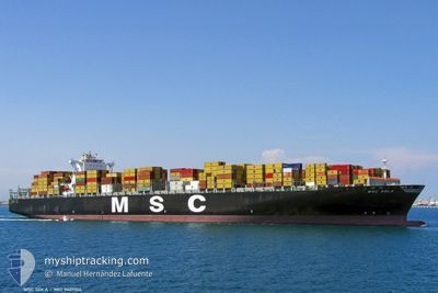
MSC SOLA
Container Ship
Current Trip
| Time Travelled | 18 h, 38 mins |
|---|---|
| Remaining Time | 1 day |
| Distance Travelled | 317.13 nm |
| Remaining Distance | 677.52 nm |
| AVG Speed | 17.7 Knop |
| MAX Speed | 19.4 Knop |
| AVG Wind | 16.2 knots |
| MAX Wind | 25 knots |
| MIN Temp | 26.8°C / 80.24°F |
| MAX Temp | 28.6°C / 83.48°F |
| Djupgående | 13.6 m |
| Position mottagen | 16 h, 32 m sen |
Current Position
| Longitud | --- |
|---|---|
| Latitude | --- |
| Status | Under way using engine |
| Fart | 18.9 Knop |
| Kurs | 49° |
| Område | Caribbean Sea |
| Station | T-AIS |
| Position mottagen | 16 h, 32 m sen |
Info
Information
The current position of MSC SOLA is in Caribbean Sea with coordinates 9.80483° / -79.60175° as reported on 2025-12-11 22:46 by AIS to our vessel tracker app. The vessel's current speed is 18.9 Knop and is heading at the port of BOCA CHIKA. The estimated time of arrival as calculated by MyShipTracking vessel tracking app is 2025-12-13 11:44 LT
The vessel MSC SOLA (IMO: 9401104, MMSI: 370894000) is a Container Ship that was built in 2008 ( 17 År gammal ). It's sailing under the flag of [PA] Panama.
In this page you can find informations about the vessels current position, last detected port calls, and current voyage information. If the vessels is not in coverage by AIS you will find the latest position.
The current position of MSC SOLA is detected by our AIS receivers and we are not responsible for the reliability of the data. The last position was recorded while the vessel was in Coverage by the Ais receivers of our vessel tracking app.
The current draught of MSC SOLA as reported by AIS is 13.6 meters
Weather
| Temperature | 27.2°C / 80.96°F |
|---|---|
| Wind Speed | 23 knots |
| Direction | 81° E |
| Pressure | 1012 hPa |
| Humidity | 79.7 % |
| Cloud Coverage | 4 % |
Featured Company
Last Port Calls
| Port | Arrival | Departure | Time In Port |
|---|---|---|---|
| 2025-12-09 12:05 | 2025-12-11 15:40 | 2 d | |
| 2025-12-06 10:31 | 2025-12-08 05:11 | 1 d | |
| 2025-11-14 13:03 | 2025-11-15 20:48 | 1 d | |
| 2025-11-10 13:52 | 2025-11-11 12:44 | 22 h | |
| 2025-11-03 02:07 | 2025-11-03 14:00 | 11 h | |
| 2025-10-25 10:24 | 2025-10-26 07:04 | 20 h |
Last Trips
| Origin | Departure | Destination | Arrival | Distance | |
|---|---|---|---|---|---|
| 2025-12-08 05:11 | 2025-12-09 12:05 | 57.41 nm | |||
| 2025-11-15 20:48 | 2025-12-06 10:31 | 8766.43 nm | |||
| 2025-11-11 12:44 | 2025-11-14 13:03 | 532.82 nm | |||
| 2025-11-03 14:00 | 2025-11-10 13:52 | 557.24 nm | |||
| 2025-10-26 07:04 | 2025-11-03 02:07 | 967.84 nm | |||
| 2025-09-24 03:26 | 2025-10-25 10:24 | 11514.89 nm |
Events
| Tid | Event | Detaljer | Position / Dest | Information |
|---|---|---|---|---|
| 2025-12-11 22:55 | Status ändrad | Default Under way using engine |
9.83555 / -79.56570
DOCAU
|
Fart: 18.9 kn Kurs: 49° |
| 2025-12-11 22:46 | UTANFÖR täckningsområde |
9.80483 / -79.60175
Caribbean Sea
|
Fart: 18.9 kn Kurs: 49° |
|
| 2025-12-11 21:28 | Djupgående ändrat | 13.6 14.9 |
9.48925 / -79.85918
DOCAU
|
Fart: 15.9 kn Kurs: 34° |
| 2025-12-11 21:28 | Destination ändrad | DOCAU PAROD |
9.48925 / -79.85918
DOCAU
|
Fart: 15.9 kn Kurs: 34° |
| 2025-12-11 20:40 | AVGÅTT HAMN |
|
9.35142 / -79.91798
PAROD
|
Fart: 4.9 kn Kurs: 318° |
| 2025-12-11 20:36 | STARTAR förflyttning |
9.34906 / -79.91364
[PA] CRISTOBAL
|
Fart: 3.1 kn Kurs: 292° |
|
| 2025-12-11 20:05 | Status ändrad | Under way using engine Moored |
9.35074 / -79.90842
[PA] CRISTOBAL
|
Fart: 0.8 kn Kurs: 97° |
| 2025-12-11 17:36 | Status ändrad | Moored Default |
9.35098 / -79.90751
[PA] CRISTOBAL
|
Fart: Kurs: 99° |
| 2025-12-11 17:33 | Status ändrad | Default Moored |
9.35097 / -79.90752
[PA] CRISTOBAL
|
Fart: Kurs: 99° |
| 2025-12-11 15:48 | Status ändrad | Moored Default |
9.35097 / -79.90751
[PA] CRISTOBAL
|
Fart: Kurs: 99° |