
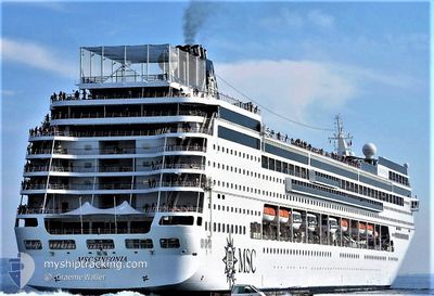
MSC SINFONIA
Passengers Ship
Current Trip
HRSPL
| Time Travelled | 16 h, 51 mins |
|---|---|
| Remaining Time | --- |
| Distance Travelled | 298.08 nm |
| Remaining Distance | --- |
| AVG Speed | 18 Knop |
| MAX Speed | 19.1 Knop |
| AVG Wind | 9.5 knots |
| MAX Wind | 23.6 knots |
| MIN Temp | 16.4°C / 61.52°F |
| MAX Temp | 20.9°C / 69.62°F |
| Djupgående | 6.6 m |
| Position mottagen | 1 m sen |
Current Position
| Longitud | 20.00918° |
|---|---|
| Latitude | 37.96980° |
| Status | Under way using engine |
| Fart | 17.6 Knop |
| Kurs | 336.5° |
| Område | Ionian Sea |
| Station | T-AIS |
| Position mottagen | 1 m sen |
Info
Information
The current position of MSC SINFONIA is in Ionian Sea with coordinates 37.96980° / 20.00918° as reported on 2024-05-10 06:57 by AIS to our vessel tracker app. The vessel's current speed is 17.6 Knop
The vessel MSC SINFONIA (IMO: 9210153, MMSI: 356716000) is a Passengers Ship that was built in 2002 ( 22 År gammal ). It's sailing under the flag of [PA] Panama.
In this page you can find informations about the vessels current position, last detected port calls, and current voyage information. If the vessels is not in coverage by AIS you will find the latest position.
The current position of MSC SINFONIA is detected by our AIS receivers and we are not responsible for the reliability of the data. The last position was recorded while the vessel was in Coverage by the Ais receivers of our vessel tracking app.
The current draught of MSC SINFONIA as reported by AIS is 6.6 meters
Weather
| Temperature | 18.4°C / 65.12°F |
|---|---|
| Wind Speed | 16 knots |
| Direction | 9° N |
| Pressure | 1009.8 hPa |
| Humidity | 75.9 % |
| Cloud Coverage | 93 % |
Featured Company
Last Port Calls
| Port | Arrival | Departure | Time In Port |
|---|---|---|---|
| 2024-05-09 01:29 | 2024-05-09 14:08 | 12 h | |
| 2024-05-06 12:52 | 2024-05-06 19:52 | 7 h | |
| 2024-05-05 04:00 | 2024-05-05 14:28 | 10 h | |
| 2024-05-02 01:35 | 2024-05-02 14:11 | 12 h | |
| 2024-05-01 17:04 | 2024-05-01 17:13 | 8 m | |
| 2024-05-01 05:11 | 2024-05-01 16:32 | 11 h | |
| 2024-04-29 12:52 | 2024-04-29 19:57 | 7 h | |
| 2024-04-28 04:05 | 2024-04-28 14:16 | 10 h | |
| 2024-04-25 01:33 | 2024-04-25 14:15 | 12 h | |
| 2024-04-24 04:42 | 2024-04-24 16:34 | 11 h |
Last Trips
| Origin | Departure | Destination | Arrival | Distance | |
|---|---|---|---|---|---|
| 2024-05-06 21:52 | 2024-05-09 04:29 | 635.11 nm | |||
| 2024-05-05 16:28 | 2024-05-06 14:52 | 398.81 nm | |||
| 2024-05-02 17:11 | 2024-05-05 06:00 | 915.10 nm | |||
| 2024-05-01 20:13 | 2024-05-02 04:35 | 108.28 nm | |||
| 2024-05-01 19:32 | 2024-05-01 20:04 | 0.19 nm | |||
| 2024-04-29 21:57 | 2024-05-01 08:11 | 524.03 nm | |||
| 2024-04-28 16:16 | 2024-04-29 14:52 | 396.63 nm | |||
| 2024-04-25 17:15 | 2024-04-28 06:05 | 915.48 nm | |||
| 2024-04-24 19:34 | 2024-04-25 04:33 | 107.49 nm | |||
| 2024-04-22 22:01 | 2024-04-24 07:42 | 521.24 nm |
Events
| Tid | Event | Detaljer | Position / Dest | Information |
|---|---|---|---|---|
| 2024-05-10 02:55 | Upptäckt i hav | Greek part of the Ionian Sea |
36.97992 / 20.85358
Ionian Sea
HRSPL
|
Fart: 17.7 kn Kurs: 321.4° |
| 2024-05-10 02:54 | Status ändrad | Under way using engine Default |
36.97452 / 20.85898
HRSPL
|
Fart: 17 kn Kurs: 320° |
| 2024-05-10 02:54 | I täckningsområde |
36.97992 / 20.85358
Ionian Sea
HRSPL
|
Fart: 17.7 kn Kurs: 321.4° |
|
| 2024-05-09 20:17 | Status ändrad | Default Under way using engine |
36.42375 / 22.99027
HRSPL
|
Fart: 18.5 kn Kurs: 288.7° |
| 2024-05-09 20:11 | UTANFÖR täckningsområde |
36.41422 / 23.02663
Mediterranean Sea - Eastern Basin
HRSPL
|
Fart: 18.5 kn Kurs: 288.7° |
|
| 2024-05-09 20:08 | Byter havsområde | Greek part of the Mediterranean Sea - Eastern Basin Greek part of the Aegean Sea |
36.40870 / 23.04723
Mediterranean Sea - Eastern Basin
HRSPL
|
Fart: 18.4 kn Kurs: 289.4° |
| 2024-05-09 19:54 | Status ändrad | Under way using engine Default |
36.39203 / 23.13335
HRSPL
|
Fart: 19 kn Kurs: 283° |
| 2024-05-09 19:44 | Status ändrad | Default Under way using engine |
36.38334 / 23.19333
HRSPL
|
Fart: 18.4 kn Kurs: 264.8° |
| 2024-05-09 14:08 | AVGÅTT HAMN |
|
37.93702 / 23.61873
HRSPL
|
Fart: 7.7 kn Kurs: 248° |
| 2024-05-09 13:57 | STARTAR förflyttning |
37.93988 / 23.63732
[GR] PIRAEUS
|
Fart: 4 kn Kurs: 183° |