
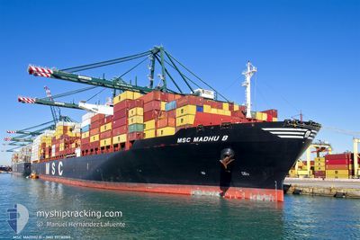
MSC MADHU B
Not available
Current Trip
| Time Travelled | 6 days |
|---|---|
| Remaining Time | 13 days |
| Distance Travelled | 2988.26 nm |
| Remaining Distance | 6043.82 nm |
| AVG Speed | 17.7 Knop |
| MAX Speed | 19.7 Knop |
| AVG Wind | 12.4 knots |
| MAX Wind | 21 knots |
| MIN Temp | 26.7°C / 80.06°F |
| MAX Temp | 30.3°C / 86.54°F |
| Djupgående | 14 m |
| Position mottagen | 5 d sen |
Current Position
| Longitud | 95.06274° |
|---|---|
| Latitude | 5.94670° |
| Status | Under way using engine |
| Fart | 17.2 Knop |
| Kurs | 261° |
| Område | Andaman or Burma Sea |
| Station | T-AIS |
| Position mottagen | 5 d sen |
Info
Information
The current position of MSC MADHU B is in Andaman or Burma Sea with coordinates 5.94670° / 95.06274° as reported on 2024-04-20 17:25 by AIS to our vessel tracker app. The vessel's current speed is 17.2 Knop and is heading at the port of SANTOS. The estimated time of arrival as calculated by MyShipTracking vessel tracking app is 2024-05-09 16:54 LT
The vessel MSC MADHU B (MMSI: 255806031) is a Not available It's sailing under the flag of [PT] Portugal.
In this page you can find informations about the vessels current position, last detected port calls, and current voyage information. If the vessels is not in coverage by AIS you will find the latest position.
The current position of MSC MADHU B is detected by our AIS receivers and we are not responsible for the reliability of the data. The last position was recorded while the vessel was in Coverage by the Ais receivers of our vessel tracking app.
The current draught of MSC MADHU B as reported by AIS is 14 meters
Weather
| Temperature | 26.8°C / 80.24°F |
|---|---|
| Wind Speed | 15 knots |
| Direction | 102° ESE |
| Pressure | 1013.9 hPa |
| Humidity | 76.6 % |
| Cloud Coverage | 1 % |
Featured Company
Last Port Calls
| Port | Arrival | Departure | Time In Port |
|---|---|---|---|
| 2024-04-16 23:28 | 2024-04-19 05:49 | 2 d | |
| 2024-04-06 03:51 | 2024-04-06 16:21 | 12 h | |
| 2024-03-24 22:49 | 2024-03-25 13:02 | 14 h | |
| 2024-03-18 18:07 | 2024-03-20 22:29 | 2 d | |
| 2024-03-18 01:44 | 2024-03-18 16:23 | 14 h | |
| 2024-02-19 08:41 | 2024-02-19 09:32 | 50 m | |
| 2024-02-10 18:35 | 2024-02-11 17:34 | 22 h | |
| 2024-02-06 03:19 | 2024-02-06 17:23 | 14 h |
Most Visited Ports (Last year)
| Port | Arrivals | |
|---|---|---|
| 10 | ||
| 6 | ||
| 5 | ||
| 5 | ||
| 3 | ||
| 3 |
Last Trips
| Origin | Departure | Destination | Arrival | Distance | |
|---|---|---|---|---|---|
| 2024-04-07 00:21 | 2024-04-17 07:28 | 1682.08 nm | |||
| 2024-03-25 21:02 | 2024-04-06 11:51 | 1834.50 nm | |||
| 2024-03-21 06:29 | 2024-03-25 06:49 | 1462.48 nm | |||
| 2024-03-19 00:23 | 2024-03-19 02:07 | 10.71 nm | |||
| 2024-02-19 06:32 | 2024-03-18 09:44 | 9053.55 nm | |||
| 2024-02-11 14:34 | 2024-02-19 05:41 | 886.49 nm | |||
| 2024-02-06 14:23 | 2024-02-10 15:35 | 264.17 nm | |||
| 2024-01-30 06:05 | 2024-02-06 00:19 | 1174.40 nm |
Events
| Tid | Event | Detaljer | Position / Dest | Information |
|---|---|---|---|---|
| 2024-04-20 17:43 | Status ändrad | Default Under way using engine |
5.93167 / 94.97833
SANTOS
|
Fart: 17.2 kn Kurs: 261° |
| 2024-04-20 17:25 | UTANFÖR täckningsområde |
5.94670 / 95.06274
Andaman or Burma Sea
|
Fart: 17.2 kn Kurs: 261° |
|
| 2024-04-20 16:20 | Djupgående ändrat | 14 14.4 |
5.98208 / 95.36901
SANTOS
|
Fart: 16.3 kn Kurs: 269° |
| 2024-04-20 15:54 | Upptäckt i hav | Indonesian part of the Andaman or Burma Sea |
5.96571 / 95.48932
Andaman or Burma Sea
SANTOS
|
Fart: 17.7 kn Kurs: 282° |
| 2024-04-20 15:54 | Status ändrad | Under way using engine Default |
5.96571 / 95.48932
SANTOS
|
Fart: 18 kn Kurs: 281° |
| 2024-04-20 15:49 | I täckningsområde |
5.96571 / 95.48932
Andaman or Burma Sea
SANTOS
|
Fart: 17.7 kn Kurs: 282° |
|
| 2024-04-19 07:24 | UTANFÖR täckningsområde |
1.21838 / 103.47870
Singapore Strait
SANTOS
|
Fart: 15.2 kn Kurs: 288° |
|
| 2024-04-19 06:58 | Byter havsområde | Malaysian part of the Singapore Strait Indonesian part of the Singapore Strait |
1.18979 / 103.57948
Singapore Strait
SANTOS
|
Fart: 14.1 kn Kurs: 281.1° |
| 2024-04-19 06:40 | Byter havsområde | Indonesian part of the Singapore Strait Singaporean part of the Singapore Strait |
1.19733 / 103.64381
Singapore Strait
SANTOS
|
Fart: 10.9 kn Kurs: 249.8° |
| 2024-04-19 05:51 | STARTAR förflyttning | 2.04 nm, North of BUKOM ISLAND |
1.27069 / 103.75652
SANTOS
|
Fart: 3.1 kn Kurs: 248° |