
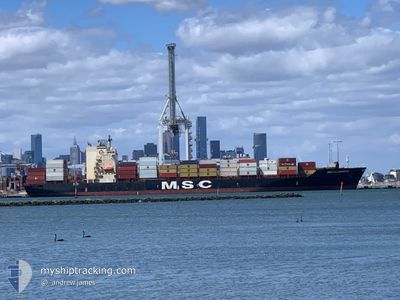
MSC ALABAMA III
Container Ship
Current Trip
| Time Travelled | 3 days |
|---|---|
| Remaining Time | 6 days |
| Distance Travelled | 430.06 nm |
| Remaining Distance | 1765.51 nm |
| AVG Speed | 9.2 Knop |
| MAX Speed | 12.1 Knop |
| AVG Wind | 6.3 knots |
| MAX Wind | 11.9 knots |
| MIN Temp | 27°C / 80.6°F |
| MAX Temp | 30.1°C / 86.18°F |
| Djupgående | 8 m |
| Position mottagen | 1 d sen |
Current Position
| Longitud | 104.31593° |
|---|---|
| Latitude | 1.28824° |
| Status | Under way using engine |
| Fart | 10.5 Knop |
| Kurs | 77.4° |
| Område | Singapore Strait |
| Station | T-AIS |
| Position mottagen | 1 d sen |
Info
Information
The current position of MSC ALABAMA III is in Singapore Strait with coordinates 1.28824° / 104.31593° as reported on 2024-05-09 08:55 by AIS to our vessel tracker app. The vessel's current speed is 10.5 Knop and is heading at the port of SHANGHAI. The estimated time of arrival as calculated by MyShipTracking vessel tracking app is 2024-05-16 23:22 LT
The vessel MSC ALABAMA III (IMO: 9123166, MMSI: 371602000) is a Container Ship that was built in 1996 ( 28 År gammal ). It's sailing under the flag of [PA] Panama.
In this page you can find informations about the vessels current position, last detected port calls, and current voyage information. If the vessels is not in coverage by AIS you will find the latest position.
The current position of MSC ALABAMA III is detected by our AIS receivers and we are not responsible for the reliability of the data. The last position was recorded while the vessel was in Coverage by the Ais receivers of our vessel tracking app.
The current draught of MSC ALABAMA III as reported by AIS is 8 meters
Weather
| Temperature | 29.5°C / 85.1°F |
|---|---|
| Wind Speed | 9 knots |
| Direction | 74° ENE |
| Pressure | 1009.5 hPa |
| Humidity | 71.8 % |
| Cloud Coverage | 85 % |
Featured Company
Most Visited Ports (Last year)
| Port | Arrivals | |
|---|---|---|
| 12 | ||
| 7 | ||
| 5 | ||
| 4 | ||
| 3 | ||
| 3 |
Events
| Tid | Event | Detaljer | Position / Dest | Information |
|---|---|---|---|---|
| 2024-05-09 08:58 | Status ändrad | Default Under way using engine |
1.29060 / 104.32478
SGSIN>CNSHA
|
Fart: 10.5 kn Kurs: 77.4° |
| 2024-05-09 08:55 | UTANFÖR täckningsområde |
1.28824 / 104.31593
Singapore Strait
SGSIN>CNSHA
|
Fart: 10.5 kn Kurs: 77.4° |
|
| 2024-05-09 07:46 | Byter havsområde | Malaysian part of the Singapore Strait Indonesian part of the Singapore Strait |
1.26545 / 104.11534
Singapore Strait
SGSIN>CNSHA
|
Fart: 10.1 kn Kurs: 84° |
| 2024-05-09 06:52 | Byter havsområde | Indonesian part of the Singapore Strait Singaporean part of the Singapore Strait |
1.23875 / 103.95795
Singapore Strait
SGSIN>CNSHA
|
Fart: 6.9 kn Kurs: 90.7° |
| 2024-05-09 06:17 | STARTAR förflyttning | 2.26 nm, East of SINGAPORE |
1.25505 / 103.89208
SGSIN>CNSHA
|
Fart: 3.2 kn Kurs: 111° |
| 2024-05-09 06:15 | ETA ändrat | 2024/05/17 21:00 2024/05/15 18:00 |
1.25485 / 103.89099
SGSIN>CNSHA
|
Fart: 1.6 kn Kurs: 81° |
| 2024-05-09 06:15 | Status ändrad | Under way using engine At anchor |
1.25475 / 103.89083
SGSIN>CNSHA
|
Fart: 0.2 kn Kurs: 48° |
| 2024-05-09 05:59 | Djupgående ändrat | 8 7.6 |
1.25521 / 103.89167
SGSIN>CNSHA
|
Fart: Kurs: 51° |
| 2024-05-09 05:55 | Djupgående ändrat | 7.6 7.8 |
1.25518 / 103.89161
SGSIN>CNSHA
|
Fart: 0.1 kn Kurs: 54° |
| 2024-05-08 06:30 | Status ändrad | At anchor Default |
1.25656 / 103.89137
SGSIN>CNSHA
|
Fart: Kurs: 96° |