
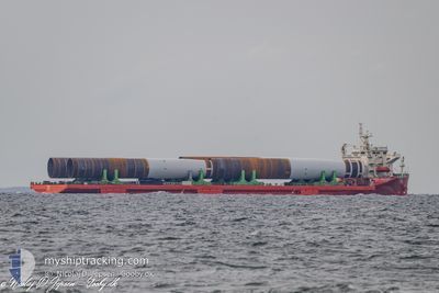
MEGA CARAVAN 2
Heavy Load Carrier
Current Trip
MUPLU
| Time Travelled | 2 days |
|---|---|
| Remaining Time | --- |
| Distance Travelled | 877.46 nm |
| Remaining Distance | --- |
| AVG Speed | 12.4 Knop |
| MAX Speed | 13.9 Knop |
| AVG Wind | 8.8 knots |
| MAX Wind | 15 knots |
| MIN Temp | 23.8°C / 74.84°F |
| MAX Temp | 27.2°C / 80.96°F |
| Djupgående | 5.4 m |
| Position mottagen | 3 d sen |
Current Position
| Longitud | --- |
|---|---|
| Latitude | --- |
| Status | At anchor |
| Fart | |
| Kurs | 354° |
| Område | Indian Ocean |
| Station | T-AIS |
| Position mottagen | 3 d sen |
Info
Information
The current position of MEGA CARAVAN 2 is in Indian Ocean with coordinates -20.14925° / 57.46088° as reported on 2025-12-05 11:26 by AIS to our vessel tracker app. The vessel's current speed is 0 Knop
The vessel MEGA CARAVAN 2 (IMO: 9586758, MMSI: 441946000) is a Heavy Load Carrier that was built in 2011 ( 14 År gammal ). It's sailing under the flag of [KR] Korea.
In this page you can find informations about the vessels current position, last detected port calls, and current voyage information. If the vessels is not in coverage by AIS you will find the latest position.
The current position of MEGA CARAVAN 2 is detected by our AIS receivers and we are not responsible for the reliability of the data. The last position was recorded while the vessel was in Coverage by the Ais receivers of our vessel tracking app.
The current draught of MEGA CARAVAN 2 as reported by AIS is 5.4 meters
Weather
| Temperature | 24.4°C / 75.92°F |
|---|---|
| Wind Speed | 9 knots |
| Direction | 124° SE |
| Pressure | 1014.6 hPa |
| Humidity | 79.2 % |
| Cloud Coverage | 97 % |
Featured Company
Last Port Calls
Most Visited Ports (Last year)
| Port | Arrivals | |
|---|---|---|
| 5 | ||
| 4 | ||
| 3 | ||
| 2 | ||
| 1 | ||
| 1 |
Last Trips
| Origin | Departure | Destination | Arrival | Distance | |
|---|---|---|---|---|---|
| 2025-11-20 16:07 | 2025-12-04 08:52 | 3389.80 nm | |||
| 2025-10-21 15:00 | 2025-10-22 10:21 | 56.36 nm | |||
| 2025-10-19 13:33 | 2025-10-19 14:05 | 1.15 nm | |||
| 2025-10-18 10:07 | 2025-10-18 10:51 | 0.61 nm | |||
| 2025-09-24 13:03 | 2025-10-05 15:52 | 2405.25 nm |
Events
| Tid | Event | Detaljer | Position / Dest | Information |
|---|---|---|---|---|
| 2025-12-05 13:24 | STARTAR förflyttning | 1.45 nm, West of PORT LOUIS |
-20.14053 / 57.45684
MUPLU
|
Fart: 8.2 kn Kurs: 301° |
| 2025-12-05 13:24 | AVGÅTT HAMN |
|
-20.14053 / 57.45684
MUPLU
|
Fart: 3.3 kn Kurs: 351° |
| 2025-12-05 11:32 | Status ändrad | Default At anchor |
-20.14922 / 57.46087
[MU] PORT LOUIS
|
Fart: Kurs: 354° |
| 2025-12-05 11:26 | UTANFÖR täckningsområde |
-20.14925 / 57.46088
Indian Ocean
[MU] PORT LOUIS
|
Fart: Kurs: 84.9° |
|
| 2025-12-05 11:20 | Status ändrad | At anchor Default |
-20.14922 / 57.46095
[MU] PORT LOUIS
|
Fart: Kurs: 356° |
| 2025-12-05 11:20 | I täckningsområde |
-20.14922 / 57.46095
Indian Ocean
[MU] PORT LOUIS
|
Fart: 0.1 kn Kurs: 84.9° |
|
| 2025-12-05 09:07 | Status ändrad | Default At anchor |
-20.14923 / 57.46073
[MU] PORT LOUIS
|
Fart: 0.1 kn Kurs: 6° |
| 2025-12-05 09:02 | UTANFÖR täckningsområde |
-20.14916 / 57.46077
Indian Ocean
[MU] PORT LOUIS
|
Fart: 0.1 kn Kurs: 309.6° |
|
| 2025-12-05 08:53 | Status ändrad | At anchor Default |
-20.14923 / 57.46086
[MU] PORT LOUIS
|
Fart: 0.2 kn Kurs: 349° |
| 2025-12-05 08:44 | I täckningsområde |
-20.14923 / 57.46086
Indian Ocean
[MU] PORT LOUIS
|
Fart: 0.1 kn Kurs: 89.3° |