
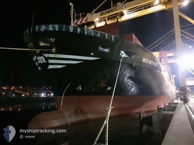
MED BEYKOZ
Container Ship
Current Trip
| Trip Time | 1 day |
|---|---|
| Trip Distance | 464.69 nm |
| AVG Speed | 12.4 Knop |
| MAX Speed | 15.3 Knop |
| Djupgående | 8 m |
| AVG Wind | 15.4 knots |
| MAX Wind | 27 knots |
| MIN Temp | 8.3°C / 46.94°F |
| MAX Temp | 19.1°C / 66.38°F |
| Position mottagen | 1 d sen |
Current Position
| Longitud | --- |
|---|---|
| Latitude | --- |
| Status | Under way using engine |
| Fart | 14.3 Knop |
| Kurs | 93.4° |
| Område | Mediterranean Sea - Eastern Basin |
| Station | T-AIS |
| Position mottagen | 1 d sen |
Info
Information
The current position of MED BEYKOZ is in Mediterranean Sea - Eastern Basin with coordinates 36.01617° / 29.67206° as reported on 2025-12-09 16:03 by AIS to our vessel tracker app. The vessel's current speed is 14.3 Knop and is currently inside the port of ANTALYA.
The vessel MED BEYKOZ (IMO: 9064748, MMSI: 271052890) is a Container Ship that was built in 1994 ( 31 År gammal ). It's sailing under the flag of [TR] Turkey.
In this page you can find informations about the vessels current position, last detected port calls, and current voyage information. If the vessels is not in coverage by AIS you will find the latest position.
The current position of MED BEYKOZ is detected by our AIS receivers and we are not responsible for the reliability of the data. The last position was recorded while the vessel was in Coverage by the Ais receivers of our vessel tracking app.
The current draught of MED BEYKOZ as reported by AIS is 8 meters
Weather
| Temperature | 9.9°C / 49.82°F |
|---|---|
| Wind Speed | 4 knots |
| Direction | 280° W |
| Pressure | 1015.3 hPa |
| Humidity | 55.7 % |
| Cloud Coverage | 100 % |
Featured Company
Last Port Calls
| Port | Arrival | Departure | Time In Port |
|---|---|---|---|
| 2025-12-10 02:13 | |||
| 2025-12-07 10:14 | 2025-12-08 14:16 | 1 d | |
| 2025-12-05 03:48 | 2025-12-06 15:44 | 1 d | |
| 2025-12-03 00:17 | 2025-12-03 12:49 | 12 h | |
| 2025-11-30 01:33 | 2025-12-01 10:52 | 1 d | |
| 2025-11-27 07:29 | 2025-11-28 09:00 | 1 d | |
| 2025-11-25 06:22 | 2025-11-26 11:42 | 1 d | |
| 2025-11-21 19:16 | 2025-11-23 10:00 | 1 d | |
| 2025-11-19 18:39 | 2025-11-20 05:48 | 11 h | |
| 2025-11-16 10:00 | 2025-11-18 22:27 | 2 d |
Last Trips
| Origin | Departure | Destination | Arrival | Distance | |
|---|---|---|---|---|---|
| 2025-12-08 14:16 | 2025-12-10 02:13 | 464.69 nm | |||
| 2025-12-06 15:44 | 2025-12-07 10:14 | 227.73 nm | |||
| 2025-12-03 12:49 | 2025-12-05 03:48 | 218.46 nm | |||
| 2025-12-01 10:52 | 2025-12-03 00:17 | 450.02 nm | |||
| 2025-11-28 09:00 | 2025-11-30 01:33 | 463.18 nm | |||
| 2025-11-26 11:42 | 2025-11-27 07:29 | 228.92 nm | |||
| 2025-11-23 10:00 | 2025-11-25 06:22 | 587.29 nm | |||
| 2025-11-20 05:48 | 2025-11-21 19:16 | 464.93 nm | |||
| 2025-11-18 22:27 | 2025-11-19 18:39 | 229.17 nm | |||
| 2025-11-12 10:12 | 2025-11-16 10:00 | 5.54 nm |
Events
| Tid | Event | Detaljer | Position / Dest | Information |
|---|---|---|---|---|
| 2025-12-09 23:32 | STOPPAR förflyttning |
36.83591 / 30.61122
[TR] ANTALYA
|
Fart: 0.3 kn Kurs: 30° |
|
| 2025-12-09 23:13 | ANLÄNDER HAMN |
|
36.83592 / 30.61561
[TR] ANTALYA
|
Fart: 6.7 kn Kurs: 237° |
| 2025-12-09 16:03 | UTANFÖR täckningsområde |
36.01617 / 29.67206
Mediterranean Sea - Eastern Basin
TRAYT
|
Fart: 14.3 kn Kurs: 93.4° |
|
| 2025-12-09 16:03 | Byter havsområde | Turkish part of the Mediterranean Sea - Eastern Basin Greek part of the Mediterranean Sea - Eastern Basin |
36.01617 / 29.67206
Mediterranean Sea - Eastern Basin
TRAYT
|
Fart: 14.3 kn Kurs: 93.4° |
| 2025-12-09 15:46 | Byter havsområde | Greek part of the Mediterranean Sea - Eastern Basin Turkish part of the Mediterranean Sea - Eastern Basin |
36.01904 / 29.58786
Mediterranean Sea - Eastern Basin
TRAYT
|
Fart: 14.6 kn Kurs: 87.9° |
| 2025-12-09 15:44 | I täckningsområde |
36.01904 / 29.58786
Mediterranean Sea - Eastern Basin
TRAYT
|
Fart: 14.6 kn Kurs: 87.9° |
|
| 2025-12-09 13:26 | Status ändrad | Default Under way using engine |
36.22167 / 28.96333
TRAYT
|
Fart: 13 kn Kurs: 114.1° |
| 2025-12-09 13:23 | UTANFÖR täckningsområde |
36.22661 / 28.95015
Mediterranean Sea - Eastern Basin
TRAYT
|
Fart: 13 kn Kurs: 114.1° |
|
| 2025-12-09 11:47 | Byter havsområde | Turkish part of the Mediterranean Sea - Eastern Basin Greek part of the Mediterranean Sea - Eastern Basin |
36.36962 / 28.59709
Mediterranean Sea - Eastern Basin
TRAYT
|
Fart: 12.5 kn Kurs: 113.4° |
| 2025-12-09 10:17 | Byter havsområde | Greek part of the Mediterranean Sea - Eastern Basin Greek part of the Aegean Sea |
36.50216 / 28.25469
Mediterranean Sea - Eastern Basin
TRAYT
|
Fart: 12 kn Kurs: 103.5° |