
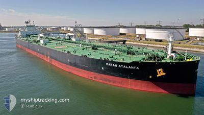
MARAN ATALANTA
Tanker
Current Trip
| Time Travelled | --- |
|---|---|
| Remaining Time | 3 h, 21 mins |
| Distance Travelled | 13954.39 nm |
| Remaining Distance | 33.45 nm |
| AVG Speed | 11.8 Knop |
| MAX Speed | 15.2 Knop |
| AVG Wind | 11.5 knots |
| MAX Wind | 33 knots |
| MIN Temp | 17.3°C / 63.14°F |
| MAX Temp | 29.7°C / 85.46°F |
| Djupgående | 20 m |
| Position mottagen | 14 h, 54 m sen |
Current Position
| Longitud | 123.24153° |
|---|---|
| Latitude | 37.00751° |
| Status | Under way using engine |
| Fart | 10.4 Knop |
| Kurs | 4.7° |
| Område | Yellow Sea |
| Station | T-AIS |
| Position mottagen | 14 h, 54 m sen |
Info
Information
The current position of MARAN ATALANTA is in Yellow Sea with coordinates 37.00751° / 123.24153° as reported on 2024-05-09 15:18 by AIS to our vessel tracker app. The vessel's current speed is 10.4 Knop and is heading at the port of YANTAI. The estimated time of arrival as calculated by MyShipTracking vessel tracking app is 2024-05-10 09:33 LT
The vessel MARAN ATALANTA (IMO: 9810393, MMSI: 241577000) is a Tanker It's sailing under the flag of [GR] Greece.
In this page you can find informations about the vessels current position, last detected port calls, and current voyage information. If the vessels is not in coverage by AIS you will find the latest position.
The current position of MARAN ATALANTA is detected by our AIS receivers and we are not responsible for the reliability of the data. The last position was recorded while the vessel was in Coverage by the Ais receivers of our vessel tracking app.
The current draught of MARAN ATALANTA as reported by AIS is 20 meters
Weather
| Temperature | 16.8°C / 62.24°F |
|---|---|
| Wind Speed | 20 knots |
| Direction | 167° SSE |
| Pressure | 1008.1 hPa |
| Humidity | 63.4 % |
| Cloud Coverage | 59 % |
Featured Company
Last Port Calls
Last Trips
| Origin | Departure | Destination | Arrival | Distance |
|---|
Events
| Tid | Event | Detaljer | Position / Dest | Information |
|---|---|---|---|---|
| 2024-05-09 15:24 | Status ändrad | Default Under way using engine |
37.02707 / 123.24354
CNYTG
|
Fart: 10.4 kn Kurs: 4.7° |
| 2024-05-09 15:18 | UTANFÖR täckningsområde |
37.00751 / 123.24153
Yellow Sea
CNYTG
|
Fart: 10.4 kn Kurs: 4.7° |
|
| 2024-05-09 15:17 | Status ändrad | Under way using engine Default |
37.00649 / 123.24143
CNYTG
|
Fart: 10.4 kn Kurs: 5° |
| 2024-05-09 14:53 | Status ändrad | Default Under way using engine |
36.93573 / 123.23452
CNYTG
|
Fart: 10.3 kn Kurs: 4° |
| 2024-05-09 14:48 | Status ändrad | Under way using engine Default |
36.92185 / 123.23326
CNYTG
|
Fart: 10.3 kn Kurs: 4° |
| 2024-05-09 14:44 | Status ändrad | Default Under way using engine |
36.91225 / 123.23239
CNYTG
|
Fart: 10.3 kn Kurs: 3.9° |
| 2024-05-09 14:24 | Status ändrad | Under way using engine Default |
36.85362 / 123.22692
CNYTG
|
Fart: 10.5 kn Kurs: 4° |
| 2024-05-09 13:40 | Status ändrad | Default Under way using engine |
36.72639 / 123.21770
CNYTG
|
Fart: 10.4 kn Kurs: 0.6° |
| 2024-05-09 13:29 | Status ändrad | Under way using engine Default |
36.69494 / 123.21692
CNYTG
|
Fart: 10.4 kn Kurs: 1° |
| 2024-05-09 13:28 | Status ändrad | Default Under way using engine |
36.69208 / 123.21687
CNYTG
|
Fart: 10.4 kn Kurs: 1.5° |