
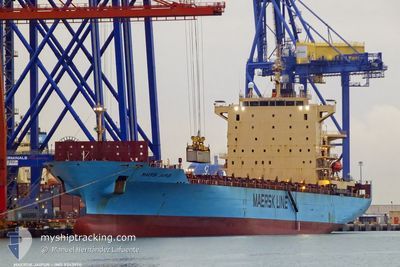
MAERSK JAIPUR
Container Ship
Current Trip
PAMIT
| Time Travelled | 7 days |
|---|---|
| Remaining Time | --- |
| Distance Travelled | 3346.31 nm |
| Remaining Distance | --- |
| AVG Speed | 17.9 Knop |
| MAX Speed | 20.6 Knop |
| AVG Wind | 12.4 knots |
| MAX Wind | 18 knots |
| MIN Temp | 24.3°C / 75.74°F |
| MAX Temp | 30.2°C / 86.36°F |
| Djupgående | 10.5 m |
| Position mottagen | 7 d sen |
Current Position
| Longitud | --- |
|---|---|
| Latitude | --- |
| Status | Under way using engine |
| Fart | 17.6 Knop |
| Kurs | 83.6° |
| Område | South Atlantic Ocean |
| Station | T-AIS |
| Position mottagen | 7 d sen |
Info
Information
The current position of MAERSK JAIPUR is in South Atlantic Ocean with coordinates -23.95610° / -42.55174° as reported on 2025-12-28 05:14 by AIS to our vessel tracker app. The vessel's current speed is 17.6 Knop
The vessel MAERSK JAIPUR (IMO: 9343974, MMSI: 248207000) is a Container Ship that was built in 2008 ( 18 År gammal ). It's sailing under the flag of [MT] Malta.
In this page you can find informations about the vessels current position, last detected port calls, and current voyage information. If the vessels is not in coverage by AIS you will find the latest position.
The current position of MAERSK JAIPUR is detected by our AIS receivers and we are not responsible for the reliability of the data. The last position was recorded while the vessel was in Coverage by the Ais receivers of our vessel tracking app.
The current draught of MAERSK JAIPUR as reported by AIS is 10.5 meters
Weather
| Temperature | 26.3°C / 79.34°F |
|---|---|
| Wind Speed | 12 knots |
| Direction | 88° E |
| Pressure | 1013 hPa |
| Humidity | 71.9 % |
| Cloud Coverage | 88 % |
Featured Company
Last Port Calls
| Port | Arrival | Departure | Time In Port |
|---|---|---|---|
| 2025-12-26 20:29 | 2025-12-27 13:12 | 16 h | |
| 2025-12-23 08:47 | 2025-12-24 00:07 | 15 h | |
| 2025-12-11 08:18 | 2025-12-11 19:49 | 11 h | |
| 2025-11-28 12:17 | 2025-11-29 07:34 | 19 h | |
| 2025-11-25 08:16 | 2025-11-25 18:58 | 10 h | |
| 2025-11-12 17:28 | 2025-11-13 15:30 | 22 h |
Last Trips
| Origin | Departure | Destination | Arrival | Distance | |
|---|---|---|---|---|---|
| 2025-12-24 00:07 | 2025-12-26 20:29 | 206.81 nm | |||
| 2025-12-11 19:49 | 2025-12-23 08:47 | 4720.91 nm | |||
| 2025-11-29 07:34 | 2025-12-11 08:18 | 4638.21 nm | |||
| 2025-11-25 18:58 | 2025-11-28 12:17 | 198.24 nm | |||
| 2025-11-13 15:30 | 2025-11-25 08:16 | 4767.58 nm | |||
| 2025-10-31 15:13 | 2025-11-12 17:28 | 4621.61 nm |
Events
| Tid | Event | Detaljer | Position / Dest | Information |
|---|---|---|---|---|
| 2025-12-28 05:20 | Status ändrad | Default Under way using engine |
-23.95167 / -42.51735
PAMIT
|
Fart: 17.6 kn Kurs: 83.6° |
| 2025-12-28 05:14 | UTANFÖR täckningsområde |
-23.95610 / -42.55174
South Atlantic Ocean
PAMIT
|
Fart: 17.6 kn Kurs: 83.6° |
|
| 2025-12-28 05:07 | Djupgående ändrat | 10.5 11.7 |
-23.96146 / -42.59414
PAMIT
|
Fart: 17.6 kn Kurs: 81.1° |
| 2025-12-28 05:07 | ETA ändrat | 2026/01/07 21:00 2025/10/15 23:00 |
-23.96146 / -42.59414
PAMIT
|
Fart: 17.6 kn Kurs: 81.1° |
| 2025-12-28 05:06 | Status ändrad | Under way using engine Default |
-23.96146 / -42.59414
PAMIT
|
Fart: 17.6 kn Kurs: 82° |
| 2025-12-28 04:54 | Status ändrad | Default Under way using engine |
-23.96833 / -42.65500
PAMIT
|
Fart: 17.2 kn Kurs: 81.3° |
| 2025-12-28 04:51 | Status ändrad | Under way using engine Default |
-23.97165 / -42.67036
PAMIT
|
Fart: 17 kn Kurs: 82° |
| 2025-12-28 04:39 | I täckningsområde |
-23.97165 / -42.67036
South Atlantic Ocean
|
Fart: 17.2 kn Kurs: 81.3° |
|
| 2025-12-27 16:12 | AVGÅTT HAMN |
|
-24.00631 / -46.33688
PAMIT
|
Fart: 9.1 kn Kurs: 206° |
| 2025-12-27 15:24 | STARTAR förflyttning |
-23.92889 / -46.31740
[BR] SANTOS
|
Fart: 5.4 kn Kurs: 122° |