
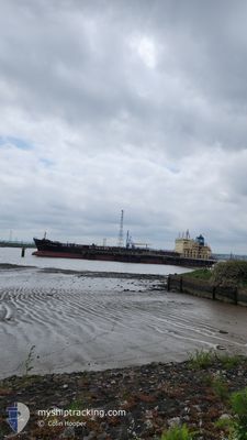
MAERSK BERING
Oil/Chemical Tanker
Current Trip
| Time Travelled | 7 days |
|---|---|
| Remaining Time | --- |
| Distance Travelled | 1021.03 nm |
| Remaining Distance | --- |
| AVG Speed | 10.9 Knop |
| MAX Speed | 14.8 Knop |
| AVG Wind | 9 knots |
| MAX Wind | 18.4 knots |
| MIN Temp | 28.2°C / 82.76°F |
| MAX Temp | 37.1°C / 98.78°F |
| Djupgående | 8.8 m |
| Position mottagen | 1 m sen |
Current Position
| Longitud | 55.34739° |
|---|---|
| Latitude | 25.55342° |
| Status | At anchor |
| Fart | |
| Kurs | 46° |
| Område | Persian Gulf |
| Station | T-AIS |
| Position mottagen | 1 m sen |
Info
Information
The current position of MAERSK BERING is in Persian Gulf with coordinates 25.55342° / 55.34739° as reported on 2024-05-27 15:38 by AIS to our vessel tracker app. The vessel's current speed is 0 Knop
The vessel MAERSK BERING (IMO: 9299422, MMSI: 563654000) is a Oil/Chemical Tanker that was built in 2005 ( 19 År gammal ). It's sailing under the flag of [SG] Singapore.
In this page you can find informations about the vessels current position, last detected port calls, and current voyage information. If the vessels is not in coverage by AIS you will find the latest position.
The current position of MAERSK BERING is detected by our AIS receivers and we are not responsible for the reliability of the data. The last position was recorded while the vessel was in Coverage by the Ais receivers of our vessel tracking app.
The current draught of MAERSK BERING as reported by AIS is 8.8 meters
Weather
| Temperature | 32.1°C / 89.78°F |
|---|---|
| Wind Speed | 12 knots |
| Direction | 307° NW |
| Pressure | 1001 hPa |
| Humidity | 70.6 % |
| Cloud Coverage | --- |
Featured Company
Last Port Calls
| Port | Arrival | Departure | Time In Port |
|---|---|---|---|
| 2024-05-19 16:00 | 2024-05-20 15:10 | 23 h | |
| 2024-03-24 08:07 | 2024-03-27 17:11 | 3 d | |
| 2024-03-18 02:00 | 2024-03-20 12:02 | 2 d | |
| 2024-03-08 03:21 | 2024-03-09 15:10 | 1 d | |
| 2024-03-01 19:30 |
Most Visited Ports (Last year)
| Port | Arrivals | |
|---|---|---|
| 2 | ||
| 2 | ||
| 2 | ||
| 2 | ||
| 1 | ||
| 1 |
Last Trips
| Origin | Departure | Destination | Arrival | Distance | |
|---|---|---|---|---|---|
| 2024-03-27 12:11 | 2024-05-19 21:30 | 11794.15 nm | |||
| 2024-03-20 08:02 | 2024-03-24 03:07 | 1050.83 nm | |||
| 2024-03-09 10:10 | 2024-03-17 22:00 | 507.59 nm | |||
| 2024-02-17 11:39 | 2024-03-01 15:30 | 1644.03 nm |
Events
| Tid | Event | Detaljer | Position / Dest | Information |
|---|---|---|---|---|
| 2024-05-27 15:26 | Status ändrad | At anchor Default |
25.55347 / 55.34732
AE HAM
|
Fart: Kurs: 45° |
| 2024-05-27 15:17 | Status ändrad | Default At anchor |
25.55349 / 55.34736
AE HAM
|
Fart: Kurs: 45° |
| 2024-05-27 14:35 | Status ändrad | At anchor Default |
25.55356 / 55.34728
AE HAM
|
Fart: Kurs: 31° |
| 2024-05-27 14:26 | Status ändrad | Default At anchor |
25.55340 / 55.34740
AE HAM
|
Fart: Kurs: 31° |
| 2024-05-27 07:56 | Status ändrad | At anchor Default |
25.55532 / 55.35014
AE HAM
|
Fart: Kurs: 246° |
| 2024-05-27 07:44 | Status ändrad | Default At anchor |
25.55541 / 55.35009
AE HAM
|
Fart: Kurs: 246° |
| 2024-05-27 07:05 | Status ändrad | At anchor Default |
25.55563 / 55.34979
AE HAM
|
Fart: Kurs: 235° |
| 2024-05-27 06:41 | Status ändrad | Default At anchor |
25.55590 / 55.34957
AE HAM
|
Fart: Kurs: 226° |
| 2024-05-27 06:26 | Status ändrad | At anchor Default |
25.55583 / 55.34963
AE HAM
|
Fart: Kurs: 227° |
| 2024-05-27 06:08 | Status ändrad | Default At anchor |
25.55587 / 55.34960
AE HAM
|
Fart: Kurs: 227° |