
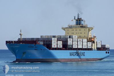
MAERSK BALI
Container Ship
Current Trip
| Time Travelled | 6 h, 43 mins |
|---|---|
| Remaining Time | --- |
| Distance Travelled | 15.31 nm |
| Remaining Distance | --- |
| AVG Speed | 7.8 Knop |
| MAX Speed | 10.5 Knop |
| AVG Wind | 7.5 knots |
| MAX Wind | 9.8 knots |
| MIN Temp | 24.8°C / 76.64°F |
| MAX Temp | 26.7°C / 80.06°F |
| Djupgående | 9.7 m |
| Position mottagen | 1 h, 6 m sen |
Current Position
| Longitud | -79.58326° |
|---|---|
| Latitude | 8.81738° |
| Status | At anchor |
| Fart | |
| Kurs | 286° |
| Område | North Pacific Ocean |
| Station | T-AIS |
| Position mottagen | 1 h, 6 m sen |
Info
Information
The current position of MAERSK BALI is in North Pacific Ocean with coordinates 8.81738° / -79.58326° as reported on 2024-04-28 10:27 by AIS to our vessel tracker app. The vessel's current speed is 0 Knop
The vessel MAERSK BALI (IMO: 9394870, MMSI: 563102000) is a Container Ship that was built in 2008 ( 16 År gammal ). It's sailing under the flag of [SG] Singapore.
In this page you can find informations about the vessels current position, last detected port calls, and current voyage information. If the vessels is not in coverage by AIS you will find the latest position.
The current position of MAERSK BALI is detected by our AIS receivers and we are not responsible for the reliability of the data. The last position was recorded while the vessel was in Coverage by the Ais receivers of our vessel tracking app.
The current draught of MAERSK BALI as reported by AIS is 9.7 meters
Weather
| Temperature | 26.1°C / 78.98°F |
|---|---|
| Wind Speed | 8 knots |
| Direction | 308° NW |
| Pressure | 1009.6 hPa |
| Humidity | 85.9 % |
| Cloud Coverage | 70 % |
Featured Company
Last Port Calls
| Port | Arrival | Departure | Time In Port |
|---|---|---|---|
| 2024-04-26 20:42 | 2024-04-28 04:50 | 1 d | |
| 2024-04-09 21:18 | 2024-04-10 17:18 | 20 h | |
| 2024-04-04 16:15 | 2024-04-05 17:17 | 1 d | |
| 2024-03-28 16:13 | 2024-03-30 03:33 | 1 d | |
| 2024-03-26 09:36 | 2024-03-27 06:18 | 20 h | |
| 2024-03-20 23:20 | 2024-03-21 17:57 | 18 h | |
| 2024-03-03 02:24 | 2024-03-05 13:39 | 2 d | |
| 2024-02-13 22:57 | 2024-02-14 18:42 | 19 h | |
| 2024-02-09 19:48 | 2024-02-11 17:38 | 1 d | |
| 2024-02-03 20:05 | 2024-02-04 13:46 | 17 h |
Last Trips
| Origin | Departure | Destination | Arrival | Distance | |
|---|---|---|---|---|---|
| 2024-04-11 05:18 | 2024-04-26 15:42 | 6496.29 nm | |||
| 2024-04-06 06:17 | 2024-04-10 09:18 | 819.03 nm | |||
| 2024-03-30 14:33 | 2024-04-05 05:15 | 1411.55 nm | |||
| 2024-03-27 17:18 | 2024-03-29 03:13 | 596.54 nm | |||
| 2024-03-22 06:57 | 2024-03-26 20:36 | 1388.68 nm | |||
| 2024-03-05 08:39 | 2024-03-21 12:20 | 6507.72 nm | |||
| 2024-02-15 07:42 | 2024-03-02 21:24 | 6520.98 nm | |||
| 2024-02-12 06:38 | 2024-02-14 11:57 | 783.05 nm | |||
| 2024-02-04 23:46 | 2024-02-10 08:48 | 1716.47 nm | |||
| 2024-02-01 07:45 | 2024-02-04 06:05 | 1139.46 nm |
Events
| Tid | Event | Detaljer | Position / Dest | Information |
|---|---|---|---|---|
| 2024-04-28 10:33 | Status ändrad | Default At anchor |
8.81736 / -79.58329
PABLB>PABLB
|
Fart: Kurs: 286° |
| 2024-04-28 10:27 | Status ändrad | At anchor Default |
8.81738 / -79.58326
PABLB>PABLB
|
Fart: Kurs: 286° |
| 2024-04-28 10:27 | UTANFÖR täckningsområde |
8.81738 / -79.58326
North Pacific Ocean
|
Fart: Kurs: 301.7° |
|
| 2024-04-28 10:14 | I täckningsområde |
8.81738 / -79.58326
North Pacific Ocean
|
Fart: Kurs: 301.7° |
|
| 2024-04-28 06:26 | STOPPAR förflyttning | 2.06 nm, North West of TABOGA |
8.81833 / -79.58167
PABLB>PABLB
|
Fart: Kurs: -1° |
| 2024-04-28 05:39 | Status ändrad | Default Under way using engine |
8.84525 / -79.50832
PABLB>PABLB
|
Fart: 7.3 kn Kurs: 196.2° |
| 2024-04-28 05:30 | UTANFÖR täckningsområde |
8.85518 / -79.49838
North Pacific Ocean
PABLB>PABLB
|
Fart: 7.3 kn Kurs: 196.2° |
|
| 2024-04-28 05:29 | Status ändrad | Under way using engine Default |
8.85914 / -79.49859
PABLB>PABLB
|
Fart: 10.8 kn Kurs: 141° |
| 2024-04-28 05:18 | Status ändrad | Default Under way using engine |
8.88274 / -79.51702
PABLB>PABLB
|
Fart: 7.3 kn Kurs: 140.9° |
| 2024-04-28 05:11 | Status ändrad | Under way using engine Default |
8.89538 / -79.52738
PABLB>PABLB
|
Fart: 7.9 kn Kurs: 141° |