
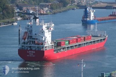
LOVISA
Cargo
Current Trip
FITOR
| Time Travelled | 4 h, 5 mins |
|---|---|
| Remaining Time | --- |
| Distance Travelled | 51.79 nm |
| Remaining Distance | --- |
| AVG Speed | 13.7 Knop |
| MAX Speed | 14.2 Knop |
| AVG Wind | 6.9 knots |
| MAX Wind | 9 knots |
| MIN Temp | -1.7°C / 28.94°F |
| MAX Temp | 0.3°C / 32.54°F |
| Djupgående | 6.7 m |
| Position mottagen | 4 d sen |
Current Position
| Longitud | --- |
|---|---|
| Latitude | --- |
| Status | Under way using engine |
| Fart | 12.7 Knop |
| Kurs | 13.4° |
| Område | Gulf of Bothnia |
| Station | T-AIS |
| Position mottagen | 4 d sen |
Info
Information
The current position of LOVISA is in Gulf of Bothnia with coordinates 60.50968° / 19.07147° as reported on 2025-12-01 03:04 by AIS to our vessel tracker app. The vessel's current speed is 12.7 Knop
The vessel LOVISA (IMO: 9957397, MMSI: 230712000) is a Cargo It's sailing under the flag of [FI] Finland.
In this page you can find informations about the vessels current position, last detected port calls, and current voyage information. If the vessels is not in coverage by AIS you will find the latest position.
The current position of LOVISA is detected by our AIS receivers and we are not responsible for the reliability of the data. The last position was recorded while the vessel was in Coverage by the Ais receivers of our vessel tracking app.
The current draught of LOVISA as reported by AIS is 6.7 meters
Weather
| Temperature | -0.7°C / 30.74°F |
|---|---|
| Wind Speed | 9 knots |
| Direction | 322° NW |
| Pressure | 1021.5 hPa |
| Humidity | 86.6 % |
| Cloud Coverage | 100 % |
Featured Company
Last Port Calls
| Port | Arrival | Departure | Time In Port |
|---|---|---|---|
| 2025-12-02 11:13 | 2025-12-05 16:29 | 3 d | |
| 2025-11-26 03:30 | 2025-11-27 20:47 | 1 d | |
| 2025-11-25 02:58 | 2025-11-25 18:37 | 15 h | |
| 2025-11-25 02:23 | 2025-11-25 02:37 | 14 m | |
| 2025-11-17 10:36 | 2025-11-19 22:12 | 2 d | |
| 2025-11-11 01:54 | 2025-11-12 17:22 | 1 d | |
| 2025-11-09 20:49 | 2025-11-10 17:11 | 20 h | |
| 2025-11-09 19:25 | 2025-11-09 20:30 | 1 h | |
| 2025-10-30 05:28 | 2025-11-04 22:52 | 5 d | |
| 2025-10-26 02:01 | 2025-10-26 02:03 | 2 m |
Last Trips
| Origin | Departure | Destination | Arrival | Distance | |
|---|---|---|---|---|---|
| 2025-11-27 20:47 | 2025-12-02 11:13 | 1278.69 nm | |||
| 2025-11-25 18:37 | 2025-11-26 03:30 | 100.28 nm | |||
| 2025-11-25 02:37 | 2025-11-25 02:58 | 0.29 nm | |||
| 2025-11-19 22:12 | 2025-11-25 02:23 | 1305.60 nm | |||
| 2025-11-12 17:22 | 2025-11-17 10:36 | 1469.34 nm | |||
| 2025-11-10 17:11 | 2025-11-11 01:54 | 100.82 nm | |||
| 2025-11-09 20:30 | 2025-11-09 20:49 | 0.33 nm | |||
| 2025-11-04 22:52 | 2025-11-09 19:25 | 1491.23 nm | |||
| 2025-10-26 02:03 | 2025-10-30 05:28 | 939.51 nm | |||
| 2025-10-24 17:33 | 2025-10-26 02:01 | 339.70 nm |
Events
| Tid | Event | Detaljer | Position / Dest | Information |
|---|---|---|---|---|
| 2025-12-05 14:29 | AVGÅTT HAMN |
|
65.74004 / 24.15965
FITOR
|
Fart: 6 kn Kurs: 170° |
| 2025-12-05 14:25 | STARTAR förflyttning |
65.74840 / 24.15556
[FI] ROYTTA
|
Fart: 6 kn Kurs: 170° |
|
| 2025-12-02 09:13 | STOPPAR förflyttning |
65.75311 / 24.16007
[FI] ROYTTA
|
Fart: 0.3 kn Kurs: 55° |
|
| 2025-12-02 09:13 | ANLÄNDER HAMN |
|
65.75311 / 24.16007
[FI] ROYTTA
|
Fart: 3.4 kn Kurs: 14° |
| 2025-12-01 03:09 | Status ändrad | Default Under way using engine |
60.52812 / 19.08018
FITOR
|
Fart: 12.7 kn Kurs: 13.4° |
| 2025-12-01 03:04 | UTANFÖR täckningsområde |
60.50968 / 19.07147
Gulf of Bothnia
FITOR
|
Fart: 12.7 kn Kurs: 13.4° |
|
| 2025-12-01 01:35 | Byter havsområde | Swedish part of the Gulf of Bothnia Finnish part of the Gulf of Bothnia |
60.20910 / 19.08055
Gulf of Bothnia
FITOR
|
Fart: 12.4 kn Kurs: 340.3° |
| 2025-11-30 22:59 | Byter havsområde | Finnish part of the Gulf of Bothnia Finnish part of the Baltic Sea |
59.79387 / 19.76087
Gulf of Bothnia
FITOR
|
Fart: 12.2 kn Kurs: 316.6° |
| 2025-11-30 22:12 | Byter havsområde | Finnish part of the Baltic Sea Swedish part of the Baltic Sea |
59.67559 / 19.97872
Baltic Sea
FITOR
|
Fart: 12.1 kn Kurs: 317.3° |
| 2025-11-30 22:12 | Status ändrad | Under way using engine Default |
59.67559 / 19.97872
FITOR
|
Fart: 12.3 kn Kurs: 317° |