
LONGWAVE
Cargo
Current Trip
| Time Travelled | 6 days |
|---|---|
| Remaining Time | 1 day |
| Distance Travelled | 1312.26 nm |
| Remaining Distance | 290.01 nm |
| AVG Speed | 8.6 Knop |
| MAX Speed | 10.6 Knop |
| AVG Wind | 10 knots |
| MAX Wind | 26.7 knots |
| MIN Temp | 7.6°C / 45.68°F |
| MAX Temp | 20.3°C / 68.54°F |
| Djupgående | 7.1 m |
| Position mottagen | 14 h, 12 m sen |
Current Position
| Longitud | --- |
|---|---|
| Latitude | --- |
| Status | Under way using engine |
| Fart | 7.1 Knop |
| Kurs | 94.5° |
| Område | Mediterranean Sea - Eastern Basin |
| Station | T-AIS |
| Position mottagen | 14 h, 12 m sen |
Info
Information
The current position of LONGWAVE is in Mediterranean Sea - Eastern Basin with coordinates 35.78446° / 29.69251° as reported on 2025-12-05 00:09 by AIS to our vessel tracker app. The vessel's current speed is 7.1 Knop and is heading at the port of ISKENDERUN. The estimated time of arrival as calculated by MyShipTracking vessel tracking app is 2025-12-07 03:55 LT
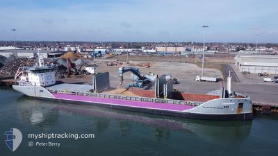
The vessel LONGWAVE (IMO: 9693109, MMSI: 246645000) is a Cargo It's sailing under the flag of [NL] Netherlands.
In this page you can find informations about the vessels current position, last detected port calls, and current voyage information. If the vessels is not in coverage by AIS you will find the latest position.
The current position of LONGWAVE is detected by our AIS receivers and we are not responsible for the reliability of the data. The last position was recorded while the vessel was in Coverage by the Ais receivers of our vessel tracking app.
The current draught of LONGWAVE as reported by AIS is 7.1 meters
Weather
| Temperature | 20.1°C / 68.18°F |
|---|---|
| Wind Speed | 28 knots |
| Direction | 100° E |
| Pressure | 1011 hPa |
| Humidity | 76.5 % |
| Cloud Coverage | 100 % |
Featured Company
Last Port Calls
| Port | Arrival | Departure | Time In Port |
|---|---|---|---|
| 2025-11-25 22:36 | 2025-11-28 20:17 | 2 d | |
| 2025-11-23 08:24 | 2025-11-25 21:05 | 2 d | |
| 2025-11-19 14:14 | 2025-11-20 06:34 | 16 h | |
| 2025-11-15 11:51 | 2025-11-18 18:03 | 3 d | |
| 2025-11-07 16:02 | 2025-11-08 12:24 | 20 h | |
| 2025-11-03 16:14 | 2025-11-05 16:23 | 2 d | |
| 2025-10-29 08:06 | 2025-10-29 14:15 | 6 h | |
| 2025-10-16 23:24 | 2025-10-20 00:34 | 3 d | |
| 2025-10-14 21:00 | 2025-10-16 14:44 | 1 d | |
| 2025-10-05 11:43 | 2025-10-05 16:19 | 4 h |
Last Trips
| Origin | Departure | Destination | Arrival | Distance | |
|---|---|---|---|---|---|
| 2025-11-25 21:05 | 2025-11-25 22:36 | 4.17 nm | |||
| 2025-11-20 06:34 | 2025-11-23 08:24 | 463.49 nm | |||
| 2025-11-18 18:03 | 2025-11-19 14:14 | 185.85 nm | |||
| 2025-11-08 12:24 | 2025-11-15 11:51 | 876.59 nm | |||
| 2025-11-05 16:23 | 2025-11-07 16:02 | 8.29 nm | |||
| 2025-10-29 14:15 | 2025-11-03 16:14 | 467.18 nm | |||
| 2025-10-20 00:34 | 2025-10-29 08:06 | 1858.14 nm | |||
| 2025-10-16 14:44 | 2025-10-16 23:24 | 74.01 nm | |||
| 2025-10-05 16:19 | 2025-10-14 21:00 | 1825.93 nm | |||
| 2025-09-29 11:39 | 2025-10-05 11:43 | 1227.95 nm |
Events
| Tid | Event | Detaljer | Position / Dest | Information |
|---|---|---|---|---|
| 2025-12-05 00:14 | Status ändrad | Default Under way using engine |
35.78419 / 29.70521
TRISK
|
Fart: 7.1 kn Kurs: 94.5° |
| 2025-12-05 00:09 | UTANFÖR täckningsområde |
35.78446 / 29.69251
Mediterranean Sea - Eastern Basin
TRISK
|
Fart: 7.1 kn Kurs: 94.5° |
|
| 2025-12-04 23:29 | Upptäckt i hav | Greek part of the Mediterranean Sea - Eastern Basin |
35.79275 / 29.59437
Mediterranean Sea - Eastern Basin
TRISK
|
Fart: 7 kn Kurs: 97.1° |
| 2025-12-04 23:29 | Status ändrad | Under way using engine Default |
35.79275 / 29.59437
TRISK
|
Fart: 6.8 kn Kurs: 93° |
| 2025-12-04 23:29 | I täckningsområde |
35.79275 / 29.59437
Mediterranean Sea - Eastern Basin
TRISK
|
Fart: 7 kn Kurs: 97.1° |
|
| 2025-12-04 18:37 | UTANFÖR täckningsområde |
35.78224 / 28.87131
Mediterranean Sea - Eastern Basin
TRISK
|
Fart: 7.3 kn Kurs: 90.2° |
|
| 2025-12-04 18:05 | Upptäckt i hav | Turkish part of the Mediterranean Sea - Eastern Basin |
35.78147 / 28.78887
Mediterranean Sea - Eastern Basin
TRISK
|
Fart: 7.4 kn Kurs: 90.8° |
| 2025-12-04 11:25 | Upptäckt i hav | Greek part of the Mediterranean Sea - Eastern Basin |
35.84252 / 27.68596
Mediterranean Sea - Eastern Basin
TRISK
|
Fart: 8.7 kn Kurs: 109° |
| 2025-12-04 08:39 | Status ändrad | Under way using engine Default |
35.94457 / 27.22516
TRISK
|
Fart: 9.1 kn Kurs: 93° |
| 2025-12-04 07:48 | Status ändrad | Default Under way using engine |
35.94714 / 27.06925
TRISK
|
Fart: 9.2 kn Kurs: 91.7° |