
LITTLE EMMA
Cargo
Current Trip
| Time Travelled | 2 days |
|---|---|
| Remaining Time | --- |
| Distance Travelled | 384.65 nm |
| Remaining Distance | --- |
| AVG Speed | 8.6 Knop |
| MAX Speed | 12.8 Knop |
| AVG Wind | 8.8 knots |
| MAX Wind | 26.9 knots |
| MIN Temp | 17.8°C / 64.04°F |
| MAX Temp | 20.8°C / 69.44°F |
| Djupgående | 9.7 m |
| Position mottagen | Nu |
Current Position
| Longitud | -4.98784° |
|---|---|
| Latitude | 36.07219° |
| Status | Under way using engine |
| Fart | 0.2 Knop |
| Kurs | 179° |
| Område | Alboran Sea |
| Station | T-AIS |
| Position mottagen | Nu |
Info
Information
The current position of LITTLE EMMA is in Alboran Sea with coordinates 36.07219° / -4.98784° as reported on 2024-06-04 13:32 by AIS to our vessel tracker app. The vessel's current speed is 0.2 Knop
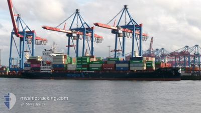
The vessel LITTLE EMMA (IMO: 9980356, MMSI: 636023243) is a Cargo It's sailing under the flag of [LR] Liberia.
In this page you can find informations about the vessels current position, last detected port calls, and current voyage information. If the vessels is not in coverage by AIS you will find the latest position.
The current position of LITTLE EMMA is detected by our AIS receivers and we are not responsible for the reliability of the data. The last position was recorded while the vessel was in Coverage by the Ais receivers of our vessel tracking app.
The current draught of LITTLE EMMA as reported by AIS is 9.7 meters
Weather
| Temperature | 19.7°C / 67.46°F |
|---|---|
| Wind Speed | 7 knots |
| Direction | 105° ESE |
| Pressure | 1015.7 hPa |
| Humidity | 81 % |
| Cloud Coverage | --- |
Featured Company
Last Port Calls
| Port | Arrival | Departure | Time In Port |
|---|---|---|---|
| 2024-06-01 16:01 | 2024-06-02 01:26 | 9 h | |
| 2024-05-29 17:49 | 2024-06-01 04:08 | 2 d | |
| 2024-05-25 15:21 | 2024-05-27 07:06 | 1 d | |
| 2024-05-22 05:01 | 2024-05-24 07:12 | 2 d | |
| 2024-05-19 23:07 | 2024-05-20 23:19 | 1 d | |
| 2024-05-17 15:16 | 2024-05-19 00:43 | 1 d | |
| 2024-05-15 06:18 | 2024-05-16 23:21 | 1 d | |
| 2024-05-11 23:12 | 2024-05-12 23:30 | 1 d | |
| 2024-05-09 15:56 | 2024-05-10 19:15 | 1 d | |
| 2024-05-07 06:53 | 2024-05-08 22:02 | 1 d |
Most Visited Ports (Last year)
| Port | Arrivals | |
|---|---|---|
| 9 | ||
| 8 | ||
| 8 | ||
| 8 | ||
| 7 | ||
| 6 |
Last Trips
| Origin | Departure | Destination | Arrival | Distance | |
|---|---|---|---|---|---|
| 2024-06-01 05:08 | 2024-06-01 17:01 | 190.50 nm | |||
| 2024-05-27 09:06 | 2024-05-29 18:49 | 491.10 nm | |||
| 2024-05-24 08:12 | 2024-05-25 17:21 | 506.67 nm | |||
| 2024-05-21 01:19 | 2024-05-22 06:01 | 484.49 nm | |||
| 2024-05-19 01:43 | 2024-05-20 01:07 | 349.11 nm | |||
| 2024-05-17 00:21 | 2024-05-17 16:16 | 191.08 nm | |||
| 2024-05-13 01:30 | 2024-05-15 07:18 | 492.79 nm | |||
| 2024-05-10 20:15 | 2024-05-12 01:12 | 349.63 nm | |||
| 2024-05-08 23:02 | 2024-05-09 16:56 | 191.25 nm | |||
| 2024-05-04 23:14 | 2024-05-07 07:53 | 489.29 nm |
Events
| Tid | Event | Detaljer | Position / Dest | Information |
|---|---|---|---|---|
| 2024-06-04 10:30 | Status ändrad | Under way using engine Default |
36.09063 / -4.98895
ESALG
|
Fart: Kurs: -1° |
| 2024-06-04 10:25 | Status ändrad | Default Under way using engine |
36.09167 / -4.98667
ESALG
|
Fart: 0.7 kn Kurs: 126° |
| 2024-06-04 10:25 | STOPPAR förflyttning | 18.58 nm, East of GIBRALTAR |
36.09167 / -4.98667
ESALG
|
Fart: Kurs: -1° |
| 2024-06-04 09:02 | STARTAR förflyttning | 13.6 nm, East of GIBRALTAR |
36.08452 / -5.09388
ESALG
|
Fart: 3.6 kn Kurs: 79° |
| 2024-06-04 04:38 | STOPPAR förflyttning | 16.17 nm, East of GIBRALTAR |
36.10411 / -5.03441
ESALG
|
Fart: 0.3 kn Kurs: 152° |
| 2024-06-04 03:56 | Byter havsområde | Gibraltarian part of the Alboran Sea Spanish part of the Alboran Sea |
36.11676 / -5.03312
Alboran Sea
|
Fart: 2.2 kn Kurs: 149.6° |
| 2024-06-04 03:50 | Byter havsområde | Spanish part of the Alboran Sea Gibraltarian part of the Alboran Sea |
36.11920 / -5.03719
Alboran Sea
|
Fart: 3 kn Kurs: 93.5° |
| 2024-06-04 03:12 | STARTAR förflyttning | 13.13 nm, East of GIBRALTAR |
36.10348 / -5.09801
ESALG
|
Fart: 3.1 kn Kurs: 62° |
| 2024-06-03 23:41 | Byter havsområde | Gibraltarian part of the Alboran Sea Spanish part of the Alboran Sea |
36.12634 / -5.06782
Alboran Sea
|
Fart: 0.9 kn Kurs: 239.5° |
| 2024-06-03 20:39 | STOPPAR förflyttning | 17.62 nm, East of GIBRALTAR |
36.13249 / -5.00057
ESALG
|
Fart: 0.3 kn Kurs: 90° |