
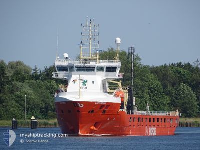
LADY MENNA
Cargo
Current Trip
| Time Travelled | 1 day |
|---|---|
| Remaining Time | 1 day |
| Distance Travelled | 640.17 nm |
| Remaining Distance | 408.83 nm |
| AVG Speed | 13.6 Knop |
| MAX Speed | 14.6 Knop |
| AVG Wind | 9.2 knots |
| MAX Wind | 19.9 knots |
| MIN Temp | 3°C / 37.4°F |
| MAX Temp | 12.6°C / 54.68°F |
| Djupgående | 6.4 m |
| Position mottagen | 1 m sen |
Current Position
| Longitud | 10.29669° |
|---|---|
| Latitude | 54.49801° |
| Status | Under way using engine |
| Fart | 12.3 Knop |
| Kurs | 233.1° |
| Område | Baltic Sea |
| Station | T-AIS |
| Position mottagen | 1 m sen |
Info
Information
The current position of LADY MENNA is in Baltic Sea with coordinates 54.49801° / 10.29669° as reported on 2024-05-12 19:15 by AIS to our vessel tracker app. The vessel's current speed is 12.3 Knop and is heading at the port of HULL. The estimated time of arrival as calculated by MyShipTracking vessel tracking app is 2024-05-14 01:02 LT
The vessel LADY MENNA (IMO: 9904340, MMSI: 245266000) is a Cargo It's sailing under the flag of [NL] Netherlands.
In this page you can find informations about the vessels current position, last detected port calls, and current voyage information. If the vessels is not in coverage by AIS you will find the latest position.
The current position of LADY MENNA is detected by our AIS receivers and we are not responsible for the reliability of the data. The last position was recorded while the vessel was in Coverage by the Ais receivers of our vessel tracking app.
The current draught of LADY MENNA as reported by AIS is 6.4 meters
Weather
| Temperature | 11.8°C / 53.24°F |
|---|---|
| Wind Speed | 17 knots |
| Direction | 97° E |
| Pressure | 1021.1 hPa |
| Humidity | 79.9 % |
| Cloud Coverage | 6 % |
Featured Company
Last Port Calls
| Port | Arrival | Departure | Time In Port |
|---|---|---|---|
| 2024-05-08 13:40 | 2024-05-10 23:50 | 2 d | |
| 2024-05-03 00:57 | 2024-05-03 19:56 | 18 h | |
| 2024-04-27 12:38 | 2024-04-29 09:12 | 1 d | |
| 2024-04-24 08:46 | 2024-04-26 15:48 | 2 d | |
| 2024-04-18 19:57 | 2024-04-20 09:13 | 1 d | |
| 2024-04-12 23:01 | 2024-04-14 07:18 | 1 d | |
| 2024-04-09 20:57 | 2024-04-10 19:54 | 22 h | |
| 2024-03-20 20:23 | 2024-03-21 17:43 | 21 h | |
| 2024-03-16 22:13 | 2024-03-19 08:54 | 2 d | |
| 2024-03-12 13:43 | 2024-03-14 01:06 | 1 d |
Most Visited Ports (Last year)
| Port | Arrivals | |
|---|---|---|
| 14 | ||
| 11 | ||
| 11 | ||
| 4 | ||
| 4 | ||
| 4 |
Last Trips
| Origin | Departure | Destination | Arrival | Distance | |
|---|---|---|---|---|---|
| 2024-05-03 19:56 | 2024-05-08 13:40 | 760.95 nm | |||
| 2024-04-29 09:12 | 2024-05-03 00:57 | 1138.73 nm | |||
| 2024-04-26 15:48 | 2024-04-27 12:38 | 252.44 nm | |||
| 2024-04-20 09:13 | 2024-04-24 08:46 | 1222.05 nm | |||
| 2024-04-14 07:18 | 2024-04-18 19:57 | 495.59 nm | |||
| 2024-04-10 19:54 | 2024-04-12 23:01 | 211.07 nm | |||
| 2024-03-21 17:43 | 2024-04-09 20:57 | 473.28 nm | |||
| 2024-03-19 08:54 | 2024-03-20 20:23 | 477.02 nm | |||
| 2024-03-14 01:06 | 2024-03-16 22:13 | 581.20 nm | |||
| 2024-03-09 10:23 | 2024-03-12 13:43 | 424.37 nm |
Events
| Tid | Event | Detaljer | Position / Dest | Information |
|---|---|---|---|---|
| 2024-05-12 18:29 | Byter havsområde | German part of the Baltic Sea Danish part of the Baltic Sea |
54.56328 / 10.55470
Baltic Sea
GBHUL
|
Fart: 13.8 kn Kurs: 250° |
| 2024-05-12 17:53 | Byter havsområde | Danish part of the Baltic Sea German part of the Baltic Sea |
54.58304 / 10.79000
Baltic Sea
GBHUL
|
Fart: 14 kn Kurs: 264.3° |
| 2024-05-12 16:47 | Byter havsområde | German part of the Baltic Sea Danish part of the Baltic Sea |
54.59318 / 11.23648
Baltic Sea
GBHUL
|
Fart: 14.4 kn Kurs: 287.8° |
| 2024-05-12 11:38 | Byter havsområde | Danish part of the Baltic Sea German part of the Baltic Sea |
54.84521 / 12.94429
Baltic Sea
GBHUL
|
Fart: 13.7 kn Kurs: 251.2° |
| 2024-05-12 09:29 | Byter havsområde | German part of the Baltic Sea Swedish part of the Baltic Sea |
55.01818 / 13.75437
Baltic Sea
GBHUL
|
Fart: 13.9 kn Kurs: 247.2° |
| 2024-05-12 06:17 | Byter havsområde | Swedish part of the Baltic Sea Danish part of the Kattegat |
55.48088 / 14.71771
Baltic Sea
GBHUL
|
Fart: 13.5 kn Kurs: 239.6° |
| 2024-05-12 04:53 | Byter havsområde | Danish part of the Kattegat Swedish part of the Baltic Sea |
55.64465 / 15.21287
Kattegat
GBHUL
|
Fart: 13.8 kn Kurs: 240.7° |
| 2024-05-11 22:21 | Status ändrad | Under way using engine Default |
56.61725 / 17.05624
GBHUL
|
Fart: 13.8 kn Kurs: 200° |
| 2024-05-11 21:52 | Status ändrad | Default Under way using engine |
56.71845 / 17.12392
GBHUL
|
Fart: 13.9 kn Kurs: 200.1° |
| 2024-05-11 21:40 | Status ändrad | Under way using engine Default |
56.76176 / 17.15277
GBHUL
|
Fart: 13.8 kn Kurs: 201° |