
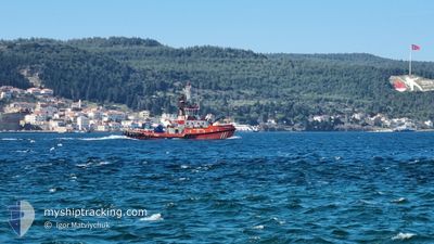
KURTARMA-3
Tug
Current Trip
Unknown
| Time Travelled | 12 h, 14 mins |
|---|---|
| Remaining Time | --- |
| Distance Travelled | 24.07 nm |
| Remaining Distance | --- |
| AVG Speed | 8.5 Knop |
| MAX Speed | 12.6 Knop |
| AVG Wind | 9.1 knots |
| MAX Wind | 10 knots |
| MIN Temp | 22.2°C / 71.96°F |
| MAX Temp | 25.1°C / 77.18°F |
| Djupgående | 0 m |
| Position mottagen | 9 h, 24 m sen |
Current Position
| Longitud | 26.51449° |
|---|---|
| Latitude | 40.24058° |
| Status | Default |
| Fart | 10 Knop |
| Kurs | 49.1° |
| Område | Sea of Marmara |
| Station | T-AIS |
| Position mottagen | 9 h, 24 m sen |
Info
Information
The current position of KURTARMA-3 is in Sea of Marmara with coordinates 40.24058° / 26.51449° as reported on 2024-05-29 15:08 by AIS to our vessel tracker app. The vessel's current speed is 10 Knop
The vessel KURTARMA-3 (IMO: 9335939, MMSI: 271001021) is a Tug that was built in 2004 ( 20 År gammal ). It's sailing under the flag of [TR] Turkey.
In this page you can find informations about the vessels current position, last detected port calls, and current voyage information. If the vessels is not in coverage by AIS you will find the latest position.
The current position of KURTARMA-3 is detected by our AIS receivers and we are not responsible for the reliability of the data. The last position was recorded while the vessel was in Coverage by the Ais receivers of our vessel tracking app.
Weather
| Temperature | 21.2°C / 70.16°F |
|---|---|
| Wind Speed | 6 knots |
| Direction | 262° W |
| Pressure | 1010.4 hPa |
| Humidity | 48.5 % |
| Cloud Coverage | 10 % |
Featured Company
Last Port Calls
| Port | Arrival | Departure | Time In Port |
|---|---|---|---|
| 2024-05-29 14:19 | 2024-05-29 15:19 | 1 h | |
| 2024-05-28 19:51 | 2024-05-29 00:03 | 4 h | |
| 2024-05-26 15:22 | 2024-05-27 15:01 | 23 h | |
| 2024-05-24 18:56 | 2024-05-26 08:59 | 1 d | |
| 2024-05-23 17:28 | 2024-05-24 06:46 | 13 h | |
| 2024-05-23 11:36 | 2024-05-23 14:29 | 2 h | |
| 2024-05-22 20:02 | 2024-05-23 06:39 | 10 h | |
| 2024-05-22 00:34 | 2024-05-22 10:57 | 10 h | |
| 2024-05-20 20:57 | 2024-05-21 18:06 | 21 h | |
| 2024-05-16 19:07 | 2024-05-16 19:18 | 11 m |
Last Trips
| Origin | Departure | Destination | Arrival | Distance | |
|---|---|---|---|---|---|
| 2024-05-29 00:03 | 2024-05-29 14:19 | 47.43 nm | |||
| 2024-05-27 15:01 | 2024-05-28 19:51 | 129.55 nm | |||
| 2024-05-26 08:59 | 2024-05-26 15:22 | 53.32 nm | |||
| 2024-05-24 06:46 | 2024-05-24 18:56 | 62.15 nm | |||
| 2024-05-23 14:29 | 2024-05-23 17:28 | 11.06 nm | |||
| 2024-05-23 06:39 | 2024-05-23 11:36 | 19.17 nm | |||
| 2024-05-22 10:57 | 2024-05-22 20:02 | 61.19 nm | |||
| 2024-05-21 18:06 | 2024-05-22 00:34 | 55.85 nm | |||
| 2024-05-16 19:18 | 2024-05-20 20:57 | 21.10 nm | |||
| 2024-05-16 18:20 | 2024-05-16 19:07 | 6.57 nm |
Events
| Tid | Event | Detaljer | Position / Dest | Information |
|---|---|---|---|---|
| 2024-05-29 17:07 | STOPPAR förflyttning | 4.74 nm, South West of LAPSEKI |
40.32001 / 26.59090
|
Fart: Kurs: 139° |
| 2024-05-29 15:08 | UTANFÖR täckningsområde |
40.24058 / 26.51449
Sea of Marmara
|
Fart: 10 kn Kurs: 49.1° |
|
| 2024-05-29 12:19 | AVGÅTT HAMN |
|
40.14740 / 26.39453
|
Fart: 7.1 kn Kurs: 215° |
| 2024-05-29 12:17 | STARTAR förflyttning |
40.15060 / 26.39776
[TR] CANAKKALE
|
Fart: 6.1 kn Kurs: 239° |
|
| 2024-05-29 11:19 | STOPPAR förflyttning |
40.15102 / 26.40040
[TR] CANAKKALE
|
Fart: 0.3 kn Kurs: 234° |
|
| 2024-05-29 11:19 | ANLÄNDER HAMN |
|
40.15102 / 26.40040
[TR] CANAKKALE
|
Fart: 1.5 kn Kurs: 218° |
| 2024-05-29 10:40 | I täckningsområde |
40.23452 / 26.45735
Sea of Marmara
|
Fart: 10.5 kn Kurs: 231° |
|
| 2024-05-28 22:54 | UTANFÖR täckningsområde |
40.24442 / 26.51897
Sea of Marmara
|
Fart: 9.4 kn Kurs: 54° |
|
| 2024-05-28 22:37 | STARTAR förflyttning | 5 nm, North East of CANAKKALE |
40.21740 / 26.47465
|
Fart: 9.4 kn Kurs: 56° |
| 2024-05-28 22:35 | STOPPAR förflyttning | 4.86 nm, North East of CANAKKALE |
40.21592 / 26.47217
|
Fart: 0.2 kn Kurs: 76° |