
KURTARMA 15
Tug
Current Trip
CANAKKALE
| Time Travelled | 44 mins |
|---|---|
| Remaining Time | --- |
| Distance Travelled | 2.25 nm |
| Remaining Distance | --- |
| AVG Speed | 12.6 Knop |
| MAX Speed | 12.6 Knop |
| AVG Wind | 5.1 knots |
| MAX Wind | 9 knots |
| MIN Temp | 18.2°C / 64.76°F |
| MAX Temp | 24.3°C / 75.74°F |
| Djupgående | 6.2 m |
| Position mottagen | 29 m sen |
Current Position
| Longitud | 26.65100° |
|---|---|
| Latitude | 40.36001° |
| Status | Under way using engine |
| Fart | 12.6 Knop |
| Kurs | 191.6° |
| Område | Sea of Marmara |
| Station | T-AIS |
| Position mottagen | 29 m sen |
Info
Information
The current position of KURTARMA 15 is in Sea of Marmara with coordinates 40.36001° / 26.65100° as reported on 2024-05-22 08:10 by AIS to our vessel tracker app. The vessel's current speed is 12.6 Knop
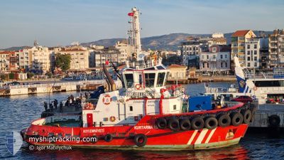
The vessel KURTARMA 15 (IMO: 9915040, MMSI: 271048881) is a Tug It's sailing under the flag of [TR] Turkey.
In this page you can find informations about the vessels current position, last detected port calls, and current voyage information. If the vessels is not in coverage by AIS you will find the latest position.
The current position of KURTARMA 15 is detected by our AIS receivers and we are not responsible for the reliability of the data. The last position was recorded while the vessel was in Coverage by the Ais receivers of our vessel tracking app.
The current draught of KURTARMA 15 as reported by AIS is 6.2 meters
Weather
| Temperature | 24.2°C / 75.56°F |
|---|---|
| Wind Speed | 1 knots |
| Direction | 50° NE |
| Pressure | 1011.6 hPa |
| Humidity | 54.1 % |
| Cloud Coverage | 2 % |
Featured Company
Last Port Calls
| Port | Arrival | Departure | Time In Port |
|---|---|---|---|
| 2024-05-21 06:27 | 2024-05-22 07:55 | 1 d | |
| 2024-05-20 17:29 | 2024-05-21 02:08 | 8 h | |
| 2024-05-20 11:34 | 2024-05-20 13:20 | 1 h | |
| 2024-05-20 04:15 | 2024-05-20 05:17 | 1 h | |
| 2024-05-19 10:14 | 2024-05-20 00:54 | 14 h | |
| 2024-05-18 14:59 | 2024-05-19 03:29 | 12 h | |
| 2024-05-16 17:33 | 2024-05-18 04:32 | 1 d | |
| 2024-05-16 08:29 | 2024-05-16 13:31 | 5 h | |
| 2024-05-15 15:52 | 2024-05-16 04:37 | 12 h | |
| 2024-05-15 08:47 | 2024-05-15 10:15 | 1 h |
Last Trips
| Origin | Departure | Destination | Arrival | Distance | |
|---|---|---|---|---|---|
| 2024-05-21 05:08 | 2024-05-21 09:27 | 39.50 nm | |||
| 2024-05-20 16:20 | 2024-05-20 20:29 | 39.88 nm | |||
| 2024-05-20 08:17 | 2024-05-20 14:34 | 57.00 nm | |||
| 2024-05-20 03:54 | 2024-05-20 07:15 | 7.74 nm | |||
| 2024-05-19 06:29 | 2024-05-19 13:14 | 62.45 nm | |||
| 2024-05-18 07:32 | 2024-05-18 17:59 | 67.09 nm | |||
| 2024-05-16 16:31 | 2024-05-16 20:33 | 39.47 nm | |||
| 2024-05-16 07:37 | 2024-05-16 11:29 | 40.61 nm | |||
| 2024-05-15 13:15 | 2024-05-15 18:52 | 38.54 nm | |||
| 2024-05-15 10:04 | 2024-05-15 11:47 | 20.37 nm |
Events
| Tid | Event | Detaljer | Position / Dest | Information |
|---|---|---|---|---|
| 2024-05-22 08:11 | Status ändrad | Default Under way using engine |
40.35848 / 26.65040
CANAKKALE
|
Fart: 12.6 kn Kurs: 191.6° |
| 2024-05-22 08:10 | Status ändrad | Under way using engine Default |
40.36001 / 26.65100
CANAKKALE
|
Fart: 9 kn Kurs: -1° |
| 2024-05-22 07:58 | STARTAR förflyttning | 0.62 nm, South West of GELIBOLU |
40.39667 / 26.66167
CANAKKALE
|
Fart: 9 kn Kurs: -1° |
| 2024-05-22 07:58 | I täckningsområde |
40.36001 / 26.65100
Sea of Marmara
|
Fart: 12.6 kn Kurs: 191.6° |
|
| 2024-05-22 07:55 | AVGÅTT HAMN |
|
40.39667 / 26.66167
CANAKKALE
|
Fart: Kurs: -1° |
| 2024-05-21 06:27 | STOPPAR förflyttning |
40.40463 / 26.66936
[TR] GELIBOLU
|
Fart: Kurs: 108° |
|
| 2024-05-21 06:27 | ANLÄNDER HAMN |
|
40.40463 / 26.66936
[TR] GELIBOLU
|
Fart: 6.1 kn Kurs: 28° |
| 2024-05-21 05:07 | Status ändrad | Default Under way using engine |
40.27537 / 26.55691
CANAKKALE
|
Fart: 10.3 kn Kurs: 44.4° |
| 2024-05-21 05:06 | Status ändrad | Under way using engine Default |
40.27210 / 26.55253
CANAKKALE
|
Fart: 10.7 kn Kurs: 43° |
| 2024-05-21 05:06 | UTANFÖR täckningsområde |
40.27210 / 26.55253
Sea of Marmara
|
Fart: 10.3 kn Kurs: 44.4° |