
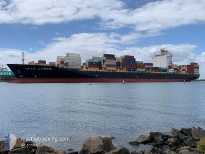
KOTA LAMBAI
Container Ship
Current Trip
| Time Travelled | 2 days |
|---|---|
| Remaining Time | 2 days |
| Distance Travelled | 1249.27 nm |
| Remaining Distance | 1051.90 nm |
| AVG Speed | 16.8 Knop |
| MAX Speed | 18.9 Knop |
| AVG Wind | 9.7 knots |
| MAX Wind | 17 knots |
| MIN Temp | 19.5°C / 67.1°F |
| MAX Temp | 27.8°C / 82.04°F |
| Djupgående | 12.5 m |
| Position mottagen | 2 d sen |
Current Position
| Longitud | 114.54833° |
|---|---|
| Latitude | -30.65020° |
| Status | Under way using engine |
| Fart | 18.1 Knop |
| Kurs | 327.1° |
| Område | Indian Ocean |
| Station | T-AIS |
| Position mottagen | 2 d sen |
Info
Information
The current position of KOTA LAMBAI is in Indian Ocean with coordinates -30.65020° / 114.54833° as reported on 2024-05-23 21:38 by AIS to our vessel tracker app. The vessel's current speed is 18.1 Knop and is heading at the port of SINGAPORE. The estimated time of arrival as calculated by MyShipTracking vessel tracking app is 2024-05-29 07:59 LT
The vessel KOTA LAMBAI (IMO: 9351024, MMSI: 565909000) is a Container Ship that was built in 2008 ( 16 År gammal ). It's sailing under the flag of [SG] Singapore.
In this page you can find informations about the vessels current position, last detected port calls, and current voyage information. If the vessels is not in coverage by AIS you will find the latest position.
The current position of KOTA LAMBAI is detected by our AIS receivers and we are not responsible for the reliability of the data. The last position was recorded while the vessel was in Coverage by the Ais receivers of our vessel tracking app.
The current draught of KOTA LAMBAI as reported by AIS is 12.5 meters
Weather
| Temperature | 27.7°C / 81.86°F |
|---|---|
| Wind Speed | 17 knots |
| Direction | 92° E |
| Pressure | 1013.2 hPa |
| Humidity | 73.3 % |
| Cloud Coverage | 14 % |
Featured Company
Last Port Calls
| Port | Arrival | Departure | Time In Port |
|---|---|---|---|
| 2024-05-22 05:16 | 2024-05-23 23:24 | 1 d | |
| 2024-05-17 15:31 | 2024-05-18 17:19 | 1 d | |
| 2024-05-13 20:55 | 2024-05-15 07:09 | 1 d | |
| 2024-05-10 08:51 | 2024-05-12 04:54 | 1 d | |
| 2024-05-02 13:30 | 2024-05-04 03:57 | 1 d | |
| 2024-04-20 23:04 | 2024-04-21 21:48 | 22 h | |
| 2024-04-19 05:28 | 2024-04-20 07:15 | 1 d | |
| 2024-04-18 09:12 | 2024-04-19 04:17 | 19 h | |
| 2024-04-09 05:56 | 2024-04-12 09:22 | 3 d | |
| 2024-04-03 19:42 | 2024-04-04 22:10 | 1 d |
Most Visited Ports (Last year)
| Port | Arrivals | |
|---|---|---|
| 18 | ||
| 18 | ||
| 9 | ||
| 9 | ||
| 9 | ||
| 8 |
Last Trips
| Origin | Departure | Destination | Arrival | Distance | |
|---|---|---|---|---|---|
| 2024-05-18 17:19 | 2024-05-22 05:16 | 1374.88 nm | |||
| 2024-05-15 07:09 | 2024-05-17 15:31 | 519.07 nm | |||
| 2024-05-12 04:54 | 2024-05-13 20:55 | 585.55 nm | |||
| 2024-05-04 03:57 | 2024-05-10 08:51 | 2199.39 nm | |||
| 2024-04-21 21:48 | 2024-05-02 13:30 | 2509.63 nm | |||
| 2024-04-20 07:15 | 2024-04-20 23:04 | 198.72 nm | |||
| 2024-04-19 04:17 | 2024-04-19 05:28 | 9.32 nm | |||
| 2024-04-12 09:22 | 2024-04-18 09:12 | 2318.63 nm | |||
| 2024-04-04 22:10 | 2024-04-09 05:56 | 1377.17 nm | |||
| 2024-04-02 13:08 | 2024-04-03 19:42 | 512.29 nm |
Events
| Tid | Event | Detaljer | Position / Dest | Information |
|---|---|---|---|---|
| 2024-05-23 21:43 | Status ändrad | Default Under way using engine |
-30.63115 / 114.53401
SGSIN-PEBGA
|
Fart: 18.1 kn Kurs: 327.1° |
| 2024-05-23 21:38 | UTANFÖR täckningsområde |
-30.65020 / 114.54833
Indian Ocean
SGSIN-PEBGA
|
Fart: 18.1 kn Kurs: 327.1° |
|
| 2024-05-23 21:36 | Status ändrad | Under way using engine Default |
-30.65739 / 114.55375
SGSIN-PEBGA
|
Fart: 18.1 kn Kurs: 327° |
| 2024-05-23 21:26 | I täckningsområde |
-30.65275 / 114.55025
Indian Ocean
SGSIN-PEBGA
|
Fart: 18.1 kn Kurs: 327.7° |
|
| 2024-05-23 20:15 | Status ändrad | Default Under way using engine |
-30.99691 / 114.79755
SGSIN-PEBGA
|
Fart: 17.7 kn Kurs: 328.3° |
| 2024-05-23 20:07 | UTANFÖR täckningsområde |
-31.03206 / 114.82184
Indian Ocean
SGSIN-PEBGA
|
Fart: 17.7 kn Kurs: 328.3° |
|
| 2024-05-23 19:33 | Status ändrad | Under way using engine Default |
-31.17547 / 114.92773
SGSIN-PEBGA
|
Fart: 18.6 kn Kurs: 327° |
| 2024-05-23 19:31 | Status ändrad | Default Under way using engine |
-31.18421 / 114.93433
SGSIN-PEBGA
|
Fart: 18.6 kn Kurs: 327.3° |
| 2024-05-23 16:31 | ETA ändrat | 2024/05/29 04:00 2024/05/29 05:00 |
-31.89993 / 115.58442
SGSIN-PEBGA
|
Fart: 18.1 kn Kurs: 318.6° |
| 2024-05-23 15:24 | AVGÅTT HAMN |
|
-32.04685 / 115.74538
SGSIN-PEBGA
|
Fart: 4.4 kn Kurs: 217° |