
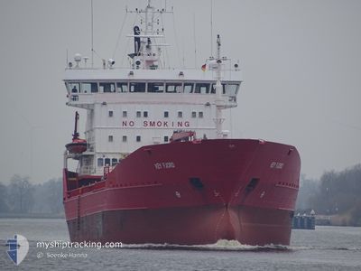
KEY FJORD
Oil/Chemical Tanker
Current Trip
| Time Travelled | 13 h, 9 mins |
|---|---|
| Remaining Time | 3 days |
| Distance Travelled | 149.17 nm |
| Remaining Distance | 892.55 nm |
| AVG Speed | 12.3 Knop |
| MAX Speed | 13.1 Knop |
| AVG Wind | 9.3 knots |
| MAX Wind | 18 knots |
| MIN Temp | 10.2°C / 50.36°F |
| MAX Temp | 11.6°C / 52.88°F |
| Djupgående | 6.9 m |
| Position mottagen | 2 h, 25 m sen |
Current Position
| Longitud | -4.93579° |
|---|---|
| Latitude | 47.75126° |
| Status | Under way using engine |
| Fart | 11.8 Knop |
| Kurs | 303.9° |
| Område | Celtic Sea |
| Station | T-AIS |
| Position mottagen | 2 h, 25 m sen |
Info
Information
The current position of KEY FJORD is in Celtic Sea with coordinates 47.75126° / -4.93579° as reported on 2024-04-26 03:59 by AIS to our vessel tracker app. The vessel's current speed is 11.8 Knop and is heading at the port of HUSOYA. The estimated time of arrival as calculated by MyShipTracking vessel tracking app is 2024-04-29 11:09 LT
The vessel KEY FJORD (IMO: 8913708, MMSI: 257136000) is a Oil/Chemical Tanker that was built in 1990 ( 34 År gammal ). It's sailing under the flag of [NO] Norway.
In this page you can find informations about the vessels current position, last detected port calls, and current voyage information. If the vessels is not in coverage by AIS you will find the latest position.
The current position of KEY FJORD is detected by our AIS receivers and we are not responsible for the reliability of the data. The last position was recorded while the vessel was in Coverage by the Ais receivers of our vessel tracking app.
The current draught of KEY FJORD as reported by AIS is 6.9 meters
Weather
| Temperature | 10.6°C / 51.08°F |
|---|---|
| Wind Speed | 18 knots |
| Direction | 305° NW |
| Pressure | 1002.2 hPa |
| Humidity | 67.7 % |
| Cloud Coverage | 99 % |
Featured Company
Last Port Calls
| Port | Arrival | Departure | Time In Port |
|---|---|---|---|
| 2024-04-24 18:29 | 2024-04-25 17:15 | 22 h | |
| 2024-04-24 18:04 | 2024-04-24 18:21 | 16 m | |
| 2024-04-20 15:30 | 2024-04-22 08:34 | 1 d | |
| 2024-04-17 16:19 | 2024-04-19 14:43 | 1 d | |
| 2024-04-14 16:05 | 2024-04-15 04:27 | 12 h | |
| 2024-04-12 02:55 | 2024-04-13 03:39 | 1 d | |
| 2024-04-05 22:43 | 2024-04-06 22:57 | 1 d | |
| 2024-03-27 18:19 | 2024-03-29 07:44 | 1 d | |
| 2024-03-26 14:46 | 2024-03-27 03:31 | 12 h | |
| 2024-03-23 05:26 | 2024-03-24 06:03 | 1 d |
Last Trips
| Origin | Departure | Destination | Arrival | Distance | |
|---|---|---|---|---|---|
| 2024-04-24 20:21 | 2024-04-24 20:29 | 0.19 nm | |||
| 2024-04-22 09:34 | 2024-04-24 20:04 | 769.58 nm | |||
| 2024-04-19 16:43 | 2024-04-20 16:30 | 210.67 nm | |||
| 2024-04-15 06:27 | 2024-04-17 18:19 | 479.40 nm | |||
| 2024-04-13 05:39 | 2024-04-14 18:05 | 418.91 nm | |||
| 2024-04-07 01:57 | 2024-04-12 04:55 | 1114.39 nm | |||
| 2024-03-29 08:44 | 2024-04-06 01:43 | 1430.48 nm | |||
| 2024-03-27 04:31 | 2024-03-27 19:19 | 185.41 nm | |||
| 2024-03-24 07:03 | 2024-03-26 15:46 | 596.48 nm | |||
| 2024-03-19 01:17 | 2024-03-23 06:26 | 1073.35 nm |
Events
| Tid | Event | Detaljer | Position / Dest | Information |
|---|---|---|---|---|
| 2024-04-26 04:06 | Status ändrad | Default Under way using engine |
47.76333 / -4.96500
NO HSO
|
Fart: 11.8 kn Kurs: 303.9° |
| 2024-04-26 03:59 | UTANFÖR täckningsområde |
47.75126 / -4.93579
Celtic Sea
NO HSO
|
Fart: 11.8 kn Kurs: 303.9° |
|
| 2024-04-26 03:58 | Status ändrad | Under way using engine Default |
47.74976 / -4.93246
NO HSO
|
Fart: 11 kn Kurs: 303° |
| 2024-04-26 03:54 | Status ändrad | Default Under way using engine |
47.74166 / -4.91500
NO HSO
|
Fart: 12 kn Kurs: 304.3° |
| 2024-04-26 03:43 | Byter havsområde | French part of the Celtic Sea French part of the Bay of Biscay |
47.72297 / -4.87325
Celtic Sea
NO HSO
|
Fart: 12 kn Kurs: 304.3° |
| 2024-04-26 03:43 | Status ändrad | Under way using engine Default |
47.72297 / -4.87325
NO HSO
|
Fart: 11 kn Kurs: 303° |
| 2024-04-26 03:43 | I täckningsområde |
47.72297 / -4.87325
Celtic Sea
NO HSO
|
Fart: 12 kn Kurs: 304.3° |
|
| 2024-04-25 23:45 | Status ändrad | Default Under way using engine |
47.27500 / -3.84667
NO HSO
|
Fart: 12.7 kn Kurs: 303.3° |
| 2024-04-25 23:37 | UTANFÖR täckningsområde |
47.26270 / -3.81501
Bay of Biscay
NO HSO
|
Fart: 12.7 kn Kurs: 303.3° |
|
| 2024-04-25 22:38 | Status ändrad | Under way using engine Default |
47.14318 / -3.55886
NO HSO
|
Fart: 12 kn Kurs: 302° |