
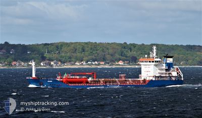
KARIA
Oil/Chemical Tanker
Current Trip
| Time Travelled | 1 day |
|---|---|
| Remaining Time | --- |
| Distance Travelled | 300.07 nm |
| Remaining Distance | --- |
| AVG Speed | 11 Knop |
| MAX Speed | 12.4 Knop |
| AVG Wind | 5.7 knots |
| MAX Wind | 15.5 knots |
| MIN Temp | 11.4°C / 52.52°F |
| MAX Temp | 18.8°C / 65.84°F |
| Djupgående | 4.7 m |
| Position mottagen | 1 m sen |
Current Position
| Longitud | --- |
|---|---|
| Latitude | --- |
| Status | Under way using engine |
| Fart | 11.2 Knop |
| Kurs | 301° |
| Område | Mediterranean Sea - Eastern Basin |
| Station | T-AIS |
| Position mottagen | 1 m sen |
Info
Information
The current position of KARIA is in Mediterranean Sea - Eastern Basin with coordinates 36.32180° / 29.01958° as reported on 2025-12-12 20:57 by AIS to our vessel tracker app. The vessel's current speed is 11.2 Knop
The vessel KARIA (IMO: 9305362, MMSI: 271049852) is a Oil/Chemical Tanker that was built in 2005 ( 20 År gammal ). It's sailing under the flag of [TR] Turkey.
In this page you can find informations about the vessels current position, last detected port calls, and current voyage information. If the vessels is not in coverage by AIS you will find the latest position.
The current position of KARIA is detected by our AIS receivers and we are not responsible for the reliability of the data. The last position was recorded while the vessel was in Coverage by the Ais receivers of our vessel tracking app.
The current draught of KARIA as reported by AIS is 4.7 meters
Weather
| Temperature | 18.5°C / 65.3°F |
|---|---|
| Wind Speed | 5 knots |
| Direction | 311° NW |
| Pressure | 1017.8 hPa |
| Humidity | 50.9 % |
| Cloud Coverage | 6 % |
Featured Company
Last Port Calls
| Port | Arrival | Departure | Time In Port |
|---|---|---|---|
| 2025-12-10 04:51 | 2025-12-11 20:58 | 1 d | |
| 2025-12-03 22:41 | 2025-12-06 00:57 | 2 d | |
| 2025-12-02 14:50 | 2025-12-03 22:13 | 1 d | |
| 2025-11-30 09:25 | 2025-12-01 15:16 | 1 d | |
| 2025-11-25 08:35 | 2025-11-26 06:59 | 22 h | |
| 2025-11-23 07:31 | 2025-11-25 08:02 | 2 d | |
| 2025-11-19 17:08 | 2025-11-21 01:08 | 1 d | |
| 2025-11-15 08:20 | 2025-11-16 22:37 | 1 d | |
| 2025-11-08 13:34 | 2025-11-09 13:28 | 23 h | |
| 2025-11-08 06:01 | 2025-11-08 11:50 | 5 h |
Last Trips
| Origin | Departure | Destination | Arrival | Distance | |
|---|---|---|---|---|---|
| 2025-12-06 00:57 | 2025-12-10 04:51 | 613.20 nm | |||
| 2025-12-03 22:13 | 2025-12-03 22:41 | 2.21 nm | |||
| 2025-12-01 15:16 | 2025-12-02 14:50 | 229.91 nm | |||
| 2025-11-26 06:59 | 2025-11-30 09:25 | 242.04 nm | |||
| 2025-11-25 08:02 | 2025-11-25 08:35 | 2.29 nm | |||
| 2025-11-21 01:08 | 2025-11-23 07:31 | 604.98 nm | |||
| 2025-11-16 22:37 | 2025-11-19 17:08 | 606.64 nm | |||
| 2025-11-09 13:28 | 2025-11-15 08:20 | 856.60 nm | |||
| 2025-11-08 11:50 | 2025-11-08 13:34 | 3.27 nm | |||
| 2025-11-03 01:39 | 2025-11-08 06:01 | 860.76 nm |
Events
| Tid | Event | Detaljer | Position / Dest | Information |
|---|---|---|---|---|
| 2025-12-12 19:47 | Status ändrad | Under way using engine Default |
36.20600 / 29.25720
TRALI>TRMER
|
Fart: 11.5 kn Kurs: 300° |
| 2025-12-12 19:10 | Status ändrad | Default Under way using engine |
36.14853 / 29.38493
TRALI>TRMER
|
Fart: 11.5 kn Kurs: 300° |
| 2025-12-12 19:06 | Upptäckt i hav | Turkish part of the Mediterranean Sea - Eastern Basin |
36.14178 / 29.39930
Mediterranean Sea - Eastern Basin
TRALI>TRMER
|
Fart: 11.5 kn Kurs: 300° |
| 2025-12-12 17:59 | Byter havsområde | Greek part of the Mediterranean Sea - Eastern Basin Turkish part of the Mediterranean Sea - Eastern Basin |
36.06182 / 29.63597
Mediterranean Sea - Eastern Basin
TRALI>TRMER
|
Fart: 10.7 kn Kurs: 277° |
| 2025-12-12 17:52 | Djupgående ändrat | 4.7 7.4 |
36.05933 / 29.66140
TRALI>TRMER
|
Fart: 10.6 kn Kurs: 274° |
| 2025-12-12 17:52 | ETA ändrat | 2025/12/14 04:00 2025/12/08 17:00 |
36.05933 / 29.66140
TRALI>TRMER
|
Fart: 10.6 kn Kurs: 274° |
| 2025-12-12 17:35 | I täckningsområde |
36.06447 / 29.71765
Mediterranean Sea - Eastern Basin
|
Fart: 10.5 kn Kurs: 260° |
|
| 2025-12-11 19:43 | Status ändrad | Default Under way using engine |
36.51762 / 34.49852
TRALI>TRMER
|
Fart: 11.1 kn Kurs: 222° |
| 2025-12-11 19:41 | Status ändrad | Under way using engine Default |
36.52405 / 34.50575
TRALI>TRMER
|
Fart: 11.1 kn Kurs: 222° |
| 2025-12-11 19:41 | UTANFÖR täckningsområde |
36.52405 / 34.50575
Mediterranean Sea - Eastern Basin
|
Fart: 11.1 kn Kurs: 222° |