
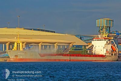
KAMELIA
General Cargo
Current Trip
| Time Travelled | 18 h, 6 mins |
|---|---|
| Remaining Time | 18 h, 20 mins |
| Distance Travelled | 71.31 nm |
| Remaining Distance | 70.21 nm |
| AVG Speed | 5.7 Knop |
| MAX Speed | 11 Knop |
| AVG Wind | 16.2 knots |
| MAX Wind | 28.7 knots |
| MIN Temp | 4.7°C / 40.46°F |
| MAX Temp | 8°C / 46.4°F |
| Djupgående | 3.9 m |
| Position mottagen | 14 m sen |
Current Position
| Longitud | --- |
|---|---|
| Latitude | --- |
| Status | Under way using engine |
| Fart | 3.2 Knop |
| Kurs | 55° |
| Område | North Sea |
| Station | T-AIS |
| Position mottagen | 14 m sen |
Info
Information
The current position of KAMELIA is in North Sea with coordinates 56.08211° / -2.59249° as reported on 2025-12-06 10:40 by AIS to our vessel tracker app. The vessel's current speed is 3.2 Knop and is heading at the port of ABERDEEN. The estimated time of arrival as calculated by MyShipTracking vessel tracking app is 2025-12-07 05:14 LT
The vessel KAMELIA (IMO: 9188958, MMSI: 229245000) is a General Cargo that was built in 1999 ( 26 År gammal ). It's sailing under the flag of [MT] Malta.
In this page you can find informations about the vessels current position, last detected port calls, and current voyage information. If the vessels is not in coverage by AIS you will find the latest position.
The current position of KAMELIA is detected by our AIS receivers and we are not responsible for the reliability of the data. The last position was recorded while the vessel was in Coverage by the Ais receivers of our vessel tracking app.
The current draught of KAMELIA as reported by AIS is 3.9 meters
Weather
| Temperature | 8°C / 46.4°F |
|---|---|
| Wind Speed | 6 knots |
| Direction | 165° SSE |
| Pressure | 985.7 hPa |
| Humidity | 87.2 % |
| Cloud Coverage | 100 % |
Featured Company
Last Port Calls
| Port | Arrival | Departure | Time In Port |
|---|---|---|---|
| 2025-12-02 23:38 | 2025-12-05 16:48 | 2 d | |
| 2025-11-26 01:29 | 2025-11-27 09:05 | 1 d | |
| 2025-11-22 10:57 | 2025-11-25 04:33 | 2 d | |
| 2025-11-18 17:56 | 2025-11-20 01:24 | 1 d | |
| 2025-11-15 11:16 | 2025-11-16 14:45 | 1 d | |
| 2025-11-10 05:57 | 2025-11-13 00:52 | 2 d | |
| 2025-10-29 14:09 | 2025-11-03 18:34 | 5 d | |
| 2025-10-24 19:07 | 2025-10-26 20:08 | 2 d | |
| 2025-10-21 19:50 | |||
| 2025-10-09 21:32 | 2025-10-12 22:32 | 3 d |
Last Trips
| Origin | Departure | Destination | Arrival | Distance | |
|---|---|---|---|---|---|
| 2025-11-27 09:05 | 2025-12-02 23:38 | 986.07 nm | |||
| 2025-11-25 04:33 | 2025-11-26 01:29 | 207.46 nm | |||
| 2025-11-20 01:24 | 2025-11-22 10:57 | 568.16 nm | |||
| 2025-11-16 14:45 | 2025-11-18 17:56 | 488.95 nm | |||
| 2025-11-13 00:52 | 2025-11-15 11:16 | 500.79 nm | |||
| 2025-11-03 18:34 | 2025-11-10 05:57 | 1237.18 nm | |||
| 2025-10-26 20:08 | 2025-10-29 14:09 | 393.75 nm | |||
| 2025-10-21 19:50 | 2025-10-24 19:07 | 534.07 nm | |||
| 2025-09-27 19:41 | 2025-10-09 21:32 | 1709.30 nm |
Events
| Tid | Event | Detaljer | Position / Dest | Information |
|---|---|---|---|---|
| 2025-12-06 09:20 | Status ändrad | Under way using engine Default |
56.02018 / -2.44974
GB ABD
|
Fart: 4 kn Kurs: -1° |
| 2025-12-06 09:18 | I täckningsområde |
56.02018 / -2.44974
North Sea
GB ABD
|
Fart: 4.7 kn Kurs: 355.1° |
|
| 2025-12-06 07:03 | Status ändrad | Default Under way using engine |
56.08500 / -2.58500
GB ABD
|
Fart: 4.3 kn Kurs: 82° |
| 2025-12-06 06:58 | UTANFÖR täckningsområde |
56.08725 / -2.59597
North Sea
GB ABD
|
Fart: 4.3 kn Kurs: 66.4° |
|
| 2025-12-06 05:27 | Status ändrad | Under way using engine Default |
56.01550 / -2.46064
GB ABD
|
Fart: 2 kn Kurs: -1° |
| 2025-12-06 05:11 | I täckningsområde |
56.01687 / -2.46316
North Sea
GB ABD
|
Fart: 4.1 kn Kurs: 308.5° |
|
| 2025-12-06 03:33 | Status ändrad | Default Under way using engine |
56.06167 / -2.55500
GB ABD
|
Fart: 4.7 kn Kurs: 78° |
| 2025-12-06 03:21 | UTANFÖR täckningsområde |
56.06764 / -2.57170
North Sea
GB ABD
|
Fart: 4.7 kn Kurs: 54.6° |
|
| 2025-12-06 02:12 | Status ändrad | Under way using engine Default |
56.01658 / -2.46436
GB ABD
|
Fart: 4 kn Kurs: -1° |
| 2025-12-06 01:54 | I täckningsområde |
56.01796 / -2.46442
North Sea
GB ABD
|
Fart: 4.8 kn Kurs: 328.6° |