
INEOS INGENUITY
Tanker
Current Trip
| Time Travelled | 16 days |
|---|---|
| Remaining Time | --- |
| Distance Travelled | 5348.72 nm |
| Remaining Distance | --- |
| AVG Speed | 14.6 Knop |
| MAX Speed | 18.1 Knop |
| AVG Wind | 13.7 knots |
| MAX Wind | 27.9 knots |
| MIN Temp | 3.1°C / 37.58°F |
| MAX Temp | 24.1°C / 75.38°F |
| Djupgående | 9.2 m |
| Position mottagen | 3 m sen |
Current Position
| Longitud | 11.68116° |
|---|---|
| Latitude | 57.57867° |
| Status | At anchor |
| Fart | 0.2 Knop |
| Kurs | 98° |
| Område | Kattegat |
| Station | T-AIS |
| Position mottagen | 3 m sen |
Info
Information
The current position of INEOS INGENUITY is in Kattegat with coordinates 57.57867° / 11.68116° as reported on 2024-04-27 09:31 by AIS to our vessel tracker app. The vessel's current speed is 0.2 Knop
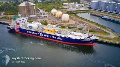
The vessel INEOS INGENUITY (IMO: 9685437, MMSI: 219000034) is a Tanker It's sailing under the flag of [DK] Denmark.
In this page you can find informations about the vessels current position, last detected port calls, and current voyage information. If the vessels is not in coverage by AIS you will find the latest position.
The current position of INEOS INGENUITY is detected by our AIS receivers and we are not responsible for the reliability of the data. The last position was recorded while the vessel was in Coverage by the Ais receivers of our vessel tracking app.
The current draught of INEOS INGENUITY as reported by AIS is 9.2 meters
Weather
| Temperature | 6.5°C / 43.7°F |
|---|---|
| Wind Speed | 6 knots |
| Direction | 89° E |
| Pressure | 1012.1 hPa |
| Humidity | 81.6 % |
| Cloud Coverage | 100 % |
Featured Company
Most Visited Ports (Last year)
| Port | Arrivals | |
|---|---|---|
| 8 | ||
| 6 | ||
| 5 | ||
| 2 | ||
| 1 |
Last Trips
| Origin | Departure | Destination | Arrival | Distance | |
|---|---|---|---|---|---|
| 2024-03-20 20:20 | 2024-04-09 01:00 | 6074.94 nm | |||
| 2024-03-07 15:21 | 2024-03-19 16:44 | 3617.26 nm | |||
| 2024-02-25 18:22 | 2024-03-06 17:56 | 3788.98 nm | |||
| 2024-02-07 19:08 | 2024-02-24 01:45 | 5550.45 nm | |||
| 2024-01-19 20:38 | 2024-02-06 09:21 | 5685.13 nm |
Events
| Tid | Event | Detaljer | Position / Dest | Information |
|---|---|---|---|---|
| 2024-04-26 07:04 | Status ändrad | At anchor Under way using engine |
57.57811 / 11.68248
USHOU-SEGOT
|
Fart: 0.5 kn Kurs: 61° |
| 2024-04-26 07:00 | STOPPAR förflyttning | 3.06 nm, West of VRANGO |
57.57844 / 11.68299
USHOU-SEGOT
|
Fart: 0.3 kn Kurs: 56° |
| 2024-04-26 04:25 | Byter havsområde | Swedish part of the Kattegat Swedish part of the Skaggerak |
57.84123 / 11.18802
Kattegat
USHOU-SEGOT
|
Fart: 12 kn Kurs: 153.1° |
| 2024-04-26 03:10 | Upptäckt i hav | Swedish part of the Skaggerak |
57.94736 / 10.84573
Skaggerak
USHOU-SEGOT
|
Fart: 11.5 kn Kurs: 92° |
| 2024-04-25 22:46 | Byter havsområde | Danish part of the Skaggerak Norwegian part of the Skaggerak |
57.88861 / 9.21469
Skaggerak
USHOU-SEGOT
|
Fart: 12 kn Kurs: 78.8° |
| 2024-04-25 17:59 | Byter havsområde | Norwegian part of the Skaggerak Norwegian part of the North Sea |
57.69320 / 7.56028
Skaggerak
USHOU-SEGOT
|
Fart: 11.6 kn Kurs: 93.8° |
| 2024-04-25 07:48 | Destination ändrad | USHOU-SEGOT US HOU-GB GRG |
57.98709 / 3.86141
USHOU-SEGOT
|
Fart: 12.4 kn Kurs: 100° |
| 2024-04-25 07:48 | ETA ändrat | 2024/04/26 07:00 2024/04/25 18:00 |
57.98709 / 3.86141
USHOU-SEGOT
|
Fart: 12.4 kn Kurs: 100° |
| 2024-04-25 07:16 | Upptäckt i hav | Norwegian part of the North Sea |
58.00693 / 3.66781
North Sea
US HOU-GB GRG
|
Fart: 12.5 kn Kurs: 101.1° |
| 2024-04-25 07:16 | I täckningsområde |
58.00693 / 3.66781
North Sea
US HOU-GB GRG
|
Fart: 12.5 kn Kurs: 101.1° |