
JAN MAAT
Fishing
Current Trip
FISHING GROUND
| Time Travelled | 19 h, 15 mins |
|---|---|
| Remaining Time | --- |
| Distance Travelled | 36.24 nm |
| Remaining Distance | --- |
| AVG Speed | 4.3 Knop |
| MAX Speed | 8.3 Knop |
| AVG Wind | 8.4 knots |
| MAX Wind | 11.8 knots |
| MIN Temp | 8.6°C / 47.48°F |
| MAX Temp | 11.3°C / 52.34°F |
| Djupgående | 2.6 m |
| Position mottagen | 1 m sen |
Current Position
| Longitud | 8.34651° |
|---|---|
| Latitude | 54.04729° |
| Status | Engaged in Fishing |
| Fart | 2.9 Knop |
| Kurs | 269° |
| Område | North Sea |
| Station | T-AIS |
| Position mottagen | 1 m sen |
Info
Information
The current position of JAN MAAT is in North Sea with coordinates 54.04729° / 8.34651° as reported on 2024-04-28 02:30 by AIS to our vessel tracker app. The vessel's current speed is 2.9 Knop
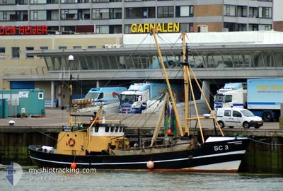
The vessel JAN MAAT (MMSI: 211315620) is a Fishing It's sailing under the flag of [DE] Germany.
In this page you can find informations about the vessels current position, last detected port calls, and current voyage information. If the vessels is not in coverage by AIS you will find the latest position.
The current position of JAN MAAT is detected by our AIS receivers and we are not responsible for the reliability of the data. The last position was recorded while the vessel was in Coverage by the Ais receivers of our vessel tracking app.
The current draught of JAN MAAT as reported by AIS is 2.6 meters
Weather
| Temperature | 11°C / 51.8°F |
|---|---|
| Wind Speed | 9 knots |
| Direction | 111° ESE |
| Pressure | 1007.7 hPa |
| Humidity | 92.3 % |
| Cloud Coverage | 100 % |
Featured Company
Last Port Calls
| Port | Arrival | Departure | Time In Port |
|---|---|---|---|
| 2024-04-27 07:16 | |||
| 2024-04-20 15:41 | |||
| 2024-04-13 15:47 | 2024-04-16 14:22 | 2 d | |
| 2024-04-09 13:49 | 2024-04-11 14:37 | 2 d | |
| 2024-04-06 10:13 | 2024-04-07 03:15 | 17 h | |
| 2024-04-01 22:40 | 2024-04-03 04:36 | 1 d | |
| 2024-04-01 06:44 | |||
| 2024-03-20 08:16 |
Events
| Tid | Event | Detaljer | Position / Dest | Information |
|---|---|---|---|---|
| 2024-04-27 21:09 | I täckningsområde |
54.03573 / 8.24068
North Sea
|
Fart: 2.7 kn Kurs: 269.4° |
|
| 2024-04-27 07:45 | UTANFÖR täckningsområde |
54.12653 / 8.75782
North Sea
|
Fart: 8 kn Kurs: 277.4° |
|
| 2024-04-27 07:23 | I täckningsområde |
54.12079 / 8.83886
North Sea
|
Fart: 7.4 kn Kurs: 287.4° |
|
| 2024-04-27 07:16 | AVGÅTT HAMN |
|
54.12061 / 8.83999
FISHING GROUND
|
Fart: Kurs: 52° |
| 2024-04-27 02:37 | UTANFÖR täckningsområde |
54.12604 / 8.86228
North Sea
[DE] BUESUM
|
Fart: Kurs: 74.3° |
|
| 2024-04-27 02:15 | I täckningsområde |
54.12605 / 8.86229
North Sea
[DE] BUESUM
|
Fart: Kurs: 74.3° |
|
| 2024-04-25 23:39 | UTANFÖR täckningsområde |
54.21810 / 8.36935
North Sea
|
Fart: 3.5 kn Kurs: 0.2° |
|
| 2024-04-25 23:31 | I täckningsområde |
54.21075 / 8.37079
North Sea
|
Fart: 3.1 kn Kurs: 8.2° |
|
| 2024-04-25 22:00 | UTANFÖR täckningsområde |
54.26564 / 8.35858
North Sea
|
Fart: 2.5 kn Kurs: 323.1° |
|
| 2024-04-25 20:44 | I täckningsområde |
54.20956 / 8.37413
North Sea
|
Fart: 2.6 kn Kurs: 348.7° |