
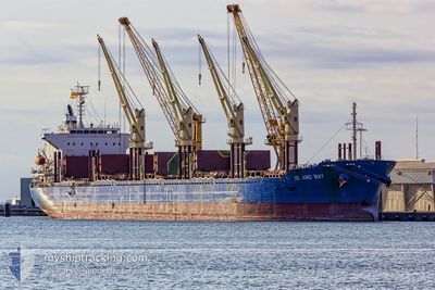
ISLAND BAY
Cargo
Current Trip
| Time Travelled | 13 days |
|---|---|
| Remaining Time | --- |
| Distance Travelled | 2532.28 nm |
| Remaining Distance | --- |
| AVG Speed | 9.9 Knop |
| MAX Speed | 13.8 Knop |
| AVG Wind | 14.9 knots |
| MAX Wind | 32.9 knots |
| MIN Temp | 5.5°C / 41.9°F |
| MAX Temp | 24.8°C / 76.64°F |
| Djupgående | 6.6 m |
| Position mottagen | 1 d sen |
Current Position
| Longitud | 142.97884° |
|---|---|
| Latitude | -40.22710° |
| Status | Under way using engine |
| Fart | 11.5 Knop |
| Kurs | 334.9° |
| Område | Great Australian Bight |
| Station | T-AIS |
| Position mottagen | 1 d sen |
Info
Information
The current position of ISLAND BAY is in Great Australian Bight with coordinates -40.22710° / 142.97884° as reported on 2024-05-01 01:14 by AIS to our vessel tracker app. The vessel's current speed is 11.5 Knop
The vessel ISLAND BAY (IMO: 9663283, MMSI: 477694600) is a Cargo It's sailing under the flag of [HK] Hong Kong.
In this page you can find informations about the vessels current position, last detected port calls, and current voyage information. If the vessels is not in coverage by AIS you will find the latest position.
The current position of ISLAND BAY is detected by our AIS receivers and we are not responsible for the reliability of the data. The last position was recorded while the vessel was in Coverage by the Ais receivers of our vessel tracking app.
The current draught of ISLAND BAY as reported by AIS is 6.6 meters
Weather
| Temperature | 13.2°C / 55.76°F |
|---|---|
| Wind Speed | 10 knots |
| Direction | 102° ESE |
| Pressure | 1031.4 hPa |
| Humidity | 82.2 % |
| Cloud Coverage | 12 % |
Featured Company
Most Visited Ports (Last year)
| Port | Arrivals | |
|---|---|---|
| 3 | ||
| 2 | ||
| 2 | ||
| 2 | ||
| 1 | ||
| 1 |
Last Trips
Events
| Tid | Event | Detaljer | Position / Dest | Information |
|---|---|---|---|---|
| 2024-05-01 12:47 | STOPPAR förflyttning | 5.46 nm, East of PORTLAND-AU |
-38.32025 / 141.72890
AU PTJ
|
Fart: 0.2 kn Kurs: 113° |
| 2024-05-01 01:19 | Status ändrad | Default Under way using engine |
-40.21272 / 142.97012
AU PTJ
|
Fart: 11.5 kn Kurs: 334.9° |
| 2024-05-01 01:14 | UTANFÖR täckningsområde |
-40.22710 / 142.97884
Great Australian Bight
AU PTJ
|
Fart: 11.5 kn Kurs: 334.9° |
|
| 2024-05-01 01:08 | Status ändrad | Under way using engine Default |
-40.24450 / 142.98928
AU PTJ
|
Fart: 11.4 kn Kurs: 336° |
| 2024-05-01 00:58 | Status ändrad | Default Under way using engine |
-40.27249 / 143.00581
AU PTJ
|
Fart: 11.5 kn Kurs: 335.7° |
| 2024-05-01 00:54 | Status ändrad | Under way using engine Default |
-40.28418 / 143.01261
AU PTJ
|
Fart: 11.6 kn Kurs: 338° |
| 2024-05-01 00:39 | Status ändrad | Default Under way using engine |
-40.32727 / 143.03755
AU PTJ
|
Fart: 11.6 kn Kurs: 336.1° |
| 2024-05-01 00:33 | Status ändrad | Under way using engine Default |
-40.34527 / 143.04800
AU PTJ
|
Fart: 11.6 kn Kurs: 338° |
| 2024-04-30 23:36 | Status ändrad | Default Under way using engine |
-40.51226 / 143.14319
AU PTJ
|
Fart: 11.6 kn Kurs: 339.6° |
| 2024-04-30 23:33 | Status ändrad | Under way using engine Default |
-40.52180 / 143.14807
AU PTJ
|
Fart: 11.6 kn Kurs: 339° |