
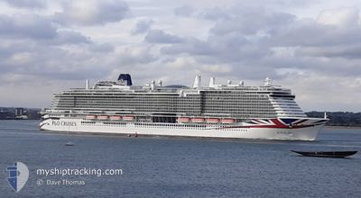
IONA
Passenger
Current Trip
| Time Travelled | 11 h, 37 mins |
|---|---|
| Remaining Time | 23 h, 49 mins |
| Distance Travelled | 209.11 nm |
| Remaining Distance | 454.26 nm |
| AVG Speed | 16.8 Knop |
| MAX Speed | 20.3 Knop |
| AVG Wind | 14.7 knots |
| MAX Wind | 19.9 knots |
| MIN Temp | 18.4°C / 65.12°F |
| MAX Temp | 20.8°C / 69.44°F |
| Djupgående | 8.8 m |
| Position mottagen | 3 m sen |
Current Position
| Longitud | 2.17829° |
|---|---|
| Latitude | 51.95041° |
| Status | Under way using engine |
| Fart | 18.6 Knop |
| Kurs | 9.1° |
| Område | North Sea |
| Station | T-AIS |
| Position mottagen | 3 m sen |
Info
Information
The current position of IONA is in North Sea with coordinates 51.95041° / 2.17829° as reported on 2024-09-01 04:29 by AIS to our vessel tracker app. The vessel's current speed is 18.6 Knop and is heading at the port of STAVANGER. The estimated time of arrival as calculated by MyShipTracking vessel tracking app is 2024-09-02 06:22 LT
The vessel IONA (IMO: 9826548, MMSI: 232025845) is a Passenger It's sailing under the flag of [GB] United Kingdom.
In this page you can find informations about the vessels current position, last detected port calls, and current voyage information. If the vessels is not in coverage by AIS you will find the latest position.
The current position of IONA is detected by our AIS receivers and we are not responsible for the reliability of the data. The last position was recorded while the vessel was in Coverage by the Ais receivers of our vessel tracking app.
The current draught of IONA as reported by AIS is 8.8 meters
Weather
| Temperature | 18.4°C / 65.12°F |
|---|---|
| Wind Speed | 14 knots |
| Direction | 73° ENE |
| Pressure | 1016.6 hPa |
| Humidity | 87.5 % |
| Cloud Coverage | 55 % |
Featured Company
Last Port Calls
| Port | Arrival | Departure | Time In Port |
|---|---|---|---|
| 2024-08-31 05:47 | 2024-08-31 17:56 | 12 h | |
| 2024-08-29 07:39 | 2024-08-29 16:57 | 9 h | |
| 2024-08-26 07:48 | 2024-08-26 17:20 | 9 h | |
| 2024-08-24 05:46 | 2024-08-24 18:06 | 12 h | |
| 2024-08-21 06:03 | 2024-08-21 17:00 | 10 h | |
| 2024-08-19 07:56 | 2024-08-19 17:24 | 9 h | |
| 2024-08-17 05:57 | 2024-08-17 18:07 | 12 h | |
| 2024-08-15 07:37 | 2024-08-15 17:04 | 9 h | |
| 2024-08-12 07:57 | 2024-08-12 17:16 | 9 h | |
| 2024-08-10 05:49 | 2024-08-10 18:00 | 12 h |
Last Trips
| Origin | Departure | Destination | Arrival | Distance | |
|---|---|---|---|---|---|
| 2024-08-29 16:57 | 2024-08-31 05:47 | 662.29 nm | |||
| 2024-08-26 17:20 | 2024-08-29 07:39 | 693.35 nm | |||
| 2024-08-24 18:06 | 2024-08-26 07:48 | 660.27 nm | |||
| 2024-08-21 17:00 | 2024-08-24 05:46 | 930.72 nm | |||
| 2024-08-19 17:24 | 2024-08-21 06:03 | 434.73 nm | |||
| 2024-08-17 18:07 | 2024-08-19 07:56 | 658.97 nm | |||
| 2024-08-15 17:04 | 2024-08-17 05:57 | 671.72 nm | |||
| 2024-08-12 17:16 | 2024-08-15 07:37 | 724.91 nm | |||
| 2024-08-10 18:00 | 2024-08-12 07:57 | 660.75 nm | |||
| 2024-08-08 17:00 | 2024-08-10 05:49 | 665.61 nm |
Events
| Tid | Event | Detaljer | Position / Dest | Information |
|---|---|---|---|---|
| 2024-09-01 01:20 | Byter havsområde | United Kingdom part of the North Sea French part of the North Sea |
51.08595 / 1.66924
North Sea
GBSOU>NOSVG
|
Fart: 19.5 kn Kurs: 31.3° |
| 2024-09-01 01:07 | Byter havsområde | French part of the North Sea French part of the English Channel |
51.03196 / 1.59428
North Sea
GBSOU>NOSVG
|
Fart: 19.9 kn Kurs: 44.9° |
| 2024-08-31 22:59 | Byter havsområde | French part of the English Channel United Kingdom part of the English Channel |
50.50762 / .95611
English Channel
GBSOU>NOSVG
|
Fart: 18.9 kn Kurs: 81.8° |
| 2024-08-31 22:29 | Status ändrad | Under way using engine Default |
50.48047 / .71665
GBSOU>NOSVG
|
Fart: 18.8 kn Kurs: 73° |
| 2024-08-31 22:25 | Status ändrad | Default Under way using engine |
50.47382 / .68316
GBSOU>NOSVG
|
Fart: 18.8 kn Kurs: 73° |
| 2024-08-31 18:54 | Status ändrad | Under way using engine Constrained by her draught |
50.62887 / -.89587
GBSOU>NOSVG
|
Fart: 13.3 kn Kurs: 123.3° |
| 2024-08-31 16:56 | AVGÅTT HAMN |
|
50.86909 / -1.37648
GBSOU>NOSVG
|
Fart: 10.9 kn Kurs: 128° |
| 2024-08-31 16:46 | STARTAR förflyttning |
50.88628 / -1.40119
[GB] SOUTHAMPTON
|
Fart: 3.2 kn Kurs: 143° |
|
| 2024-08-31 16:34 | Status ändrad | Constrained by her draught Restricted manoeuverability |
50.89319 / -1.39914
[GB] SOUTHAMPTON
|
Fart: 0.3 kn Kurs: 12° |
| 2024-08-31 16:31 | Status ändrad | Restricted manoeuverability Moored |
50.89321 / -1.39928
[GB] SOUTHAMPTON
|
Fart: Kurs: 13° |