
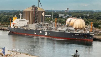
HOURAI MARU
Tanker
Current Trip
| Time Travelled | 7 days |
|---|---|
| Remaining Time | 2 days |
| Distance Travelled | 2800.14 nm |
| Remaining Distance | 768.29 nm |
| AVG Speed | 13.8 Knop |
| MAX Speed | 18.1 Knop |
| AVG Wind | 21.5 knots |
| MAX Wind | 31 knots |
| MIN Temp | 4.9°C / 40.82°F |
| MAX Temp | 13.6°C / 56.48°F |
| Djupgående | 7.6 m |
| Position mottagen | 6 d sen |
Current Position
| Longitud | -4.84073° |
|---|---|
| Latitude | 49.68353° |
| Status | Under way using engine |
| Fart | 14 Knop |
| Kurs | 255.6° |
| Område | English Channel |
| Station | T-AIS |
| Position mottagen | 6 d sen |
Info
Information
The current position of HOURAI MARU is in English Channel with coordinates 49.68353° / -4.84073° as reported on 2024-04-29 16:03 by AIS to our vessel tracker app. The vessel's current speed is 14 Knop and is heading at the port of MARCUS HOOK. The estimated time of arrival as calculated by MyShipTracking vessel tracking app is 2024-05-08 12:10 LT
The vessel HOURAI MARU (IMO: 9796585, MMSI: 538008262) is a Tanker It's sailing under the flag of [MH] Marshall Is.
In this page you can find informations about the vessels current position, last detected port calls, and current voyage information. If the vessels is not in coverage by AIS you will find the latest position.
The current position of HOURAI MARU is detected by our AIS receivers and we are not responsible for the reliability of the data. The last position was recorded while the vessel was in Coverage by the Ais receivers of our vessel tracking app.
The current draught of HOURAI MARU as reported by AIS is 7.6 meters
Weather
| Temperature | 11.9°C / 53.42°F |
|---|---|
| Wind Speed | 4 knots |
| Direction | 6° N |
| Pressure | 1023.2 hPa |
| Humidity | 65.8 % |
| Cloud Coverage | 100 % |
Featured Company
Last Port Calls
| Port | Arrival | Departure | Time In Port |
|---|---|---|---|
| 2024-04-26 15:15 | 2024-04-28 12:30 | 1 d | |
| 2024-04-23 10:12 | 2024-04-24 14:04 | 1 d | |
| 2024-04-21 08:27 | 2024-04-22 12:56 | 1 d | |
| 2024-04-15 15:51 | 2024-04-16 19:24 | 1 d | |
| 2024-04-11 04:43 | 2024-04-12 10:19 | 1 d | |
| 2024-04-05 14:57 | 2024-04-07 04:15 | 1 d | |
| 2024-03-27 09:10 | 2024-03-29 16:02 | 2 d | |
| 2024-03-22 11:57 | 2024-03-23 23:33 | 1 d | |
| 2024-03-16 07:09 | 2024-03-17 08:57 | 1 d | |
| 2024-03-15 06:36 |
Last Trips
| Origin | Departure | Destination | Arrival | Distance | |
|---|---|---|---|---|---|
| 2024-04-24 16:04 | 2024-04-26 17:15 | 639.30 nm | |||
| 2024-04-22 14:56 | 2024-04-23 12:12 | 297.84 nm | |||
| 2024-04-16 21:24 | 2024-04-21 10:27 | 429.10 nm | |||
| 2024-04-12 12:19 | 2024-04-15 17:51 | 420.20 nm | |||
| 2024-04-07 06:15 | 2024-04-11 06:43 | 1260.78 nm | |||
| 2024-03-29 17:02 | 2024-04-05 16:57 | 1465.22 nm | |||
| 2024-03-24 00:33 | 2024-03-27 10:10 | 527.73 nm | |||
| 2024-03-17 08:57 | 2024-03-22 12:57 | 1603.73 nm | |||
| 2024-03-15 06:36 | 2024-03-16 07:09 | 85.62 nm |
Events
| Tid | Event | Detaljer | Position / Dest | Information |
|---|---|---|---|---|
| 2024-04-29 16:10 | Status ändrad | Default Under way using engine |
49.67606 / -4.88341
BEANR>USMAH
|
Fart: 14 kn Kurs: 255.6° |
| 2024-04-29 16:03 | Status ändrad | Under way using engine Default |
49.68353 / -4.84073
BEANR>USMAH
|
Fart: 13.9 kn Kurs: 255° |
| 2024-04-29 16:03 | UTANFÖR täckningsområde |
49.68353 / -4.84073
English Channel
BEANR>USMAH
|
Fart: 14 kn Kurs: 255.6° |
|
| 2024-04-29 16:02 | Status ändrad | Default Under way using engine |
49.68454 / -4.83495
BEANR>USMAH
|
Fart: 14.4 kn Kurs: 253.6° |
| 2024-04-29 11:32 | Byter havsområde | United Kingdom part of the English Channel Guernsey part of the English Channel |
49.96655 / -3.16416
English Channel
BEANR>USMAH
|
Fart: 14.3 kn Kurs: 257.9° |
| 2024-04-29 11:29 | Status ändrad | Under way using engine Default |
49.96880 / -3.14732
BEANR>USMAH
|
Fart: 14.3 kn Kurs: 258° |
| 2024-04-29 10:39 | Status ändrad | Default Under way using engine |
50.00311 / -2.84771
BEANR>USMAH
|
Fart: 13.6 kn Kurs: 251.8° |
| 2024-04-29 10:19 | Status ändrad | Under way using engine Default |
50.02607 / -2.74057
BEANR>USMAH
|
Fart: 13.6 kn Kurs: 252° |
| 2024-04-29 09:54 | Status ändrad | Default Under way using engine |
50.05624 / -2.60139
BEANR>USMAH
|
Fart: 13.6 kn Kurs: 251.3° |
| 2024-04-29 09:54 | Status ändrad | Under way using engine Default |
50.05663 / -2.59953
BEANR>USMAH
|
Fart: 13.5 kn Kurs: 246° |