
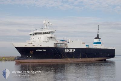
HOLMFOSS
Reefer
Current Trip
| Time Travelled | 15 h, 41 mins |
|---|---|
| Remaining Time | --- |
| Distance Travelled | 155.05 nm |
| Remaining Distance | --- |
| AVG Speed | 12.2 Knop |
| MAX Speed | 13.3 Knop |
| AVG Wind | 9.7 knots |
| MAX Wind | 17.3 knots |
| MIN Temp | -4.3°C / 24.26°F |
| MAX Temp | 4.4°C / 39.92°F |
| Djupgående | 5.3 m |
| Position mottagen | 2 m sen |
Current Position
| Longitud | --- |
|---|---|
| Latitude | --- |
| Status | Under way using engine |
| Fart | |
| Kurs | 224° |
| Område | Norwegian Sea |
| Station | T-AIS |
| Position mottagen | 2 m sen |
Info
Information
The current position of HOLMFOSS is in Norwegian Sea with coordinates 64.90148° / 11.30470° as reported on 2025-12-23 06:21 by AIS to our vessel tracker app. The vessel's current speed is 0 Knop
The vessel HOLMFOSS (IMO: 9359662, MMSI: 257302000) is a Reefer that was built in 2007 ( 18 År gammal ). It's sailing under the flag of [NO] Norway.
In this page you can find informations about the vessels current position, last detected port calls, and current voyage information. If the vessels is not in coverage by AIS you will find the latest position.
The current position of HOLMFOSS is detected by our AIS receivers and we are not responsible for the reliability of the data. The last position was recorded while the vessel was in Coverage by the Ais receivers of our vessel tracking app.
The current draught of HOLMFOSS as reported by AIS is 5.3 meters
Weather
| Temperature | 0.6°C / 33.08°F |
|---|---|
| Wind Speed | 11 knots |
| Direction | 152° SSE |
| Pressure | 1029.4 hPa |
| Humidity | 72.9 % |
| Cloud Coverage | 80 % |
Featured Company
Last Port Calls
| Port | Arrival | Departure | Time In Port |
|---|---|---|---|
| 2025-12-22 14:53 | 2025-12-22 15:43 | 50 m | |
| 2025-12-21 13:46 | 2025-12-21 14:53 | 1 h | |
| 2025-12-20 14:32 | 2025-12-20 20:08 | 5 h | |
| 2025-12-19 00:40 | 2025-12-19 01:34 | 53 m | |
| 2025-12-18 09:51 | 2025-12-19 00:20 | 14 h | |
| 2025-12-18 08:27 | 2025-12-18 09:38 | 1 h | |
| 2025-12-16 14:11 | 2025-12-17 16:51 | 1 d | |
| 2025-12-13 20:30 | 2025-12-13 21:30 | 59 m | |
| 2025-12-13 12:21 | 2025-12-13 13:38 | 1 h | |
| 2025-12-13 05:12 | 2025-12-13 06:03 | 50 m |
Last Trips
| Origin | Departure | Destination | Arrival | Distance | |
|---|---|---|---|---|---|
| 2025-12-21 14:53 | 2025-12-22 14:53 | 118.10 nm | |||
| 2025-12-20 20:08 | 2025-12-21 13:46 | 231.80 nm | |||
| 2025-12-19 01:34 | 2025-12-20 14:32 | 519.98 nm | |||
| 2025-12-19 00:20 | 2025-12-19 00:40 | 1.08 nm | |||
| 2025-12-18 09:38 | 2025-12-18 09:51 | 1.13 nm | |||
| 2025-12-17 16:51 | 2025-12-18 08:27 | 191.28 nm | |||
| 2025-12-13 21:30 | 2025-12-16 14:11 | 610.62 nm | |||
| 2025-12-13 13:38 | 2025-12-13 20:30 | 2.70 nm | |||
| 2025-12-13 06:03 | 2025-12-13 12:21 | 66.33 nm | |||
| 2025-12-13 04:56 | 2025-12-13 05:12 | 1.26 nm |
Events
| Tid | Event | Detaljer | Position / Dest | Information |
|---|---|---|---|---|
| 2025-12-23 03:30 | STOPPAR förflyttning | 2.6 nm, North of OTTERSOYA |
64.90150 / 11.30468
NORVK
|
Fart: 0.2 kn Kurs: 222° |
| 2025-12-22 15:31 | Status ändrad | Under way using engine Default |
63.19589 / 7.85253
NORVK
|
Fart: 12.3 kn Kurs: 56° |
| 2025-12-22 15:30 | Status ändrad | Default Under way using engine |
63.19346 / 7.84420
NORVK
|
Fart: 12.2 kn Kurs: 55.8° |
| 2025-12-22 15:04 | Destination ändrad | NORVK KSU |
63.13255 / 7.68996
NORVK
|
Fart: 12.5 kn Kurs: 43.6° |
| 2025-12-22 15:04 | ETA ändrat | 2025/12/23 04:00 2025/12/22 15:00 |
63.13255 / 7.68996
NORVK
|
Fart: 12.5 kn Kurs: 43.6° |
| 2025-12-22 14:43 | AVGÅTT HAMN |
|
63.10098 / 7.76391
KSU
|
Fart: 10.4 kn Kurs: 237° |
| 2025-12-22 14:42 | STARTAR förflyttning |
63.10298 / 7.76930
[NO] KRISTIANSUND
|
Fart: 7.6 kn Kurs: 209° |
|
| 2025-12-22 13:57 | STOPPAR förflyttning |
63.10563 / 7.77074
[NO] KRISTIANSUND
|
Fart: 0.3 kn Kurs: 295° |
|
| 2025-12-22 13:53 | ANLÄNDER HAMN |
|
63.10314 / 7.76991
[NO] KRISTIANSUND
|
Fart: 5.1 kn Kurs: 42° |
| 2025-12-22 12:24 | Destination ändrad | KSU KRISTINSUND |
63.01492 / 7.11474
KSU
|
Fart: 14.1 kn Kurs: 62.7° |