
HEYN
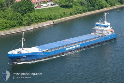
General Cargo
Current Trip
| Time Travelled | 2 days |
|---|---|
| Remaining Time | 1 day |
| Distance Travelled | 534.25 nm |
| Remaining Distance | 452.55 nm |
| AVG Speed | 8.8 Knop |
| MAX Speed | 13.5 Knop |
| AVG Wind | 8.1 knots |
| MAX Wind | 14 knots |
| MIN Temp | 12.2°C / 53.96°F |
| MAX Temp | 18.3°C / 64.94°F |
| Djupgående | 5.5 m |
| Position mottagen | 1 m sen |
Current Position
| Longitud | 14.37411° |
|---|---|
| Latitude | 55.17237° |
| Status | Under way using engine |
| Fart | 10.4 Knop |
| Kurs | 39.2° |
| Område | Kattegat |
| Station | T-AIS |
| Position mottagen | 1 m sen |
Info
Information
The current position of HEYN is in Kattegat with coordinates 55.17237° / 14.37411° as reported on 2024-06-01 02:00 by AIS to our vessel tracker app. The vessel's current speed is 10.4 Knop and is heading at the port of MUUGA. The estimated time of arrival as calculated by MyShipTracking vessel tracking app is 2024-06-02 22:01 LT
The vessel HEYN (IMO: 9423671, MMSI: 244130642) is a General Cargo that was built in 2008 ( 16 År gammal ). It's sailing under the flag of [NL] Netherlands.
In this page you can find informations about the vessels current position, last detected port calls, and current voyage information. If the vessels is not in coverage by AIS you will find the latest position.
The current position of HEYN is detected by our AIS receivers and we are not responsible for the reliability of the data. The last position was recorded while the vessel was in Coverage by the Ais receivers of our vessel tracking app.
The current draught of HEYN as reported by AIS is 5.5 meters
Weather
| Temperature | 13.1°C / 55.58°F |
|---|---|
| Wind Speed | 12 knots |
| Direction | 43° NE |
| Pressure | 1012.2 hPa |
| Humidity | 93.9 % |
| Cloud Coverage | 19 % |
Featured Company
Last Port Calls
| Port | Arrival | Departure | Time In Port |
|---|---|---|---|
| 2024-05-29 18:37 | 2024-05-29 19:43 | 1 h | |
| 2024-05-28 15:23 | 2024-05-29 18:12 | 1 d | |
| 2024-05-26 09:19 | 2024-05-28 15:02 | 2 d | |
| 2024-05-19 21:20 | 2024-05-21 21:40 | 2 d | |
| 2024-05-14 21:35 | 2024-05-15 20:51 | 23 h | |
| 2024-05-12 04:23 | 2024-05-13 22:03 | 1 d | |
| 2024-05-07 15:00 | 2024-05-08 19:07 | 1 d | |
| 2024-05-01 01:59 | 2024-05-06 16:47 | 5 d | |
| 2024-04-21 10:22 | 2024-04-24 17:42 | 3 d | |
| 2024-04-14 17:18 | 2024-04-16 17:18 | 2 d |
Last Trips
| Origin | Departure | Destination | Arrival | Distance | |
|---|---|---|---|---|---|
| 2024-05-29 18:12 | 2024-05-29 18:37 | 0.50 nm | |||
| 2024-05-28 15:02 | 2024-05-28 15:23 | 1.45 nm | |||
| 2024-05-21 21:40 | 2024-05-26 09:19 | 1077.30 nm | |||
| 2024-05-15 20:51 | 2024-05-19 21:20 | 940.85 nm | |||
| 2024-05-13 22:03 | 2024-05-14 21:35 | 241.02 nm | |||
| 2024-05-08 19:07 | 2024-05-12 04:23 | 606.83 nm | |||
| 2024-05-06 16:47 | 2024-05-07 15:00 | 96.97 nm | |||
| 2024-04-24 17:42 | 2024-05-01 01:59 | 1505.63 nm | |||
| 2024-04-16 17:18 | 2024-04-21 10:22 | 512.60 nm | |||
| 2024-04-10 09:15 | 2024-04-14 17:18 | 1050.00 nm |
Events
| Tid | Event | Detaljer | Position / Dest | Information |
|---|---|---|---|---|
| 2024-06-01 00:25 | Upptäckt i hav | Danish part of the Kattegat |
54.98005 / 14.02521
Kattegat
EEMUG
|
Fart: 11.2 kn Kurs: 65.3° |
| 2024-06-01 00:16 | Upptäckt i hav | Swedish part of the Baltic Sea |
54.96844 / 13.98063
Baltic Sea
EEMUG
|
Fart: 11.2 kn Kurs: 65.5° |
| 2024-05-31 17:25 | Upptäckt i hav | German part of the Baltic Sea |
54.41454 / 12.12339
Baltic Sea
EEMUG
|
Fart: 10.6 kn Kurs: 89.9° |
| 2024-05-31 15:04 | Byter havsområde | Danish part of the Baltic Sea German part of the Baltic Sea |
54.50259 / 11.43612
Baltic Sea
EEMUG
|
Fart: 10.7 kn Kurs: 113.3° |
| 2024-05-31 11:16 | Byter havsområde | German part of the Baltic Sea German part of the North Sea |
54.45670 / 10.28606
Baltic Sea
EEMUG
|
Fart: 10.4 kn Kurs: 54.7° |
| 2024-05-31 10:30 | STARTAR förflyttning | 1.31 nm, South West of STICKENHΟRN SPORT |
54.36557 / 10.14519
EEMUG
|
Fart: 4.9 kn Kurs: 100° |
| 2024-05-31 09:47 | STOPPAR förflyttning | 1.37 nm, South West of STICKENHΟRN SPORT |
54.36595 / 10.14185
EEMUG
|
Fart: 0.3 kn Kurs: 105° |
| 2024-05-31 03:45 | Status ändrad | Under way using engine Default |
54.13653 / 9.33745
EEMUG
|
Fart: 6.6 kn Kurs: 17° |
| 2024-05-31 03:39 | Status ändrad | Default Under way using engine |
54.12648 / 9.33011
EEMUG
|
Fart: 6.6 kn Kurs: 8.8° |
| 2024-05-31 03:37 | Status ändrad | Under way using engine Default |
54.12319 / 9.32904
EEMUG
|
Fart: 6.6 kn Kurs: 356° |