
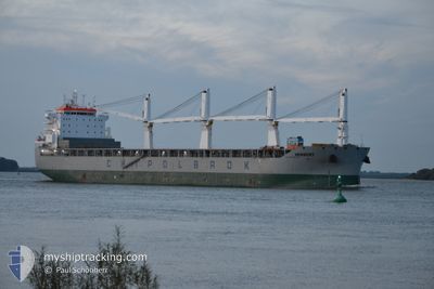
HERBERT
Cargo
Current Position
| Longitud | 24.07437° |
|---|---|
| Latitude | 59.33602° |
| Status | Moored |
| Fart | |
| Kurs | 179° |
| Område | Gulf of Finland |
| Station | T-AIS |
| Position mottagen | Nu |
Info
Information
The current position of HERBERT is in Gulf of Finland with coordinates 59.33602° / 24.07437° as reported on 2024-05-02 00:30 by AIS to our vessel tracker app. The vessel's current speed is 0 Knop and is currently inside the port of PALDISKI.
The vessel HERBERT (IMO: 9931551, MMSI: 636020696) is a Cargo It's sailing under the flag of [LR] Liberia.
In this page you can find informations about the vessels current position, last detected port calls, and current voyage information. If the vessels is not in coverage by AIS you will find the latest position.
The current position of HERBERT is detected by our AIS receivers and we are not responsible for the reliability of the data. The last position was recorded while the vessel was in Coverage by the Ais receivers of our vessel tracking app.
The current draught of HERBERT as reported by AIS is 8.7 meters
Weather
| Temperature | 6°C / 42.8°F |
|---|---|
| Wind Speed | 4 knots |
| Direction | 112° ESE |
| Pressure | 1026.6 hPa |
| Humidity | 76.8 % |
| Cloud Coverage | 3 % |
Featured Company
Most Visited Ports (Last year)
| Port | Arrivals | |
|---|---|---|
| 3 | ||
| 2 | ||
| 2 | ||
| 2 | ||
| 1 | ||
| 1 |
Events
| Tid | Event | Detaljer | Position / Dest | Information |
|---|---|---|---|---|
| 2024-05-01 20:09 | Status ändrad | Moored Default |
59.33604 / 24.07436
[EE] PALDISKI
|
Fart: Kurs: 179° |
| 2024-05-01 20:03 | Status ändrad | Default Moored |
59.33600 / 24.07437
[EE] PALDISKI
|
Fart: Kurs: 179° |
| 2024-05-01 00:02 | ETA ändrat | 2025/04/27 09:00 2024/04/27 09:00 |
59.33607 / 24.07439
[EE] PALDISKI
|
Fart: Kurs: 179° |
| 2024-04-30 23:24 | Status ändrad | Moored Under way using engine |
59.33551 / 24.07428
[EE] PALDISKI
|
Fart: 0.3 kn Kurs: 181° |
| 2024-04-30 23:08 | ANLÄNDER HAMN |
|
59.33212 / 24.07449
[EE] PALDISKI
|
Fart: 1 kn Kurs: 161° |
| 2024-04-30 22:59 | STOPPAR förflyttning | 1.53 nm, South East of PALDISKI |
59.32988 / 24.07429
EE PLA
|
Fart: 0.3 kn Kurs: 102° |
| 2024-04-30 21:28 | STARTAR förflyttning | 4.1 nm, West of PALDISKI |
59.37412 / 23.91808
EE PLA
|
Fart: 3.1 kn Kurs: 48° |
| 2024-04-30 21:26 | Status ändrad | Under way using engine Default |
59.37269 / 23.91715
EE PLA
|
Fart: 0.3 kn Kurs: 30° |
| 2024-04-30 21:17 | Status ändrad | Default At anchor |
59.37076 / 23.91518
EE PLA
|
Fart: 0.5 kn Kurs: 37° |
| 2024-04-30 21:14 | Status ändrad | At anchor Default |
59.37095 / 23.91515
EE PLA
|
Fart: 0.1 kn Kurs: 31° |