
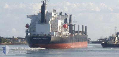
HANDY INCLUSIVITY
Cargo
Current Trip
| Trip Time | 6 days |
|---|---|
| Trip Distance | 798.04 nm |
| AVG Speed | 11.6 Knop |
| MAX Speed | 15.4 Knop |
| Djupgående | 10.5 m |
| AVG Wind | 11.9 knots |
| MAX Wind | 20 knots |
| MIN Temp | 22.3°C / 72.14°F |
| MAX Temp | 30.4°C / 86.72°F |
| Position mottagen | 1 d sen |
Current Position
| Longitud | -96.04731° |
|---|---|
| Latitude | 19.16728° |
| Status | At anchor |
| Fart | |
| Kurs | 92° |
| Område | Gulf of Mexico |
| Station | T-AIS |
| Position mottagen | 1 d sen |
Info
Information
The current position of HANDY INCLUSIVITY is in Gulf of Mexico with coordinates 19.16728° / -96.04731° as reported on 2024-05-28 03:03 by AIS to our vessel tracker app. The vessel's current speed is 0 Knop and is currently inside the port of VERACRUZ.
The vessel HANDY INCLUSIVITY (IMO: 9951800, MMSI: 352001882) is a Cargo It's sailing under the flag of [PA] Panama.
In this page you can find informations about the vessels current position, last detected port calls, and current voyage information. If the vessels is not in coverage by AIS you will find the latest position.
The current position of HANDY INCLUSIVITY is detected by our AIS receivers and we are not responsible for the reliability of the data. The last position was recorded while the vessel was in Coverage by the Ais receivers of our vessel tracking app.
The current draught of HANDY INCLUSIVITY as reported by AIS is 10.5 meters
Weather
| Temperature | --- |
|---|---|
| Wind Speed | --- |
| Direction | --- |
| Pressure | --- |
| Humidity | --- |
| Cloud Coverage | --- |
Featured Company
Last Port Calls
| Port | Arrival | Departure | Time In Port |
|---|---|---|---|
| 2024-05-28 16:21 | |||
| 2024-05-10 07:14 | 2024-05-21 22:20 | 11 d | |
| 2024-04-29 21:38 | 2024-05-07 04:38 | 7 d | |
| 2024-04-27 13:21 | 2024-04-28 11:39 | 22 h | |
| 2024-04-13 23:38 | 2024-04-14 04:21 | 4 h | |
| 2024-04-07 04:39 | 2024-04-12 11:11 | 5 d | |
| 2024-04-03 13:27 | 2024-04-05 09:52 | 1 d | |
| 2024-03-31 06:59 | 2024-04-01 19:48 | 1 d |
Most Visited Ports (Last year)
| Port | Arrivals | |
|---|---|---|
| 3 | ||
| 2 | ||
| 1 | ||
| 1 | ||
| 1 | ||
| 1 |
Last Trips
| Origin | Departure | Destination | Arrival | Distance | |
|---|---|---|---|---|---|
| 2024-05-21 22:20 | 2024-05-28 16:21 | 798.04 nm | |||
| 2024-05-07 04:38 | 2024-05-10 07:14 | 976.98 nm | |||
| 2024-04-28 11:39 | 2024-04-29 21:38 | 8.20 nm | |||
| 2024-04-14 04:21 | 2024-04-27 13:21 | 1078.37 nm | |||
| 2024-04-12 11:11 | 2024-04-13 23:38 | 436.49 nm | |||
| 2024-04-05 09:52 | 2024-04-07 04:39 | 437.52 nm | |||
| 2024-04-01 19:48 | 2024-04-03 13:27 | 488.71 nm |
Events
| Tid | Event | Detaljer | Position / Dest | Information |
|---|---|---|---|---|
| 2024-05-28 21:39 | STOPPAR förflyttning |
19.21167 / -96.13500
[MX] VERACRUZ
|
Fart: Kurs: -1° |
|
| 2024-05-28 21:21 | ANLÄNDER HAMN |
|
19.20333 / -96.12500
[MX] VERACRUZ
|
Fart: 9.1 kn Kurs: 272° |
| 2024-05-28 20:43 | STARTAR förflyttning | 5.08 nm, East of VERACRUZ |
19.17333 / -96.04166
MX VER
|
Fart: 4 kn Kurs: -1° |
| 2024-05-28 03:09 | Status ändrad | Default At anchor |
19.16729 / -96.04725
MX VER
|
Fart: Kurs: 92° |
| 2024-05-28 03:03 | Status ändrad | At anchor Default |
19.16728 / -96.04731
MX VER
|
Fart: Kurs: 91° |
| 2024-05-28 03:03 | UTANFÖR täckningsområde |
19.16728 / -96.04731
Gulf of Mexico
|
Fart: Kurs: 359.5° |
|
| 2024-05-28 02:57 | Status ändrad | Default At anchor |
19.16728 / -96.04730
MX VER
|
Fart: Kurs: 89° |
| 2024-05-28 01:21 | Status ändrad | At anchor Default |
19.16752 / -96.04718
MX VER
|
Fart: Kurs: 102° |
| 2024-05-28 01:15 | I täckningsområde |
19.16752 / -96.04718
Gulf of Mexico
|
Fart: Kurs: 183.9° |
|
| 2024-05-27 05:06 | UTANFÖR täckningsområde |
19.16819 / -96.04687
Gulf of Mexico
|
Fart: Kurs: 331.1° |