
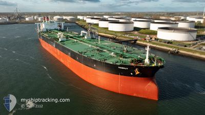
HABRUT
Crude Oil Tanker
Current Trip
ZA CPT>US GOLA
| Time Travelled | --- |
|---|---|
| Remaining Time | --- |
| Distance Travelled | 6156.60 nm |
| Remaining Distance | --- |
| AVG Speed | 12.6 Knop |
| MAX Speed | 15.6 Knop |
| AVG Wind | 10.8 knots |
| MAX Wind | 25.7 knots |
| MIN Temp | 15.4°C / 59.72°F |
| MAX Temp | 29.2°C / 84.56°F |
| Djupgående | 10.9 m |
| Position mottagen | 4 d sen |
Current Position
| Longitud | 17.38949° |
|---|---|
| Latitude | -33.67727° |
| Status | Under way using engine |
| Fart | 11.9 Knop |
| Kurs | 276.2° |
| Område | South Atlantic Ocean |
| Station | T-AIS |
| Position mottagen | 4 d sen |
Info
Information
The current position of HABRUT is in South Atlantic Ocean with coordinates -33.67727° / 17.38949° as reported on 2024-05-28 03:18 by AIS to our vessel tracker app. The vessel's current speed is 11.9 Knop
The vessel HABRUT (IMO: 9500730, MMSI: 538004577) is a Crude Oil Tanker that was built in 2012 ( 12 År gammal ). It's sailing under the flag of [MH] Marshall Is.
In this page you can find informations about the vessels current position, last detected port calls, and current voyage information. If the vessels is not in coverage by AIS you will find the latest position.
The current position of HABRUT is detected by our AIS receivers and we are not responsible for the reliability of the data. The last position was recorded while the vessel was in Coverage by the Ais receivers of our vessel tracking app.
The current draught of HABRUT as reported by AIS is 10.9 meters
Weather
| Temperature | 17.9°C / 64.22°F |
|---|---|
| Wind Speed | 17 knots |
| Direction | 143° SE |
| Pressure | 1027.6 hPa |
| Humidity | 48.3 % |
| Cloud Coverage | 67 % |
Featured Company
Last Port Calls
Most Visited Ports (Last year)
| Port | Arrivals | |
|---|---|---|
| 2 | ||
| 1 | ||
| 1 |
Last Trips
| Origin | Departure | Destination | Arrival | Distance |
|---|
Events
| Tid | Event | Detaljer | Position / Dest | Information |
|---|---|---|---|---|
| 2024-05-28 03:24 | Status ändrad | Default Under way using engine |
-33.67629 / 17.36478
ZA CPT>US GOLA
|
Fart: 11.9 kn Kurs: 276.2° |
| 2024-05-28 03:18 | UTANFÖR täckningsområde |
-33.67727 / 17.38949
South Atlantic Ocean
|
Fart: 11.9 kn Kurs: 276.2° |
|
| 2024-05-28 02:58 | Status ändrad | Under way using engine Default |
-33.67382 / 17.47038
ZA CPT>US GOLA
|
Fart: 12.2 kn Kurs: 286° |
| 2024-05-28 02:37 | Status ändrad | Default Under way using engine |
-33.69018 / 17.55452
ZA CPT>US GOLA
|
Fart: 12.1 kn Kurs: 290.9° |
| 2024-05-28 02:26 | Status ändrad | Under way using engine Default |
-33.70075 / 17.59684
ZA CPT>US GOLA
|
Fart: 11.9 kn Kurs: 283° |
| 2024-05-28 02:24 | Status ändrad | Default Under way using engine |
-33.70206 / 17.60195
ZA CPT>US GOLA
|
Fart: 12.9 kn Kurs: 304.2° |
| 2024-05-28 02:16 | Destination ändrad | ZA CPT>US GOLA MU PLU>ZA CPT |
-33.71410 / 17.63893
ZA CPT>US GOLA
|
Fart: 12.5 kn Kurs: 297.8° |
| 2024-05-28 02:16 | ETA ändrat | 2024/05/22 22:00 2024/05/26 06:00 |
-33.71410 / 17.63893
ZA CPT>US GOLA
|
Fart: 12.5 kn Kurs: 297.8° |
| 2024-05-28 01:27 | Status ändrad | Under way using engine Default |
-33.77436 / 17.81634
MU PLU>ZA CPT
|
Fart: 11.8 kn Kurs: 287° |
| 2024-05-28 01:24 | Status ändrad | Default Under way using engine |
-33.77626 / 17.82520
MU PLU>ZA CPT
|
Fart: 11.6 kn Kurs: 285.2° |