
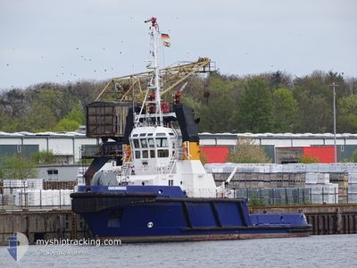
GROSSNORDSEE
Tug
Current Trip
| Time Travelled | 14 h, 11 mins |
|---|---|
| Remaining Time | 3 h, 47 mins |
| Distance Travelled | 32.51 nm |
| Remaining Distance | 25.44 nm |
| AVG Speed | 6 Knop |
| MAX Speed | 8.8 Knop |
| AVG Wind | 12.7 knots |
| MAX Wind | 15.9 knots |
| MIN Temp | 15.1°C / 59.18°F |
| MAX Temp | 21.5°C / 70.7°F |
| Djupgående | 4.6 m |
| Position mottagen | Nu |
Current Position
| Longitud | 9.60132° |
|---|---|
| Latitude | 54.22653° |
| Status | Under way using engine |
| Fart | 6.6 Knop |
| Kurs | 25.5° |
| Område | North Sea |
| Station | T-AIS |
| Position mottagen | Nu |
Info
Information
The current position of GROSSNORDSEE is in North Sea with coordinates 54.22653° / 9.60132° as reported on 2024-05-16 00:33 by AIS to our vessel tracker app. The vessel's current speed is 6.6 Knop and is heading at the port of KIEL. The estimated time of arrival as calculated by MyShipTracking vessel tracking app is 2024-05-16 04:21 LT
The vessel GROSSNORDSEE (IMO: 9067271, MMSI: 218008130) is a Tug that was built in 1994 ( 30 År gammal ). It's sailing under the flag of [DE] Germany.
In this page you can find informations about the vessels current position, last detected port calls, and current voyage information. If the vessels is not in coverage by AIS you will find the latest position.
The current position of GROSSNORDSEE is detected by our AIS receivers and we are not responsible for the reliability of the data. The last position was recorded while the vessel was in Coverage by the Ais receivers of our vessel tracking app.
The current draught of GROSSNORDSEE as reported by AIS is 4.6 meters
Weather
| Temperature | 17.1°C / 62.78°F |
|---|---|
| Wind Speed | 11 knots |
| Direction | 107° ESE |
| Pressure | 1010.6 hPa |
| Humidity | 58.8 % |
| Cloud Coverage | 38 % |
Featured Company
Last Port Calls
| Port | Arrival | Departure | Time In Port |
|---|---|---|---|
| 2024-05-15 10:13 | 2024-05-15 10:23 | 9 m | |
| 2024-05-13 23:22 | 2024-05-14 19:42 | 20 h | |
| 2024-05-11 10:58 | 2024-05-12 01:21 | 14 h | |
| 2024-04-28 00:40 | 2024-04-29 20:10 | 1 d | |
| 2024-04-26 19:27 | 2024-04-26 21:10 | 1 h | |
| 2024-04-22 05:30 | 2024-04-26 18:45 | 4 d | |
| 2024-04-21 10:32 | 2024-04-21 11:36 | 1 h | |
| 2024-04-15 00:50 | 2024-04-18 14:35 | 3 d | |
| 2024-04-05 21:57 | 2024-04-13 15:26 | 7 d | |
| 2024-04-05 16:17 | 2024-04-05 17:09 | 51 m |
Most Visited Ports (Last year)
| Port | Arrivals | |
|---|---|---|
| 51 | ||
| 29 | ||
| 25 | ||
| 6 | ||
| 4 | ||
| 3 |
Last Trips
| Origin | Departure | Destination | Arrival | Distance | |
|---|---|---|---|---|---|
| 2024-05-14 21:42 | 2024-05-15 12:13 | 76.48 nm | |||
| 2024-05-12 03:21 | 2024-05-14 01:22 | 361.68 nm | |||
| 2024-04-29 22:10 | 2024-05-11 12:58 | 954.91 nm | |||
| 2024-04-26 23:10 | 2024-04-28 02:40 | 242.35 nm | |||
| 2024-04-26 20:45 | 2024-04-26 21:27 | 5.41 nm | |||
| 2024-04-21 13:36 | 2024-04-22 07:30 | 129.92 nm | |||
| 2024-04-18 16:35 | 2024-04-21 12:32 | 74.00 nm | |||
| 2024-04-13 17:26 | 2024-04-15 02:50 | 175.04 nm | |||
| 2024-04-05 19:09 | 2024-04-05 23:57 | 32.24 nm | |||
| 2024-04-05 12:55 | 2024-04-05 18:17 | 31.12 nm |
Events
| Tid | Event | Detaljer | Position / Dest | Information |
|---|---|---|---|---|
| 2024-05-15 22:42 | Status ändrad | Under way using engine Default |
54.12268 / 9.32892
KIEL
|
Fart: 6.5 kn Kurs: 4° |
| 2024-05-15 22:37 | Status ändrad | Default Under way using engine |
54.11372 / 9.32852
KIEL
|
Fart: 6.3 kn Kurs: 16.4° |
| 2024-05-15 19:51 | STARTAR förflyttning | 0.64 nm, South West of BRUNSBUETTEL |
53.89547 / 9.14725
KIEL
|
Fart: 3.1 kn Kurs: 46° |
| 2024-05-15 18:19 | STOPPAR förflyttning | 0.88 nm, South West of BRUNSBUETTEL |
53.89275 / 9.14216
KIEL
|
Fart: 0.2 kn Kurs: 38° |
| 2024-05-15 17:45 | STARTAR förflyttning | 2.34 nm, South West of BRUNSBUETTEL |
53.88274 / 9.10372
KIEL
|
Fart: 3.1 kn Kurs: 309° |
| 2024-05-15 17:11 | STOPPAR förflyttning | 2.34 nm, South West of BRUNSBUETTEL |
53.88496 / 9.10130
KIEL
|
Fart: 0.3 kn Kurs: 38° |
| 2024-05-15 17:09 | Status ändrad | Under way using engine Default |
53.88506 / 9.10075
KIEL
|
Fart: 1 kn Kurs: 305° |
| 2024-05-15 17:08 | Status ändrad | Default Under way using engine |
53.88497 / 9.10069
KIEL
|
Fart: 1.6 kn Kurs: 278° |
| 2024-05-15 16:47 | STARTAR förflyttning | 0.89 nm, South West of BRUNSBUETTEL |
53.89080 / 9.14557
KIEL
|
Fart: 7.6 kn Kurs: 217.1° |
| 2024-05-15 16:38 | Byter havsområde | German part of the North Sea German part of the Baltic Sea |
53.89241 / 9.14783
North Sea
KIEL
|
Fart: Kurs: 210.3° |