
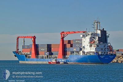
GOURAYA
General Cargo
Current Trip
DZALG
| Time Travelled | 20 h, 51 mins |
|---|---|
| Remaining Time | --- |
| Distance Travelled | 178.12 nm |
| Remaining Distance | --- |
| AVG Speed | 8.5 Knop |
| MAX Speed | 9.3 Knop |
| AVG Wind | 9.1 knots |
| MAX Wind | 17 knots |
| MIN Temp | 15.8°C / 60.44°F |
| MAX Temp | 19.8°C / 67.64°F |
| Djupgående | 6.2 m |
| Position mottagen | 5 d sen |
Current Position
| Longitud | --- |
|---|---|
| Latitude | --- |
| Status | Moored |
| Fart | |
| Kurs | 17° |
| Område | Mediterranean Sea - Western Basin |
| Station | T-AIS |
| Position mottagen | 5 d sen |
Info
Information
The current position of GOURAYA is in Mediterranean Sea - Western Basin with coordinates 36.77975° / 3.06513° as reported on 2025-12-10 19:02 by AIS to our vessel tracker app. The vessel's current speed is 0 Knop
The vessel GOURAYA (IMO: 9393230, MMSI: 605066012) is a General Cargo that was built in 2010 ( 15 År gammal ). It's sailing under the flag of [DZ] Algeria.
In this page you can find informations about the vessels current position, last detected port calls, and current voyage information. If the vessels is not in coverage by AIS you will find the latest position.
The current position of GOURAYA is detected by our AIS receivers and we are not responsible for the reliability of the data. The last position was recorded while the vessel was in Coverage by the Ais receivers of our vessel tracking app.
The current draught of GOURAYA as reported by AIS is 6.2 meters
Weather
| Temperature | 15.9°C / 60.62°F |
|---|---|
| Wind Speed | 14 knots |
| Direction | 194° SSW |
| Pressure | 1007 hPa |
| Humidity | 74.6 % |
| Cloud Coverage | 100 % |
Featured Company
Events
| Tid | Event | Detaljer | Position / Dest | Information |
|---|---|---|---|---|
| 2025-12-15 10:54 | AVGÅTT HAMN |
|
36.77404 / 3.08189
DZALG
|
Fart: 6.1 kn Kurs: 130° |
| 2025-12-15 10:46 | STARTAR förflyttning |
36.77986 / 3.06942
[DZ] ALGER
|
Fart: 3.5 kn Kurs: 119° |
|
| 2025-12-10 19:07 | Status ändrad | Default Moored |
36.77974 / 3.06513
[DZ] ALGER
|
Fart: Kurs: 17° |
| 2025-12-10 19:02 | Status ändrad | Moored Default |
36.77975 / 3.06513
[DZ] ALGER
|
Fart: Kurs: 17° |
| 2025-12-10 19:02 | UTANFÖR täckningsområde |
36.77975 / 3.06513
Mediterranean Sea - Western Basin
[DZ] ALGER
|
Fart: Kurs: 203.5° |
|
| 2025-12-10 18:47 | I täckningsområde |
36.77975 / 3.06513
Mediterranean Sea - Western Basin
[DZ] ALGER
|
Fart: Kurs: 203.5° |
|
| 2025-12-10 15:07 | Status ändrad | Default Moored |
36.77977 / 3.06510
[DZ] ALGER
|
Fart: Kurs: 17° |
| 2025-12-10 15:02 | Status ändrad | Moored Default |
36.77975 / 3.06511
[DZ] ALGER
|
Fart: Kurs: 17° |
| 2025-12-10 15:02 | UTANFÖR täckningsområde |
36.77975 / 3.06511
Mediterranean Sea - Western Basin
[DZ] ALGER
|
Fart: Kurs: 203.5° |
|
| 2025-12-10 14:46 | I täckningsområde |
36.77975 / 3.06511
Mediterranean Sea - Western Basin
[DZ] ALGER
|
Fart: Kurs: 203.5° |