
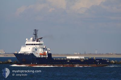
FS BALMORAL
Offshore Supply Ship
Current Trip
| Trip Time | 2 days |
|---|---|
| Trip Distance | 428.45 nm |
| AVG Speed | 4.3 Knop |
| MAX Speed | 4.3 Knop |
| Djupgående | 4.2 m |
| AVG Wind | 5.5 knots |
| MAX Wind | 18.7 knots |
| MIN Temp | 7.2°C / 44.96°F |
| MAX Temp | 9.9°C / 49.82°F |
| Position mottagen | 5 m sen |
Current Position
| Longitud | --- |
|---|---|
| Latitude | --- |
| Status | Moored |
| Fart | |
| Kurs | 55° |
| Område | North Sea |
| Station | T-AIS |
| Position mottagen | 5 m sen |
Info
Information
The current position of FS BALMORAL is in North Sea with coordinates 57.14501° / -2.09311° as reported on 2025-12-10 00:57 by AIS to our vessel tracker app. The vessel's current speed is 0 Knop and is currently inside the port of ABERDEEN.
The vessel FS BALMORAL (IMO: 9402330, MMSI: 232007020) is a Offshore Supply Ship that was built in 2008 ( 17 År gammal ). It's sailing under the flag of [GB] United Kingdom.
In this page you can find informations about the vessels current position, last detected port calls, and current voyage information. If the vessels is not in coverage by AIS you will find the latest position.
The current position of FS BALMORAL is detected by our AIS receivers and we are not responsible for the reliability of the data. The last position was recorded while the vessel was in Coverage by the Ais receivers of our vessel tracking app.
The current draught of FS BALMORAL as reported by AIS is 4.2 meters
Weather
| Temperature | 10.6°C / 51.08°F |
|---|---|
| Wind Speed | 31 knots |
| Direction | 221° SW |
| Pressure | 983.5 hPa |
| Humidity | 75.7 % |
| Cloud Coverage | 95 % |
Featured Company
Last Port Calls
| Port | Arrival | Departure | Time In Port |
|---|---|---|---|
| 2025-12-07 11:08 | |||
| 2025-12-06 11:26 | 2025-12-06 13:19 | 1 h | |
| 2025-12-04 20:55 | 2025-12-04 22:40 | 1 h | |
| 2025-12-02 22:06 | 2025-12-03 12:52 | 14 h | |
| 2025-12-01 16:50 | 2025-12-01 17:36 | 45 m | |
| 2025-11-29 20:56 | 2025-11-30 11:10 | 14 h | |
| 2025-11-27 08:49 | 2025-11-27 14:15 | 5 h | |
| 2025-11-24 06:39 | 2025-11-25 21:06 | 1 d | |
| 2025-11-14 13:14 | 2025-11-20 23:16 | 6 d | |
| 2025-11-13 23:08 | 2025-11-14 12:46 | 13 h |
Most Visited Ports (Last year)
| Port | Arrivals | |
|---|---|---|
| 43 | ||
| 16 | ||
| 8 | ||
| 8 | ||
| 3 | ||
| 3 |
Last Trips
| Origin | Departure | Destination | Arrival | Distance | |
|---|---|---|---|---|---|
| 2025-12-04 22:40 | 2025-12-07 11:08 | 428.45 nm | |||
| 2025-12-04 22:40 | 2025-12-06 11:26 | 357.05 nm | |||
| 2025-12-03 12:52 | 2025-12-04 20:55 | 130.74 nm | |||
| 2025-12-01 17:36 | 2025-12-02 22:06 | 159.57 nm | |||
| 2025-11-30 11:10 | 2025-12-01 16:50 | 151.38 nm | |||
| 2025-11-27 14:15 | 2025-11-29 20:56 | 183.58 nm | |||
| 2025-11-25 21:06 | 2025-11-27 08:49 | 359.33 nm | |||
| 2025-11-20 23:16 | 2025-11-24 06:39 | 55.36 nm | |||
| 2025-11-06 08:17 | 2025-11-14 13:14 | 194.47 nm | |||
| 2025-11-06 08:17 | 2025-11-13 23:08 | 189.49 nm |
Events
| Tid | Event | Detaljer | Position / Dest | Information |
|---|---|---|---|---|
| 2025-12-08 08:30 | Status ändrad | Moored Under way using engine |
57.14503 / -2.09313
[GB] ABERDEEN
|
Fart: Kurs: 55° |
| 2025-12-07 11:32 | STOPPAR förflyttning |
57.14510 / -2.09313
[GB] ABERDEEN
|
Fart: 0.3 kn Kurs: 53° |
|
| 2025-12-07 11:08 | ANLÄNDER HAMN |
|
57.14539 / -2.05881
[GB] ABERDEEN
|
Fart: 7.2 kn Kurs: 236.4° |
| 2025-12-07 10:40 | STARTAR förflyttning | 0.81 nm, South of ABERDEEN ANCH |
57.17802 / -2.02170
ABERDEEN
|
Fart: 4.1 kn Kurs: 194° |
| 2025-12-07 09:49 | STOPPAR förflyttning | 0.72 nm, South East of ABERDEEN ANCH |
57.17988 / -2.02099
ABERDEEN
|
Fart: 0.3 kn Kurs: 219° |
| 2025-12-07 09:09 | STARTAR förflyttning | 2.46 nm, North East of ABERDEEN ANCH |
57.20834 / -1.96192
ABERDEEN
|
Fart: 3.8 kn Kurs: 221° |
| 2025-12-07 09:05 | STOPPAR förflyttning | 2.57 nm, North East of ABERDEEN ANCH |
57.20927 / -1.95897
ABERDEEN
|
Fart: 0.3 kn Kurs: 153° |
| 2025-12-06 13:19 | AVGÅTT HAMN |
|
57.17588 / -2.02510
ABERDEEN
|
Fart: 3.6 kn Kurs: 97° |
| 2025-12-06 13:13 | STARTAR förflyttning |
57.17813 / -2.04009
[GB] ABERDEEN ANCH
|
Fart: 4.8 kn Kurs: 100° |
|
| 2025-12-06 11:26 | STOPPAR förflyttning |
57.17909 / -2.04302
[GB] ABERDEEN ANCH
|
Fart: 0.3 kn Kurs: 117° |