
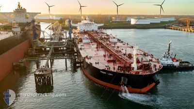
CAPE BENAT
Crude Oil Tanker
Current Trip
EG SKT
| Time Travelled | 10 days |
|---|---|
| Remaining Time | --- |
| Distance Travelled | 868.92 nm |
| Remaining Distance | --- |
| AVG Speed | 8.3 Knop |
| MAX Speed | 13.6 Knop |
| AVG Wind | 14.6 knots |
| MAX Wind | 28 knots |
| MIN Temp | 11.1°C / 51.98°F |
| MAX Temp | 18.3°C / 64.94°F |
| Djupgående | 9.1 m |
| Position mottagen | Nu |
Current Position
| Longitud | -3.13725° |
|---|---|
| Latitude | 36.05590° |
| Status | Under way using engine |
| Fart | 11.7 Knop |
| Kurs | 91.4° |
| Område | Alboran Sea |
| Station | T-AIS |
| Position mottagen | Nu |
Info
Information
The current position of CAPE BENAT is in Alboran Sea with coordinates 36.05590° / -3.13725° as reported on 2024-05-10 18:12 by AIS to our vessel tracker app. The vessel's current speed is 11.7 Knop
The vessel CAPE BENAT (IMO: 9406013, MMSI: 538008947) is a Crude Oil Tanker that was built in 2010 ( 14 År gammal ). It's sailing under the flag of [MH] Marshall Is.
In this page you can find informations about the vessels current position, last detected port calls, and current voyage information. If the vessels is not in coverage by AIS you will find the latest position.
The current position of CAPE BENAT is detected by our AIS receivers and we are not responsible for the reliability of the data. The last position was recorded while the vessel was in Coverage by the Ais receivers of our vessel tracking app.
The current draught of CAPE BENAT as reported by AIS is 9.1 meters
Weather
| Temperature | 18.1°C / 64.58°F |
|---|---|
| Wind Speed | 18 knots |
| Direction | 80° E |
| Pressure | 1014.8 hPa |
| Humidity | 78.6 % |
| Cloud Coverage | 100 % |
Featured Company
Most Visited Ports (Last year)
| Port | Arrivals | |
|---|---|---|
| 2 | ||
| 1 | ||
| 1 | ||
| 1 | ||
| 1 |
Events
| Tid | Event | Detaljer | Position / Dest | Information |
|---|---|---|---|---|
| 2024-05-10 16:44 | Status ändrad | Under way using engine Default |
36.06361 / -3.49656
EG SKT
|
Fart: 11.6 kn Kurs: 90° |
| 2024-05-10 16:42 | Status ändrad | Default Under way using engine |
36.06363 / -3.50257
EG SKT
|
Fart: 12 kn Kurs: 92° |
| 2024-05-10 16:34 | Status ändrad | Under way using engine Default |
36.06421 / -3.53980
EG SKT
|
Fart: 12.4 kn Kurs: 89° |
| 2024-05-10 15:44 | Status ändrad | Default Under way using engine |
36.05896 / -3.74979
EG SKT
|
Fart: 13 kn Kurs: 91.1° |
| 2024-05-10 15:39 | Status ändrad | Under way using engine Default |
36.05951 / -3.77507
EG SKT
|
Fart: 13.1 kn Kurs: 91° |
| 2024-05-10 15:34 | Status ändrad | Default Under way using engine |
36.05977 / -3.79449
EG SKT
|
Fart: 13 kn Kurs: 89.9° |
| 2024-05-10 15:29 | Status ändrad | Under way using engine Default |
36.05996 / -3.82093
EG SKT
|
Fart: 13 kn Kurs: 90° |
| 2024-05-10 15:18 | Status ändrad | Default Under way using engine |
36.05981 / -3.86547
EG SKT
|
Fart: 12.7 kn Kurs: 90.4° |
| 2024-05-10 15:07 | Status ändrad | Under way using engine Default |
36.06073 / -3.91494
EG SKT
|
Fart: 12.7 kn Kurs: 90° |
| 2024-05-10 15:00 | Status ändrad | Default Under way using engine |
36.06082 / -3.94403
EG SKT
|
Fart: 12.5 kn Kurs: 91.8° |