
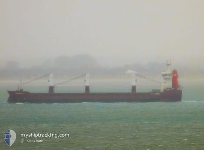
FLORIJNGRACHT
General Cargo
Current Trip
| Trip Time | 2 days |
|---|---|
| Trip Distance | 912.91 nm |
| AVG Speed | 13.6 Knop |
| MAX Speed | 15.6 Knop |
| Djupgående | 5.8 m |
| AVG Wind | 12.7 knots |
| MAX Wind | 18.9 knots |
| MIN Temp | -0.8°C / 30.56°F |
| MAX Temp | 5.5°C / 41.9°F |
| Position mottagen | 6 d sen |
Current Position
| Longitud | 20.92825° |
|---|---|
| Latitude | 63.55900° |
| Status | Under way using engine |
| Fart | 13.4 Knop |
| Kurs | 83.4° |
| Område | Gulf of Bothnia |
| Station | T-AIS |
| Position mottagen | 6 d sen |
Info
Information
The current position of FLORIJNGRACHT is in Gulf of Bothnia with coordinates 63.55900° / 20.92825° as reported on 2024-04-26 03:49 by AIS to our vessel tracker app. The vessel's current speed is 13.4 Knop and is currently inside the port of RONNSKAR.
The vessel FLORIJNGRACHT (IMO: 9428413, MMSI: 246592000) is a General Cargo that was built in 2010 ( 14 År gammal ). It's sailing under the flag of [NL] Netherlands.
In this page you can find informations about the vessels current position, last detected port calls, and current voyage information. If the vessels is not in coverage by AIS you will find the latest position.
The current position of FLORIJNGRACHT is detected by our AIS receivers and we are not responsible for the reliability of the data. The last position was recorded while the vessel was in Coverage by the Ais receivers of our vessel tracking app.
The current draught of FLORIJNGRACHT as reported by AIS is 5.8 meters
Weather
| Temperature | 1.4°C / 34.52°F |
|---|---|
| Wind Speed | --- |
| Direction | 359° N |
| Pressure | 1026.6 hPa |
| Humidity | 99.6 % |
| Cloud Coverage | 100 % |
Featured Company
Last Port Calls
| Port | Arrival | Departure | Time In Port |
|---|---|---|---|
| 2024-04-26 16:16 | |||
| 2024-04-23 23:16 | 2024-04-23 23:18 | 1 m | |
| 2024-04-20 22:46 | 2024-04-22 14:06 | 1 d | |
| 2024-04-05 10:42 | 2024-04-10 01:54 | 4 d | |
| 2024-03-05 11:41 | 2024-03-09 09:16 | 3 d | |
| 2024-03-01 09:46 | 2024-03-01 19:34 | 9 h |
Most Visited Ports (Last year)
| Port | Arrivals | |
|---|---|---|
| 2 | ||
| 2 | ||
| 1 | ||
| 1 | ||
| 1 | ||
| 1 |
Last Trips
| Origin | Departure | Destination | Arrival | Distance | |
|---|---|---|---|---|---|
| 2024-04-24 01:18 | 2024-04-26 18:16 | 912.91 nm | |||
| 2024-04-22 16:06 | 2024-04-24 01:16 | 392.84 nm | |||
| 2024-04-09 21:54 | 2024-04-21 00:46 | 3387.30 nm | |||
| 2024-03-09 10:16 | 2024-04-05 06:42 | 3338.52 nm | |||
| 2024-03-01 20:34 | 2024-03-05 12:41 | 891.99 nm | |||
| 2024-02-17 19:17 | 2024-03-01 10:46 | 3831.07 nm |
Events
| Tid | Event | Detaljer | Position / Dest | Information |
|---|---|---|---|---|
| 2024-04-26 16:28 | STOPPAR förflyttning |
64.67045 / 21.27919
[SE] RONNSKAR
|
Fart: 0.3 kn Kurs: 293° |
|
| 2024-04-26 16:16 | ANLÄNDER HAMN |
|
64.66896 / 21.28918
[SE] RONNSKAR
|
Fart: 4.1 kn Kurs: 297° |
| 2024-04-26 16:01 | STARTAR förflyttning | 2.43 nm, South East of RONNSKAR |
64.64990 / 21.32199
SEROR
|
Fart: 8.6 kn Kurs: 310° |
| 2024-04-26 15:48 | STOPPAR förflyttning | 2.95 nm, South East of RONNSKAR |
64.64879 / 21.34699
SEROR
|
Fart: Kurs: 259° |
| 2024-04-26 03:56 | Status ändrad | Default Under way using engine |
63.56773 / 20.98730
SEROR
|
Fart: 13.4 kn Kurs: 83.4° |
| 2024-04-26 03:49 | Status ändrad | Under way using engine Default |
63.55900 / 20.92825
SEROR
|
Fart: 12.9 kn Kurs: 81° |
| 2024-04-26 03:49 | UTANFÖR täckningsområde |
63.55900 / 20.92825
Gulf of Bothnia
SEROR
|
Fart: 13.4 kn Kurs: 83.4° |
|
| 2024-04-26 03:41 | Status ändrad | Default Under way using engine |
63.55461 / 20.86499
SEROR
|
Fart: 7.2 kn Kurs: 14.2° |
| 2024-04-26 03:23 | Status ändrad | Under way using engine Default |
63.54241 / 20.78938
SEROR
|
Fart: 14.2 kn Kurs: 68° |
| 2024-04-26 03:16 | Status ändrad | Default Under way using engine |
63.53206 / 20.74025
SEROR
|
Fart: 12.6 kn Kurs: 25.4° |