
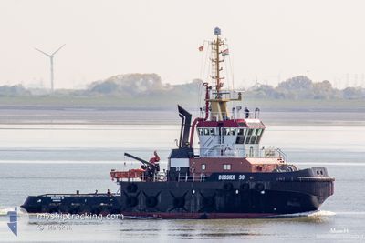
FAIRPLAY-30
Tug
Current Trip
ETV FEMERN BELT SITE
| Time Travelled | 45 days |
|---|---|
| Remaining Time | --- |
| Distance Travelled | 449.02 nm |
| Remaining Distance | --- |
| AVG Speed | 7.3 Knop |
| MAX Speed | 13.8 Knop |
| AVG Wind | 15.9 knots |
| MAX Wind | 24.9 knots |
| MIN Temp | 2.7°C / 36.86°F |
| MAX Temp | 14.8°C / 58.64°F |
| Djupgående | 6.2 m |
| Position mottagen | 3 m sen |
Current Position
| Longitud | 11.21133° |
|---|---|
| Latitude | 54.52533° |
| Status | At anchor |
| Fart | |
| Kurs | 128° |
| Område | Baltic Sea |
| Station | T-AIS |
| Position mottagen | 3 m sen |
Info
Information
The current position of FAIRPLAY-30 is in Baltic Sea with coordinates 54.52533° / 11.21133° as reported on 2024-05-11 23:38 by AIS to our vessel tracker app. The vessel's current speed is 0 Knop
The vessel FAIRPLAY-30 (IMO: 9416563, MMSI: 211156800) is a Tug that was built in 2008 ( 16 År gammal ). It's sailing under the flag of [DE] Germany.
In this page you can find informations about the vessels current position, last detected port calls, and current voyage information. If the vessels is not in coverage by AIS you will find the latest position.
The current position of FAIRPLAY-30 is detected by our AIS receivers and we are not responsible for the reliability of the data. The last position was recorded while the vessel was in Coverage by the Ais receivers of our vessel tracking app.
The current draught of FAIRPLAY-30 as reported by AIS is 6.2 meters
Weather
| Temperature | 11.6°C / 52.88°F |
|---|---|
| Wind Speed | 13 knots |
| Direction | 96° E |
| Pressure | 1025.4 hPa |
| Humidity | 86.9 % |
| Cloud Coverage | 79 % |
Featured Company
Last Port Calls
| Port | Arrival | Departure | Time In Port |
|---|---|---|---|
| 2024-03-20 23:32 | 2024-03-27 16:53 | 6 d | |
| 2024-03-08 13:46 | 2024-03-10 17:13 | 2 d | |
| 2024-03-07 17:39 | 2024-03-08 12:49 | 19 h | |
| 2024-03-07 09:11 | 2024-03-07 13:30 | 4 h | |
| 2024-03-07 07:46 |
Most Visited Ports (Last year)
| Port | Arrivals | |
|---|---|---|
| 75 | ||
| 8 | ||
| 5 | ||
| 3 | ||
| 2 | ||
| 2 |
Last Trips
| Origin | Departure | Destination | Arrival | Distance | |
|---|---|---|---|---|---|
| 2024-03-10 18:13 | 2024-03-20 23:32 | 915.32 nm | |||
| 2024-03-08 13:49 | 2024-03-08 14:46 | 6.78 nm | |||
| 2024-03-07 14:30 | 2024-03-07 18:39 | 47.82 nm | |||
| 2024-03-07 08:46 | 2024-03-07 10:11 | 12.76 nm |
Events
| Tid | Event | Detaljer | Position / Dest | Information |
|---|---|---|---|---|
| 2024-05-11 16:17 | Status ändrad | At anchor Default |
54.52530 / 11.21187
ETV FEMERN BELT SITE
|
Fart: Kurs: -1° |
| 2024-05-11 16:13 | Status ändrad | Default At anchor |
54.52500 / 11.21167
ETV FEMERN BELT SITE
|
Fart: Kurs: 121° |
| 2024-05-10 08:41 | Status ändrad | At anchor Default |
54.52492 / 11.21361
ETV FEMERN BELT SITE
|
Fart: 0.1 kn Kurs: 279° |
| 2024-05-10 08:38 | Status ändrad | Default At anchor |
54.52498 / 11.21363
ETV FEMERN BELT SITE
|
Fart: 0.1 kn Kurs: 314° |
| 2024-05-08 15:14 | Status ändrad | At anchor Under way using engine |
54.52541 / 11.21091
ETV FEMERN BELT SITE
|
Fart: 0.1 kn Kurs: 157° |
| 2024-05-08 13:47 | STOPPAR förflyttning | 1.4 nm, North West of PUTTGARDEN |
54.52486 / 11.21278
ETV FEMERN BELT SITE
|
Fart: 0.3 kn Kurs: 266° |
| 2024-05-08 13:20 | Byter havsområde | German part of the Baltic Sea Danish part of the Baltic Sea |
54.56435 / 11.31278
Baltic Sea
|
Fart: 11.7 kn Kurs: 203.4° |
| 2024-05-08 12:54 | STARTAR förflyttning | 1.4 nm, South East of RODBYHAVN |
54.63636 / 11.37740
ETV FEMERN BELT SITE
|
Fart: 8.7 kn Kurs: 160.1° |
| 2024-05-08 09:35 | STOPPAR förflyttning | 1.28 nm, South East of RODBYHAVN |
54.63829 / 11.37585
ETV FEMERN BELT SITE
|
Fart: 0.3 kn Kurs: 20° |
| 2024-05-08 09:05 | Byter havsområde | Danish part of the Baltic Sea German part of the Baltic Sea |
54.58066 / 11.29039
Baltic Sea
|
Fart: 12.2 kn Kurs: 50.5° |