
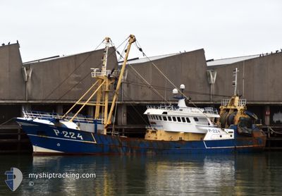
F/V MIRANDA
Other Type
Current Trip
| Trip Time | 3 days |
|---|---|
| Trip Distance | 363.82 nm |
| AVG Speed | 4.5 Knop |
| MAX Speed | 11 Knop |
| Djupgående | 0 m |
| AVG Wind | 15.3 knots |
| MAX Wind | 32.7 knots |
| MIN Temp | 5.9°C / 42.62°F |
| MAX Temp | 11.4°C / 52.52°F |
| Position mottagen | 2 m sen |
Current Position
| Longitud | --- |
|---|---|
| Latitude | --- |
| Status | Engaged in Fishing |
| Fart | |
| Kurs | 290° |
| Område | North Sea |
| Station | T-AIS |
| Position mottagen | 2 m sen |
Info
Information
The current position of F/V MIRANDA is in North Sea with coordinates 51.44424° / 3.59021° as reported on 2025-12-05 22:14 by AIS to our vessel tracker app. The vessel's current speed is 0 Knop and is currently inside the port of VLISSINGEN STATION.
The vessel F/V MIRANDA (MMSI: 232006030) is a Other Type It's sailing under the flag of [GB] United Kingdom.
In this page you can find informations about the vessels current position, last detected port calls, and current voyage information. If the vessels is not in coverage by AIS you will find the latest position.
The current position of F/V MIRANDA is detected by our AIS receivers and we are not responsible for the reliability of the data. The last position was recorded while the vessel was in Coverage by the Ais receivers of our vessel tracking app.
Weather
| Temperature | 5.9°C / 42.62°F |
|---|---|
| Wind Speed | 24 knots |
| Direction | 171° S |
| Pressure | 1004 hPa |
| Humidity | 84 % |
| Cloud Coverage | 100 % |
Featured Company
Last Port Calls
| Port | Arrival | Departure | Time In Port |
|---|---|---|---|
| 2025-12-05 20:24 | |||
| 2025-11-27 18:24 | 2025-12-01 22:02 | 4 d | |
| 2025-11-21 01:28 | 2025-11-24 05:28 | 3 d | |
| 2025-11-14 18:06 | 2025-11-17 01:06 | 2 d | |
| 2025-11-13 00:11 | 2025-11-13 01:44 | 1 h | |
| 2025-11-07 00:25 | 2025-11-10 01:15 | 3 d | |
| 2025-10-31 22:13 | 2025-11-03 04:16 | 2 d | |
| 2025-10-23 04:16 | 2025-10-27 11:47 | 4 d | |
| 2025-10-17 20:04 | 2025-10-18 01:07 | 5 h | |
| 2025-10-10 20:18 | 2025-10-13 11:25 | 2 d |
Most Visited Ports (Last year)
| Port | Arrivals | |
|---|---|---|
| 23 | ||
| 21 | ||
| 5 | ||
| 3 | ||
| 2 |
Last Trips
| Origin | Departure | Destination | Arrival | Distance | |
|---|---|---|---|---|---|
| 2025-12-01 22:02 | 2025-12-05 20:24 | 363.82 nm | |||
| 2025-11-24 05:28 | 2025-11-27 18:24 | 276.35 nm | |||
| 2025-11-17 01:06 | 2025-11-21 01:28 | 315.16 nm | |||
| 2025-11-13 01:44 | 2025-11-14 18:06 | 227.85 nm | |||
| 2025-11-10 01:15 | 2025-11-13 00:11 | 158.46 nm | |||
| 2025-11-03 04:16 | 2025-11-07 00:25 | 235.88 nm | |||
| 2025-10-27 11:47 | 2025-10-31 22:13 | 230.97 nm | |||
| 2025-10-18 01:07 | 2025-10-23 04:16 | 18.57 nm | |||
| 2025-10-13 11:25 | 2025-10-17 20:04 | 494.54 nm | |||
| 2025-10-06 11:49 | 2025-10-10 20:18 | 635.93 nm |
Events
| Tid | Event | Detaljer | Position / Dest | Information |
|---|---|---|---|---|
| 2025-12-05 19:25 | STOPPAR förflyttning |
51.44518 / 3.59152
[NL] VLISSINGEN STATION
|
Fart: 0.1 kn Kurs: 96° |
|
| 2025-12-05 19:24 | ANLÄNDER HAMN |
|
51.44515 / 3.59174
[NL] VLISSINGEN STATION
|
Fart: 1.4 kn Kurs: 35° |
| 2025-12-05 19:22 | STARTAR förflyttning | 0.27 nm, South of VLISSINGEN STATION |
51.44329 / 3.59312
NORTHSEA
|
Fart: 3.7 kn Kurs: 294° |
| 2025-12-05 18:56 | STOPPAR förflyttning | 0.35 nm, South East of VLISSINGEN STATION |
51.44268 / 3.59586
NORTHSEA
|
Fart: Kurs: 290° |
| 2025-12-05 17:38 | Byter havsområde | Dutch part of the North Sea Belgian part of the North Sea |
51.41409 / 3.33518
North Sea
|
Fart: 8.7 kn Kurs: 86.4° |
| 2025-12-05 14:49 | Upptäckt i hav | Belgian part of the North Sea |
51.52011 / 2.64646
North Sea
|
Fart: 10.4 kn Kurs: 118.7° |
| 2025-12-05 14:49 | I täckningsområde |
51.52011 / 2.64646
North Sea
|
Fart: 10.4 kn Kurs: 118.7° |
|
| 2025-12-05 10:54 | UTANFÖR täckningsområde |
51.41624 / 2.17681
North Sea
|
Fart: 2.4 kn Kurs: 79.8° |
|
| 2025-12-05 08:52 | Byter havsområde | French part of the North Sea United Kingdom part of the North Sea |
51.30972 / 2.01939
North Sea
|
Fart: 7.5 kn Kurs: 59.2° |
| 2025-12-05 08:46 | Byter havsområde | United Kingdom part of the North Sea French part of the North Sea |
51.30186 / 2.00700
North Sea
|
Fart: 3.4 kn Kurs: 255.5° |