
EXPRESS 1
High speed craft
Current Trip
DKRNN
| Time Travelled | 15 mins |
|---|---|
| Remaining Time | --- |
| Distance Travelled | 2.09 nm |
| Remaining Distance | --- |
| AVG Speed | --- |
| MAX Speed | --- |
| AVG Wind | 22.9 knots |
| MAX Wind | 24 knots |
| MIN Temp | 8.9°C / 48.02°F |
| MAX Temp | 9.1°C / 48.38°F |
| Djupgående | 3.2 m |
| Position mottagen | 9 h, 13 m sen |
Current Position
| Longitud | --- |
|---|---|
| Latitude | --- |
| Status | Under way using engine |
| Fart | 37.1 Knop |
| Kurs | 110.8° |
| Område | Baltic Sea |
| Station | T-AIS |
| Position mottagen | 9 h, 13 m sen |
Info
Information
The current position of EXPRESS 1 is in Baltic Sea with coordinates 55.28376° / 12.70973° as reported on 2025-12-08 03:23 by AIS to our vessel tracker app. The vessel's current speed is 37.1 Knop
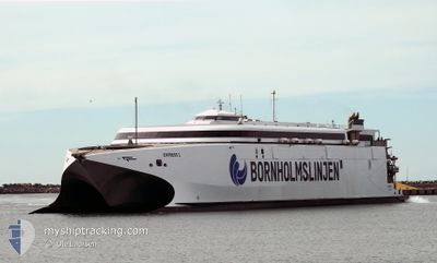
The vessel EXPRESS 1 (IMO: 9501590, MMSI: 219017081) is a High speed craft that was built in 2009 ( 16 År gammal ). It's sailing under the flag of [DK] Denmark.
In this page you can find informations about the vessels current position, last detected port calls, and current voyage information. If the vessels is not in coverage by AIS you will find the latest position.
The current position of EXPRESS 1 is detected by our AIS receivers and we are not responsible for the reliability of the data. The last position was recorded while the vessel was in Coverage by the Ais receivers of our vessel tracking app.
The current draught of EXPRESS 1 as reported by AIS is 3.2 meters
Weather
| Temperature | 9°C / 48.2°F |
|---|---|
| Wind Speed | 24 knots |
| Direction | 229° SW |
| Pressure | 1007.7 hPa |
| Humidity | 85.6 % |
| Cloud Coverage | 100 % |
Featured Company
Last Port Calls
| Port | Arrival | Departure | Time In Port |
|---|---|---|---|
| 2025-12-08 06:37 | 2025-12-08 13:21 | 6 h | |
| 2025-12-07 20:35 | 2025-12-07 23:02 | 2 h | |
| 2025-12-07 18:53 | 2025-12-07 19:29 | 36 m | |
| 2025-12-07 16:57 | 2025-12-07 17:37 | 40 m | |
| 2025-12-07 14:57 | 2025-12-07 15:37 | 39 m | |
| 2025-12-07 12:56 | 2025-12-07 13:33 | 37 m | |
| 2025-12-07 10:50 | 2025-12-07 11:33 | 42 m | |
| 2025-12-06 15:54 | 2025-12-07 09:33 | 17 h | |
| 2025-12-06 13:57 | 2025-12-06 14:33 | 35 m | |
| 2025-12-06 11:57 | 2025-12-06 12:31 | 33 m |
Most Visited Ports (Last year)
| Port | Arrivals | |
|---|---|---|
| 453 | ||
| 437 | ||
| 166 | ||
| 162 | ||
| 1 |
Last Trips
| Origin | Departure | Destination | Arrival | Distance | |
|---|---|---|---|---|---|
| 2025-12-07 23:02 | 2025-12-08 06:37 | 203.99 nm | |||
| 2025-12-07 19:29 | 2025-12-07 20:35 | 37.40 nm | |||
| 2025-12-07 17:37 | 2025-12-07 18:53 | 37.91 nm | |||
| 2025-12-07 15:37 | 2025-12-07 16:57 | 37.34 nm | |||
| 2025-12-07 13:33 | 2025-12-07 14:57 | 37.59 nm | |||
| 2025-12-07 11:33 | 2025-12-07 12:56 | 37.34 nm | |||
| 2025-12-07 09:33 | 2025-12-07 10:50 | 37.26 nm | |||
| 2025-12-06 14:33 | 2025-12-06 15:54 | 36.81 nm | |||
| 2025-12-06 12:31 | 2025-12-06 13:57 | 37.60 nm | |||
| 2025-12-06 10:41 | 2025-12-06 11:57 | 35.91 nm |
Events
| Tid | Event | Detaljer | Position / Dest | Information |
|---|---|---|---|---|
| 2025-12-08 12:21 | AVGÅTT HAMN |
|
55.09712 / 14.67200
DKRNN
|
Fart: 8.8 kn Kurs: 237° |
| 2025-12-08 12:17 | STARTAR förflyttning |
55.09568 / 14.68873
[DK] ROENNE
|
Fart: 8.8 kn Kurs: 237° |
|
| 2025-12-08 05:45 | STOPPAR förflyttning |
55.09917 / 14.69163
[DK] ROENNE
|
Fart: 0.2 kn Kurs: 176° |
|
| 2025-12-08 05:37 | ANLÄNDER HAMN |
|
55.09646 / 14.69121
[DK] ROENNE
|
Fart: 13.9 kn Kurs: 114° |
| 2025-12-08 03:37 | Status ändrad | Default Under way using engine |
55.24261 / 12.94518
DKRNN
|
Fart: 37.1 kn Kurs: 110.8° |
| 2025-12-08 03:23 | UTANFÖR täckningsområde |
55.28376 / 12.70973
Baltic Sea
DKRNN
|
Fart: 37.1 kn Kurs: 110.8° |
|
| 2025-12-08 03:19 | Byter havsområde | Swedish part of the Baltic Sea Danish part of the Baltic Sea |
55.29584 / 12.65380
Baltic Sea
DKRNN
|
Fart: 36.4 kn Kurs: 110.5° |
| 2025-12-08 03:16 | Byter havsområde | Danish part of the Baltic Sea Danish part of the Kattegat |
55.32009 / 12.62265
Baltic Sea
DKRNN
|
Fart: 35.5 kn Kurs: 189.2° |
| 2025-12-08 03:14 | Byter havsområde | Danish part of the Kattegat Swedish part of the Kattegat |
55.34379 / 12.62919
Kattegat
DKRNN
|
Fart: 34.7 kn Kurs: 188.6° |
| 2025-12-08 02:50 | Byter havsområde | Swedish part of the Kattegat Danish part of the Kattegat |
55.46392 / 12.67042
Kattegat
DKRNN
|
Fart: 17 kn Kurs: 191.1° |