
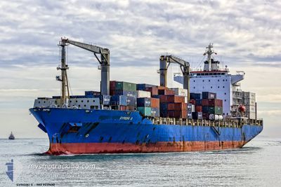
EVRIDIKI G
Container Ship
Current Trip
| Time Travelled | 14 days |
|---|---|
| Remaining Time | 10 mins |
| Distance Travelled | 4949.93 nm |
| Remaining Distance | 5.35 nm |
| AVG Speed | 11.6 Knop |
| MAX Speed | 17.4 Knop |
| AVG Wind | 9.7 knots |
| MAX Wind | 25.6 knots |
| MIN Temp | 12.2°C / 53.96°F |
| MAX Temp | 27.7°C / 81.86°F |
| Djupgående | 10.9 m |
| Position mottagen | 2 m sen |
Current Position
| Longitud | -1.31129° |
|---|---|
| Latitude | 50.82967° |
| Status | Under way using engine |
| Fart | 8.1 Knop |
| Kurs | 324.5° |
| Område | English Channel |
| Station | T-AIS |
| Position mottagen | 2 m sen |
Info
Information
The current position of EVRIDIKI G is in English Channel with coordinates 50.82967° / -1.31129° as reported on 2024-05-10 22:11 by AIS to our vessel tracker app. The vessel's current speed is 8.1 Knop and is heading at the port of SOUTHAMPTON. The estimated time of arrival as calculated by MyShipTracking vessel tracking app is 2024-05-10 22:23 LT
The vessel EVRIDIKI G (IMO: 9231482, MMSI: 636013898) is a Container Ship that was built in 2001 ( 23 År gammal ). It's sailing under the flag of [LR] Liberia.
In this page you can find informations about the vessels current position, last detected port calls, and current voyage information. If the vessels is not in coverage by AIS you will find the latest position.
The current position of EVRIDIKI G is detected by our AIS receivers and we are not responsible for the reliability of the data. The last position was recorded while the vessel was in Coverage by the Ais receivers of our vessel tracking app.
The current draught of EVRIDIKI G as reported by AIS is 10.9 meters
Weather
| Temperature | 13.7°C / 56.66°F |
|---|---|
| Wind Speed | 6 knots |
| Direction | 82° E |
| Pressure | 1022.2 hPa |
| Humidity | 92.5 % |
| Cloud Coverage | 100 % |
Featured Company
Last Port Calls
| Port | Arrival | Departure | Time In Port |
|---|---|---|---|
| 2024-04-25 11:58 | 2024-04-26 11:54 | 23 h | |
| 2024-04-20 13:34 | 2024-04-21 12:34 | 22 h | |
| 2024-04-16 09:28 | 2024-04-16 22:48 | 13 h | |
| 2024-03-27 07:45 | 2024-03-27 23:10 | 15 h | |
| 2024-03-24 16:15 | 2024-03-26 06:20 | 1 d | |
| 2024-03-22 04:08 | 2024-03-23 02:42 | 22 h | |
| 2024-03-07 13:12 | 2024-03-08 11:40 | 22 h | |
| 2024-03-03 22:15 | |||
| 2024-03-01 07:51 |
Most Visited Ports (Last year)
| Port | Arrivals | |
|---|---|---|
| 12 | ||
| 8 | ||
| 7 | ||
| 7 | ||
| 7 | ||
| 7 |
Last Trips
| Origin | Departure | Destination | Arrival | Distance | |
|---|---|---|---|---|---|
| 2024-04-21 06:34 | 2024-04-25 06:58 | 791.09 nm | |||
| 2024-04-16 17:48 | 2024-04-20 07:34 | 953.63 nm | |||
| 2024-03-28 00:10 | 2024-04-16 04:28 | 6179.44 nm | |||
| 2024-03-26 07:20 | 2024-03-27 08:45 | 336.07 nm | |||
| 2024-03-23 02:42 | 2024-03-24 17:15 | 325.12 nm | |||
| 2024-03-08 06:40 | 2024-03-22 04:08 | 4841.99 nm | |||
| 2024-03-01 01:51 | 2024-03-03 16:15 | 707.51 nm |
Events
| Tid | Event | Detaljer | Position / Dest | Information |
|---|---|---|---|---|
| 2024-05-10 21:17 | Byter havsområde | United Kingdom part of the English Channel Guernsey part of the English Channel |
50.75593 / -1.12462
English Channel
GB SOU
|
Fart: 14.8 kn Kurs: 294.4° |
| 2024-05-10 21:17 | Status ändrad | Under way using engine Default |
50.75524 / -1.12228
GB SOU
|
Fart: 8.3 kn Kurs: 80° |
| 2024-05-10 21:17 | I täckningsområde |
50.75593 / -1.12462
English Channel
GB SOU
|
Fart: 14.8 kn Kurs: 294.4° |
|
| 2024-05-10 20:26 | ETA ändrat | 2024/05/10 21:30 2024/05/10 15:30 |
50.33487 / -1.62209
GB SOU
|
Fart: 8.1 kn Kurs: 80° |
| 2024-05-10 17:07 | STARTAR förflyttning | 19.93 nm, South East of SWANAGE |
50.31397 / -1.70926
GB SOU
|
Fart: 3.1 kn Kurs: 349° |
| 2024-05-10 15:10 | STOPPAR förflyttning | 20.66 nm, South East of SWANAGE |
50.32987 / -1.63217
GB SOU
|
Fart: 0.2 kn Kurs: 67° |
| 2024-05-10 01:22 | Status ändrad | Default Under way using engine |
49.74171 / -3.14612
GB SOU
|
Fart: 3.7 kn Kurs: 68° |
| 2024-05-10 01:18 | UTANFÖR täckningsområde |
49.73977 / -3.15288
English Channel
GB SOU
|
Fart: 3.7 kn Kurs: 63.9° |
|
| 2024-05-09 21:37 | Upptäckt i hav | Guernsey part of the English Channel |
49.62998 / -3.56865
English Channel
GB SOU
|
Fart: 5.9 kn Kurs: 68.7° |
| 2024-05-09 21:23 | ETA ändrat | 2024/05/10 15:30 2024/05/10 01:00 |
49.62152 / -3.60185
GB SOU
|
Fart: 6.1 kn Kurs: 68.6° |