
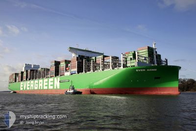
EVER ACME
Cargo D
Current Trip
| Time Travelled | 4 days |
|---|---|
| Remaining Time | --- |
| Distance Travelled | 1510.30 nm |
| Remaining Distance | --- |
| AVG Speed | 13.8 Knop |
| MAX Speed | 19.5 Knop |
| AVG Wind | 8.1 knots |
| MAX Wind | 19 knots |
| MIN Temp | 25.1°C / 77.18°F |
| MAX Temp | 30.6°C / 87.08°F |
| Djupgående | 16.5 m |
| Position mottagen | 53 m sen |
Current Position
| Longitud | 103.44813° |
|---|---|
| Latitude | 1.21827° |
| Status | Constrained by her draught |
| Fart | 16.5 Knop |
| Kurs | 285.6° |
| Område | Malacca Strait |
| Station | T-AIS |
| Position mottagen | 53 m sen |
Info
Information
The current position of EVER ACME is in Malacca Strait with coordinates 1.21827° / 103.44813° as reported on 2024-05-22 18:57 by AIS to our vessel tracker app. The vessel's current speed is 16.5 Knop and is heading at the port of ROTTERDAM. The estimated time of arrival as calculated by MyShipTracking vessel tracking app is 2024-06-19 10:00 LT
The vessel EVER ACME (IMO: 9943267, MMSI: 563176600) is a Cargo D It's sailing under the flag of [SG] Singapore.
In this page you can find informations about the vessels current position, last detected port calls, and current voyage information. If the vessels is not in coverage by AIS you will find the latest position.
The current position of EVER ACME is detected by our AIS receivers and we are not responsible for the reliability of the data. The last position was recorded while the vessel was in Coverage by the Ais receivers of our vessel tracking app.
The current draught of EVER ACME as reported by AIS is 16.5 meters
Weather
| Temperature | 27.5°C / 81.5°F |
|---|---|
| Wind Speed | 6 knots |
| Direction | 216° SW |
| Pressure | 1007.1 hPa |
| Humidity | 84.3 % |
| Cloud Coverage | 100 % |
Featured Company
Last Port Calls
| Port | Arrival | Departure | Time In Port |
|---|---|---|---|
| 2024-05-16 17:54 | 2024-05-18 15:12 | 1 d | |
| 2024-05-14 20:36 | 2024-05-15 13:35 | 16 h | |
| 2024-05-10 14:28 | 2024-05-12 07:00 | 1 d | |
| 2024-05-07 07:48 | 2024-05-09 03:44 | 1 d | |
| 2024-05-03 19:11 | 2024-05-04 22:34 | 1 d | |
| 2024-04-28 12:57 | 2024-04-30 09:12 | 1 d | |
| 2024-04-22 23:10 | 2024-04-23 17:21 | 18 h | |
| 2024-03-21 03:24 | 2024-03-24 20:11 | 3 d | |
| 2024-03-16 20:03 | 2024-03-19 05:36 | 2 d | |
| 2024-03-07 12:33 | 2024-03-10 20:30 | 3 d |
Most Visited Ports (Last year)
| Port | Arrivals | |
|---|---|---|
| 7 | ||
| 4 | ||
| 4 | ||
| 4 | ||
| 4 | ||
| 4 |
Last Trips
| Origin | Departure | Destination | Arrival | Distance | |
|---|---|---|---|---|---|
| 2024-05-15 13:35 | 2024-05-16 17:54 | 454.67 nm | |||
| 2024-05-12 07:00 | 2024-05-14 20:36 | 477.13 nm | |||
| 2024-05-09 03:44 | 2024-05-10 14:28 | 485.34 nm | |||
| 2024-05-04 22:34 | 2024-05-07 07:48 | 944.09 nm | |||
| 2024-04-30 09:12 | 2024-05-03 19:11 | 1650.32 nm | |||
| 2024-04-23 17:21 | 2024-04-28 12:57 | 1613.61 nm | |||
| 2024-03-24 20:11 | 2024-04-22 23:10 | 10785.65 nm | |||
| 2024-03-19 05:36 | 2024-03-21 03:24 | 313.76 nm | |||
| 2024-03-10 20:30 | 2024-03-16 20:03 | 495.14 nm | |||
| 2024-02-08 21:49 | 2024-03-07 12:33 | 11209.38 nm |
Events
| Tid | Event | Detaljer | Position / Dest | Information |
|---|---|---|---|---|
| 2024-05-22 19:00 | Status ändrad | Default Constrained by her draught |
1.22350 / 103.43161
SG SIN > NL RTM
|
Fart: 16.5 kn Kurs: 285.6° |
| 2024-05-22 18:55 | Byter havsområde | Malaysian part of the Malacca Strait Malaysian part of the Singapore Strait |
1.21586 / 103.45641
Malacca Strait
SG SIN > NL RTM
|
Fart: 16.3 kn Kurs: 285.4° |
| 2024-05-22 18:22 | Byter havsområde | Malaysian part of the Singapore Strait Indonesian part of the Singapore Strait |
1.18817 / 103.58209
Singapore Strait
SG SIN > NL RTM
|
Fart: 12.5 kn Kurs: 280.9° |
| 2024-05-22 17:25 | Byter havsområde | Indonesian part of the Singapore Strait Singaporean part of the Singapore Strait |
1.13686 / 103.72969
Singapore Strait
SG SIN > NL RTM
|
Fart: 7.2 kn Kurs: 297° |
| 2024-05-22 15:26 | Byter havsområde | Singaporean part of the Singapore Strait Indonesian part of the Singapore Strait |
1.25038 / 103.98352
Singapore Strait
SG SIN > NL RTM
|
Fart: 10.3 kn Kurs: 255.4° |
| 2024-05-22 14:56 | Byter havsområde | Indonesian part of the Singapore Strait Malaysian part of the Singapore Strait |
1.27024 / 104.06543
Singapore Strait
SG SIN > NL RTM
|
Fart: 8.5 kn Kurs: 243.7° |
| 2024-05-22 14:43 | STARTAR förflyttning | 3.98 nm, East of TANAH MERAH |
1.28960 / 104.08014
SG SIN > NL RTM
|
Fart: 3.1 kn Kurs: 207° |
| 2024-05-22 14:34 | Status ändrad | Constrained by her draught At anchor |
1.29231 / 104.08160
SG SIN > NL RTM
|
Fart: 0.2 kn Kurs: 149° |
| 2024-05-22 13:31 | Status ändrad | At anchor Default |
1.29171 / 104.08123
SG SIN > NL RTM
|
Fart: Kurs: 120° |
| 2024-05-22 13:28 | Status ändrad | Default At anchor |
1.29170 / 104.08122
SG SIN > NL RTM
|
Fart: Kurs: 120° |