
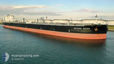
ESTEEM ASTRO
Tanker
Current Trip
| Time Travelled | 19 days |
|---|---|
| Remaining Time | --- |
| Distance Travelled | 5447.35 nm |
| Remaining Distance | --- |
| AVG Speed | 13.4 Knop |
| MAX Speed | 18.7 Knop |
| AVG Wind | 13.1 knots |
| MAX Wind | 28 knots |
| MIN Temp | 13.4°C / 56.12°F |
| MAX Temp | 30°C / 86°F |
| Djupgående | 10.7 m |
| Position mottagen | 9 h, 47 m sen |
Current Position
| Longitud | 17.67932° |
|---|---|
| Latitude | -33.64998° |
| Status | Under way using engine |
| Fart | 14 Knop |
| Kurs | 294.1° |
| Område | South Atlantic Ocean |
| Station | T-AIS |
| Position mottagen | 9 h, 47 m sen |
Info
Information
The current position of ESTEEM ASTRO is in South Atlantic Ocean with coordinates -33.64998° / 17.67932° as reported on 2024-05-01 00:47 by AIS to our vessel tracker app. The vessel's current speed is 14 Knop and is heading at the port of AEGINA. The estimated time of arrival as calculated by MyShipTracking vessel tracking app is 2024-05-08 07:00 LT
The vessel ESTEEM ASTRO (IMO: 9838008, MMSI: 355837000) is a Tanker It's sailing under the flag of [PA] Panama.
In this page you can find informations about the vessels current position, last detected port calls, and current voyage information. If the vessels is not in coverage by AIS you will find the latest position.
The current position of ESTEEM ASTRO is detected by our AIS receivers and we are not responsible for the reliability of the data. The last position was recorded while the vessel was in Coverage by the Ais receivers of our vessel tracking app.
The current draught of ESTEEM ASTRO as reported by AIS is 10.7 meters
Weather
| Temperature | 18.6°C / 65.48°F |
|---|---|
| Wind Speed | 9 knots |
| Direction | 4° N |
| Pressure | 1014.3 hPa |
| Humidity | 86.8 % |
| Cloud Coverage | 100 % |
Featured Company
Last Trips
| Origin | Departure | Destination | Arrival | Distance |
|---|
Events
| Tid | Event | Detaljer | Position / Dest | Information |
|---|---|---|---|---|
| 2024-05-01 00:55 | Status ändrad | Default Under way using engine |
-33.63905 / 17.64737
EGINA
|
Fart: 14 kn Kurs: 294.1° |
| 2024-05-01 00:47 | UTANFÖR täckningsområde |
-33.64998 / 17.67932
South Atlantic Ocean
EGINA
|
Fart: 14 kn Kurs: 294.1° |
|
| 2024-05-01 00:32 | Status ändrad | Under way using engine Default |
-33.67358 / 17.74557
EGINA
|
Fart: 13.9 kn Kurs: 294° |
| 2024-05-01 00:30 | Status ändrad | Default Under way using engine |
-33.67604 / 17.75248
EGINA
|
Fart: 13.8 kn Kurs: 295.1° |
| 2024-04-30 16:18 | Djupgående ändrat | 10.7 12.3 |
-34.76374 / 18.38331
EGINA
|
Fart: 15.3 kn Kurs: 284.5° |
| 2024-04-30 16:18 | Destination ändrad | EGINA CHENNAI |
-34.76374 / 18.38331
EGINA
|
Fart: 15.3 kn Kurs: 284.5° |
| 2024-04-30 16:18 | ETA ändrat | 2024/05/08 07:00 2024/03/30 13:30 |
-34.76374 / 18.38331
EGINA
|
Fart: 15.3 kn Kurs: 284.5° |
| 2024-04-30 15:46 | Status ändrad | Under way using engine Default |
-34.79634 / 18.54307
CHENNAI
|
Fart: 15.6 kn Kurs: 284° |
| 2024-04-30 15:33 | I täckningsområde |
-34.79366 / 18.52991
South Atlantic Ocean
|
Fart: 15.4 kn Kurs: 283.7° |
|
| 2024-04-30 14:32 | UTANFÖR täckningsområde |
-34.87279 / 18.92250
South Atlantic Ocean
|
Fart: 15.6 kn Kurs: 294.5° |