
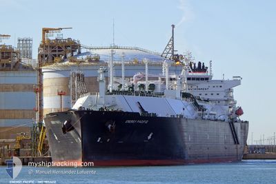
ENERGY PACIFIC
Tanker
Current Trip
FOR ORDERS
| Time Travelled | 13 days |
|---|---|
| Remaining Time | --- |
| Distance Travelled | 5522.63 nm |
| Remaining Distance | --- |
| AVG Speed | 17.3 Knop |
| MAX Speed | 19.5 Knop |
| AVG Wind | 13.2 knots |
| MAX Wind | 22.8 knots |
| MIN Temp | 23.6°C / 74.48°F |
| MAX Temp | 29.4°C / 84.92°F |
| Djupgående | 11.5 m |
| Position mottagen | 8 d sen |
Current Position
| Longitud | -63.82623° |
|---|---|
| Latitude | 12.10603° |
| Status | Under way using engine |
| Fart | 16.4 Knop |
| Kurs | 106.5° |
| Område | Caribbean Sea |
| Station | T-AIS |
| Position mottagen | 8 d sen |
Info
Information
The current position of ENERGY PACIFIC is in Caribbean Sea with coordinates 12.10603° / -63.82623° as reported on 2024-05-24 15:34 by AIS to our vessel tracker app. The vessel's current speed is 16.4 Knop
The vessel ENERGY PACIFIC (IMO: 9854612, MMSI: 538008878) is a Tanker It's sailing under the flag of [MH] Marshall Is.
In this page you can find informations about the vessels current position, last detected port calls, and current voyage information. If the vessels is not in coverage by AIS you will find the latest position.
The current position of ENERGY PACIFIC is detected by our AIS receivers and we are not responsible for the reliability of the data. The last position was recorded while the vessel was in Coverage by the Ais receivers of our vessel tracking app.
The current draught of ENERGY PACIFIC as reported by AIS is 11.5 meters
Weather
| Temperature | 23.6°C / 74.48°F |
|---|---|
| Wind Speed | 20 knots |
| Direction | 101° E |
| Pressure | 1020 hPa |
| Humidity | 70.7 % |
| Cloud Coverage | 50 % |
Featured Company
Last Port Calls
| Port | Arrival | Departure | Time In Port |
|---|---|---|---|
| 2024-05-17 04:13 | 2024-05-19 09:30 | 2 d | |
| 2024-05-01 22:31 | 2024-05-03 01:24 | 1 d |
Most Visited Ports (Last year)
| Port | Arrivals | |
|---|---|---|
| 3 | ||
| 2 | ||
| 2 | ||
| 1 | ||
| 1 | ||
| 1 |
Last Trips
| Origin | Departure | Destination | Arrival | Distance | |
|---|---|---|---|---|---|
| 2024-05-03 01:24 | 2024-05-17 04:13 | 4863.84 nm |
Events
| Tid | Event | Detaljer | Position / Dest | Information |
|---|---|---|---|---|
| 2024-05-24 15:36 | Status ändrad | Default Under way using engine |
12.10309 / -63.81585
FOR ORDERS
|
Fart: 16.4 kn Kurs: 106.5° |
| 2024-05-24 15:34 | Byter havsområde | Venezuelan part of the Caribbean Sea United States part of the Gulf of Mexico |
12.10603 / -63.82623
Caribbean Sea
FOR ORDERS
|
Fart: 16.4 kn Kurs: 106.5° |
| 2024-05-24 15:34 | Status ändrad | Under way using engine Default |
12.10603 / -63.82623
FOR ORDERS
|
Fart: 16.4 kn Kurs: 106° |
| 2024-05-24 15:34 | UTANFÖR täckningsområde |
12.10603 / -63.82623
Caribbean Sea
FOR ORDERS
|
Fart: 16.4 kn Kurs: 106.5° |
|
| 2024-05-24 15:22 | I täckningsområde |
12.10603 / -63.82623
Caribbean Sea
FOR ORDERS
|
Fart: 16.4 kn Kurs: 106.5° |