
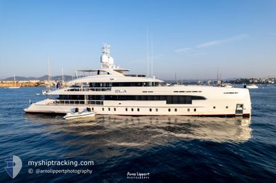
ELA
Pleasure Craft
Current Trip
NASSAU
| Time Travelled | 3 days |
|---|---|
| Remaining Time | --- |
| Distance Travelled | 18.69 nm |
| Remaining Distance | --- |
| AVG Speed | 11.5 Knop |
| MAX Speed | 14 Knop |
| AVG Wind | 10 knots |
| MAX Wind | 13 knots |
| MIN Temp | 23.3°C / 73.94°F |
| MAX Temp | 23.6°C / 74.48°F |
| Djupgående | 2.1 m |
| Position mottagen | 3 d sen |
Current Position
| Longitud | -77.52217° |
|---|---|
| Latitude | 24.99405° |
| Status | At anchor |
| Fart | 0.1 Knop |
| Kurs | 119° |
| Område | North Atlantic Ocean |
| Station | T-AIS |
| Position mottagen | 3 d sen |
Info
Information
The current position of ELA is in North Atlantic Ocean with coordinates 24.99405° / -77.52217° as reported on 2024-04-25 21:16 by AIS to our vessel tracker app. The vessel's current speed is 0.1 Knop
The vessel ELA (IMO: 9902201, MMSI: 538071605) is a Pleasure Craft It's sailing under the flag of [MH] Marshall Is.
In this page you can find informations about the vessels current position, last detected port calls, and current voyage information. If the vessels is not in coverage by AIS you will find the latest position.
The current position of ELA is detected by our AIS receivers and we are not responsible for the reliability of the data. The last position was recorded while the vessel was in Coverage by the Ais receivers of our vessel tracking app.
The current draught of ELA as reported by AIS is 2.1 meters
Weather
| Temperature | 23.5°C / 74.3°F |
|---|---|
| Wind Speed | 13 knots |
| Direction | 69° ENE |
| Pressure | 1017.6 hPa |
| Humidity | 65.8 % |
| Cloud Coverage | 100 % |
Featured Company
Last Port Calls
| Port | Arrival | Departure | Time In Port |
|---|---|---|---|
| 2024-04-25 15:26 | |||
| 2024-04-18 20:11 | 2024-04-18 20:28 | 17 m | |
| 2024-03-01 15:00 | 2024-04-18 20:07 | ||
| 2024-02-16 11:27 | |||
| 2024-02-14 18:22 | 2024-02-16 00:07 | 1 d | |
| 2024-02-13 19:24 | 2024-02-13 20:28 | 1 h | |
| 2024-02-06 18:58 | 2024-02-13 12:35 | 6 d | |
| 2024-02-02 16:50 |
Most Visited Ports (Last year)
| Port | Arrivals | |
|---|---|---|
| 4 | ||
| 3 | ||
| 3 | ||
| 2 | ||
| 2 | ||
| 2 |
Last Trips
| Origin | Departure | Destination | Arrival | Distance | |
|---|---|---|---|---|---|
| 2024-04-18 16:07 | 2024-04-18 16:11 | 0.09 nm | |||
| 2024-02-15 20:07 | 2024-02-16 07:27 | 122.69 nm | |||
| 2024-02-13 16:28 | 2024-02-14 14:22 | 95.33 nm | |||
| 2024-02-13 08:35 | 2024-02-13 15:24 | 90.29 nm | |||
| 2024-02-02 12:50 | 2024-02-06 14:58 | 277.50 nm |
Events
| Tid | Event | Detaljer | Position / Dest | Information |
|---|---|---|---|---|
| 2024-04-25 21:16 | UTANFÖR täckningsområde |
24.99405 / -77.52217
North Atlantic Ocean
|
Fart: 0.1 kn Kurs: 319.4° |
|
| 2024-04-25 17:16 | STOPPAR förflyttning | 11.58 nm, South West of NASSAU |
24.99383 / -77.52209
NASSAU
|
Fart: 0.3 kn Kurs: 98° |
| 2024-04-25 17:14 | Status ändrad | At anchor Under way using engine |
24.99360 / -77.52179
NASSAU
|
Fart: 6 kn Kurs: 96.2° |
| 2024-04-25 15:26 | AVGÅTT HAMN |
|
25.10363 / -77.37441
NASSAU
|
Fart: 9.6 kn Kurs: 331° |
| 2024-04-25 15:12 | I täckningsområde |
25.08344 / -77.33974
North Atlantic Ocean
[BS] NASSAU
|
Fart: 8.3 kn Kurs: 285.4° |
|
| 2024-04-24 22:19 | UTANFÖR täckningsområde |
25.08237 / -77.31978
North Atlantic Ocean
[BS] NASSAU
|
Fart: Kurs: 199° |
|
| 2024-04-24 22:19 | I täckningsområde |
25.08237 / -77.31978
North Atlantic Ocean
[BS] NASSAU
|
Fart: Kurs: 199° |
|
| 2024-04-24 21:01 | UTANFÖR täckningsområde |
25.08238 / -77.31978
North Atlantic Ocean
[BS] NASSAU
|
Fart: Kurs: 163.9° |
|
| 2024-04-24 19:55 | I täckningsområde |
25.08238 / -77.31977
North Atlantic Ocean
[BS] NASSAU
|
Fart: Kurs: 186.2° |
|
| 2024-04-24 18:22 | UTANFÖR täckningsområde |
25.08238 / -77.31977
North Atlantic Ocean
[BS] NASSAU
|
Fart: Kurs: 195.8° |