
ECO MALTA
Cargo A
Current Trip
| Time Travelled | 5 h, 7 mins |
|---|---|
| Remaining Time | 11 h, 49 mins |
| Distance Travelled | 96.25 nm |
| Remaining Distance | 249.65 nm |
| AVG Speed | 18.8 Knop |
| MAX Speed | 20.9 Knop |
| AVG Wind | 11.3 knots |
| MAX Wind | 16.6 knots |
| MIN Temp | 14.9°C / 58.82°F |
| MAX Temp | 18.5°C / 65.3°F |
| Djupgående | 6.3 m |
| Position mottagen | 1 m sen |
Current Position
| Longitud | 7.03879° |
|---|---|
| Latitude | 43.11655° |
| Status | Under way using engine |
| Fart | 20.4 Knop |
| Kurs | 225.9° |
| Område | Mediterranean Sea - Western Basin |
| Station | T-AIS |
| Position mottagen | 1 m sen |
Info
Information
The current position of ECO MALTA is in Mediterranean Sea - Western Basin with coordinates 43.11655° / 7.03879° as reported on 2024-05-09 10:43 by AIS to our vessel tracker app. The vessel's current speed is 20.4 Knop and is heading at the port of BARCELONA. The estimated time of arrival as calculated by MyShipTracking vessel tracking app is 2024-05-09 22:34 LT
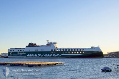
The vessel ECO MALTA (IMO: 9859583, MMSI: 247383800) is a Cargo A It's sailing under the flag of [IT] Italy.
In this page you can find informations about the vessels current position, last detected port calls, and current voyage information. If the vessels is not in coverage by AIS you will find the latest position.
The current position of ECO MALTA is detected by our AIS receivers and we are not responsible for the reliability of the data. The last position was recorded while the vessel was in Coverage by the Ais receivers of our vessel tracking app.
The current draught of ECO MALTA as reported by AIS is 6.3 meters
Weather
| Temperature | 17.6°C / 63.68°F |
|---|---|
| Wind Speed | 7 knots |
| Direction | 348° NNW |
| Pressure | 1018.4 hPa |
| Humidity | 73.4 % |
| Cloud Coverage | 97 % |
Featured Company
Last Port Calls
| Port | Arrival | Departure | Time In Port |
|---|---|---|---|
| 2024-05-08 22:17 | 2024-05-09 05:38 | 7 h | |
| 2024-05-08 06:41 | 2024-05-08 16:45 | 10 h | |
| 2024-05-07 06:04 | 2024-05-07 10:55 | 4 h | |
| 2024-05-05 15:31 | 2024-05-06 18:18 | 1 d | |
| 2024-04-28 07:34 | 2024-05-05 12:25 | 7 d | |
| 2024-04-27 08:10 | 2024-04-28 06:27 | 22 h | |
| 2024-04-19 18:11 | 2024-04-26 07:32 | 6 d | |
| 2024-04-19 04:51 | 2024-04-19 09:52 | 5 h | |
| 2024-04-18 00:05 | 2024-04-18 09:23 | 9 h | |
| 2024-04-17 06:44 | 2024-04-17 19:02 | 12 h |
Last Trips
| Origin | Departure | Destination | Arrival | Distance | |
|---|---|---|---|---|---|
| 2024-05-08 18:45 | 2024-05-09 00:17 | 93.39 nm | |||
| 2024-05-07 12:55 | 2024-05-08 08:41 | 388.67 nm | |||
| 2024-05-06 20:18 | 2024-05-07 08:04 | 162.84 nm | |||
| 2024-05-05 14:25 | 2024-05-05 17:31 | 17.56 nm | |||
| 2024-04-28 08:27 | 2024-04-28 09:34 | 14.88 nm | |||
| 2024-04-26 09:32 | 2024-04-27 10:10 | 12.08 nm | |||
| 2024-04-19 11:52 | 2024-04-19 20:11 | 163.15 nm | |||
| 2024-04-18 11:23 | 2024-04-19 06:51 | 345.44 nm | |||
| 2024-04-17 21:02 | 2024-04-18 02:05 | 93.59 nm | |||
| 2024-04-16 12:25 | 2024-04-17 08:44 | 394.80 nm |
Events
| Tid | Event | Detaljer | Position / Dest | Information |
|---|---|---|---|---|
| 2024-05-09 09:19 | Byter havsområde | French part of the Mediterranean Sea - Western Basin Mon�gasque part of the Mediterranean Sea - Western Basin |
43.44246 / 7.51495
Mediterranean Sea - Western Basin
ITSVN>ESBCN
|
Fart: 20.8 kn Kurs: 226.5° |
| 2024-05-09 09:13 | Byter havsområde | Mon�gasque part of the Mediterranean Sea - Western Basin French part of the Mediterranean Sea - Western Basin |
43.46654 / 7.54921
Mediterranean Sea - Western Basin
ITSVN>ESBCN
|
Fart: 20.7 kn Kurs: 225.9° |
| 2024-05-09 08:58 | Byter havsområde | French part of the Mediterranean Sea - Western Basin Italian part of the Mediterranean Sea - Western Basin |
43.52531 / 7.63681
Mediterranean Sea - Western Basin
ITSVN>ESBCN
|
Fart: 20.8 kn Kurs: 227° |
| 2024-05-09 08:25 | Byter havsområde | Italian part of the Mediterranean Sea - Western Basin Italian part of the Ligurian Sea |
43.65622 / 7.82827
Mediterranean Sea - Western Basin
ITSVN>ESBCN
|
Fart: 20.9 kn Kurs: 227.7° |
| 2024-05-09 07:45 | ETA ändrat | 2024/05/09 22:45 2024/05/10 22:45 |
43.80556 / 8.07266
ITSVN>ESBCN
|
Fart: 20.6 kn Kurs: 232.3° |
| 2024-05-09 07:33 | Status ändrad | Under way using engine Default |
43.84589 / 8.14444
ITSVN>ESBCN
|
Fart: 19.7 kn Kurs: 234° |
| 2024-05-09 07:29 | Status ändrad | Default Under way using engine |
43.86147 / 8.17383
ITSVN>ESBCN
|
Fart: 19 kn Kurs: 230.8° |
| 2024-05-09 05:55 | ETA ändrat | 2024/05/10 22:45 2024/05/08 21:30 |
44.26361 / 8.52573
ITSVN>ESBCN
|
Fart: 18.1 kn Kurs: 196.3° |
| 2024-05-09 05:38 | AVGÅTT HAMN |
|
44.31630 / 8.50553
ITSVN>ESBCN
|
Fart: 7.4 kn Kurs: 67° |
| 2024-05-09 05:36 | Destination ändrad | ITSVN>ESBCN ITLIV>ITSVN |
44.31392 / 8.49932
[IT] SAVONA
|
Fart: 6.7 kn Kurs: 57° |