
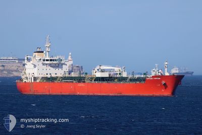
EASTERLY JUPITER
Oil/Chemical Tanker
Current Trip
| Time Travelled | 3 days |
|---|---|
| Remaining Time | --- |
| Distance Travelled | 726.36 nm |
| Remaining Distance | 71.85 nm |
| AVG Speed | 11.2 Knop |
| MAX Speed | 15.7 Knop |
| AVG Wind | 17 knots |
| MAX Wind | 24 knots |
| MIN Temp | 8.7°C / 47.66°F |
| MAX Temp | 11.6°C / 52.88°F |
| Djupgående | 7.2 m |
| Position mottagen | 4 m sen |
Current Position
| Longitud | --- |
|---|---|
| Latitude | --- |
| Status | At anchor |
| Fart | 0.3 Knop |
| Kurs | 196° |
| Område | North Sea |
| Station | T-AIS |
| Position mottagen | 4 m sen |
Info
Information
The current position of EASTERLY JUPITER is in North Sea with coordinates 51.41166° / 2.61941° as reported on 2025-12-15 18:59 by AIS to our vessel tracker app. The vessel's current speed is 0.3 Knop and is heading at the port of ANTWERP. The estimated time of arrival as calculated by MyShipTracking vessel tracking app is 2025-12-14 23:30 LT
The vessel EASTERLY JUPITER (IMO: 9383962, MMSI: 538010209) is a Oil/Chemical Tanker that was built in 2009 ( 16 År gammal ). It's sailing under the flag of [MH] Marshall Is.
In this page you can find informations about the vessels current position, last detected port calls, and current voyage information. If the vessels is not in coverage by AIS you will find the latest position.
The current position of EASTERLY JUPITER is detected by our AIS receivers and we are not responsible for the reliability of the data. The last position was recorded while the vessel was in Coverage by the Ais receivers of our vessel tracking app.
The current draught of EASTERLY JUPITER as reported by AIS is 7.2 meters
Weather
| Temperature | 10°C / 50°F |
|---|---|
| Wind Speed | 18 knots |
| Direction | 186° S |
| Pressure | 1008.6 hPa |
| Humidity | 84.5 % |
| Cloud Coverage | 85 % |
Featured Company
Last Port Calls
| Port | Arrival | Departure | Time In Port |
|---|---|---|---|
| 2025-12-09 10:17 | 2025-12-12 09:23 | 2 d | |
| 2025-12-04 12:39 | 2025-12-06 17:52 | 2 d | |
| 2025-11-19 02:23 | 2025-11-21 22:56 | 2 d | |
| 2025-11-12 23:44 | 2025-11-17 19:11 | 4 d | |
| 2025-11-11 18:26 | 2025-11-11 19:27 | 1 h | |
| 2025-11-10 00:56 | 2025-11-11 17:33 | 1 d | |
| 2025-11-07 20:35 | 2025-11-10 00:22 | 2 d | |
| 2025-11-07 18:24 | 2025-11-07 19:50 | 1 h | |
| 2025-11-02 01:58 | 2025-11-05 03:57 | 3 d | |
| 2025-10-27 17:32 | 2025-10-30 08:19 | 2 d |
Last Trips
| Origin | Departure | Destination | Arrival | Distance | |
|---|---|---|---|---|---|
| 2025-12-06 17:52 | 2025-12-09 10:17 | 639.64 nm | |||
| 2025-11-21 22:56 | 2025-12-04 12:39 | 226.82 nm | |||
| 2025-11-17 19:11 | 2025-11-19 02:23 | 281.21 nm | |||
| 2025-11-11 19:27 | 2025-11-12 23:44 | 292.36 nm | |||
| 2025-11-11 17:33 | 2025-11-11 18:26 | 4.40 nm | |||
| 2025-11-10 00:22 | 2025-11-10 00:56 | 3.56 nm | |||
| 2025-11-07 19:50 | 2025-11-07 20:35 | 4.66 nm | |||
| 2025-11-05 03:57 | 2025-11-07 18:24 | 717.65 nm | |||
| 2025-10-30 08:19 | 2025-11-02 01:58 | 249.95 nm | |||
| 2025-10-22 20:35 | 2025-10-27 17:32 | 594.86 nm |
Events
| Tid | Event | Detaljer | Position / Dest | Information |
|---|---|---|---|---|
| 2025-12-15 13:11 | Status ändrad | At anchor Default |
51.41169 / 2.61929
BEANR
|
Fart: Kurs: -1° |
| 2025-12-15 13:10 | Status ändrad | Default At anchor |
51.41167 / 2.61833
BEANR
|
Fart: 0.5 kn Kurs: 171° |
| 2025-12-15 00:59 | Status ändrad | At anchor Default |
51.41163 / 2.61875
BEANR
|
Fart: 0.1 kn Kurs: 200° |
| 2025-12-15 00:56 | Status ändrad | Default At anchor |
51.41167 / 2.61941
BEANR
|
Fart: 0.5 kn Kurs: 176° |
| 2025-12-14 20:29 | Status ändrad | At anchor Under way using engine |
51.41131 / 2.62018
BEANR
|
Fart: 0.3 kn Kurs: 210° |
| 2025-12-14 20:29 | STOPPAR förflyttning | 16.46 nm, North West of OOSTENDE |
51.41132 / 2.62023
BEANR
|
Fart: 0.3 kn Kurs: 210° |
| 2025-12-14 18:58 | Byter havsområde | Belgian part of the North Sea French part of the North Sea |
51.32905 / 2.35875
North Sea
BEANR
|
Fart: 12.7 kn Kurs: 66.2° |
| 2025-12-14 16:26 | Byter havsområde | French part of the North Sea French part of the English Channel |
51.01696 / 1.61268
North Sea
BEANR
|
Fart: 12.6 kn Kurs: 46.2° |
| 2025-12-14 13:58 | Status ändrad | Under way using engine Default |
50.60124 / 1.16958
BEANR
|
Fart: 12.7 kn Kurs: 51° |
| 2025-12-14 13:57 | Status ändrad | Default Under way using engine |
50.59933 / 1.16593
BEANR
|
Fart: 12.8 kn Kurs: 50.3° |