
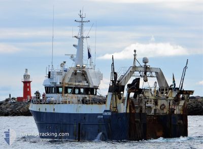
DONA JANE
Trawler
Current Trip
CAPE TOWN
| Time Travelled | 1 day |
|---|---|
| Remaining Time | --- |
| Distance Travelled | 57.88 nm |
| Remaining Distance | --- |
| AVG Speed | 7.9 Knop |
| MAX Speed | 9.2 Knop |
| AVG Wind | 7.2 knots |
| MAX Wind | 9.3 knots |
| MIN Temp | 17.7°C / 63.86°F |
| MAX Temp | 20.6°C / 69.08°F |
| Djupgående | 5.4 m |
| Position mottagen | 1 d sen |
Current Position
| Longitud | --- |
|---|---|
| Latitude | --- |
| Status | Restricted manoeuverability |
| Fart | 8 Knop |
| Kurs | 169.1° |
| Område | South Atlantic Ocean |
| Station | T-AIS |
| Position mottagen | 1 d sen |
Info
Information
The current position of DONA JANE is in South Atlantic Ocean with coordinates -34.74285° / 18.48720° as reported on 2025-12-09 04:29 by AIS to our vessel tracker app. The vessel's current speed is 8 Knop
The vessel DONA JANE (IMO: 9032472, MMSI: 601209700) is a Trawler that was built in 1992 ( 33 År gammal ). It's sailing under the flag of [ZA] South Africa.
In this page you can find informations about the vessels current position, last detected port calls, and current voyage information. If the vessels is not in coverage by AIS you will find the latest position.
The current position of DONA JANE is detected by our AIS receivers and we are not responsible for the reliability of the data. The last position was recorded while the vessel was in Coverage by the Ais receivers of our vessel tracking app.
The current draught of DONA JANE as reported by AIS is 5.4 meters
Weather
| Temperature | 20.6°C / 69.08°F |
|---|---|
| Wind Speed | 7 knots |
| Direction | 237° WSW |
| Pressure | 1015.9 hPa |
| Humidity | 79 % |
| Cloud Coverage | 100 % |
Featured Company
Most Visited Ports (Last year)
| Port | Arrivals | |
|---|---|---|
| 17 |
Events
| Tid | Event | Detaljer | Position / Dest | Information |
|---|---|---|---|---|
| 2025-12-09 04:29 | UTANFÖR täckningsområde |
-34.74285 / 18.48720
South Atlantic Ocean
|
Fart: 8 kn Kurs: 169.1° |
|
| 2025-12-09 01:45 | I täckningsområde |
-34.39079 / 18.38436
South Atlantic Ocean
|
Fart: 7.6 kn Kurs: 146.2° |
|
| 2025-12-09 00:13 | UTANFÖR täckningsområde |
-34.19831 / 18.27718
South Atlantic Ocean
|
Fart: 8.9 kn Kurs: 183.5° |
|
| 2025-12-08 21:21 | AVGÅTT HAMN |
|
-33.89676 / 18.43642
CAPE TOWN
|
Fart: 5.8 kn Kurs: 335° |
| 2025-12-08 21:14 | STARTAR förflyttning |
-33.90227 / 18.42933
[ZA] CAPE TOWN
|
Fart: 4.4 kn Kurs: 60° |
|
| 2025-12-08 21:01 | I täckningsområde |
-33.90366 / 18.42761
South Atlantic Ocean
[ZA] CAPE TOWN
|
Fart: Kurs: 334.4° |
|
| 2025-12-06 07:11 | UTANFÖR täckningsområde |
-33.90366 / 18.42761
South Atlantic Ocean
[ZA] CAPE TOWN
|
Fart: 0.1 kn Kurs: 227.9° |
|
| 2025-12-05 14:57 | STOPPAR förflyttning |
-33.90397 / 18.42777
[ZA] CAPE TOWN
|
Fart: 0.3 kn Kurs: 2° |
|
| 2025-12-05 14:44 | ANLÄNDER HAMN |
|
-33.89799 / 18.43523
[ZA] CAPE TOWN
|
Fart: 4.8 kn Kurs: 180° |
| 2025-12-05 11:47 | I täckningsområde |
-34.25899 / 18.24738
South Atlantic Ocean
|
Fart: 10 kn Kurs: 350.3° |