
DOENNLAND
Fish Carrier
Current Trip
HELLARVIKA
| Time Travelled | 15 h, 37 mins |
|---|---|
| Remaining Time | --- |
| Distance Travelled | 62.01 nm |
| Remaining Distance | --- |
| AVG Speed | 6.8 Knop |
| MAX Speed | 9.4 Knop |
| AVG Wind | 4 knots |
| MAX Wind | 9 knots |
| MIN Temp | 5.8°C / 42.44°F |
| MAX Temp | 11.4°C / 52.52°F |
| Djupgående | 5.2 m |
| Position mottagen | 2 m sen |
Current Position
| Longitud | 15.11009° |
|---|---|
| Latitude | 67.90912° |
| Status | Under way using engine |
| Fart | 5.7 Knop |
| Kurs | 269.9° |
| Område | Norwegian Sea |
| Station | T-AIS |
| Position mottagen | 2 m sen |
Info
Information
The current position of DOENNLAND is in Norwegian Sea with coordinates 67.90912° / 15.11009° as reported on 2024-05-02 09:13 by AIS to our vessel tracker app. The vessel's current speed is 5.7 Knop
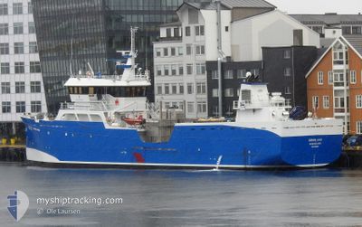
The vessel DOENNLAND (IMO: 9632569, MMSI: 257797000) is a Fish Carrier that was built in 2012 ( 12 År gammal ). It's sailing under the flag of [NO] Norway.
In this page you can find informations about the vessels current position, last detected port calls, and current voyage information. If the vessels is not in coverage by AIS you will find the latest position.
The current position of DOENNLAND is detected by our AIS receivers and we are not responsible for the reliability of the data. The last position was recorded while the vessel was in Coverage by the Ais receivers of our vessel tracking app.
The current draught of DOENNLAND as reported by AIS is 5.2 meters
Weather
| Temperature | 6.1°C / 42.98°F |
|---|---|
| Wind Speed | 9 knots |
| Direction | 61° ENE |
| Pressure | 1023.6 hPa |
| Humidity | 81.3 % |
| Cloud Coverage | 65 % |
Featured Company
Events
| Tid | Event | Detaljer | Position / Dest | Information |
|---|---|---|---|---|
| 2024-05-02 08:24 | Destination ändrad | HELLARVIKA HOLMVAAG |
67.88506 / 15.25853
HELLARVIKA
|
Fart: 6.6 kn Kurs: 30.8° |
| 2024-05-02 08:24 | ETA ändrat | 2024/05/02 18:00 2024/05/02 04:30 |
67.88506 / 15.25853
HELLARVIKA
|
Fart: 6.6 kn Kurs: 30.8° |
| 2024-05-02 08:05 | STARTAR förflyttning |
67.85976 / 15.19900
HOLMVAAG
|
Fart: 6.1 kn Kurs: 36.2° |
|
| 2024-05-02 02:26 | STOPPAR förflyttning |
67.85701 / 15.19215
HOLMVAAG
|
Fart: 0.1 kn Kurs: 203° |
|
| 2024-05-02 00:05 | STARTAR förflyttning | 21.05 nm, South East of HENNINGSVAR |
67.86853 / 14.74610
HOLMVAAG
|
Fart: 4.5 kn Kurs: 66° |
| 2024-05-01 23:42 | STOPPAR förflyttning | 21.06 nm, South East of HENNINGSVAR |
67.86671 / 14.73952
HOLMVAAG
|
Fart: 0.3 kn Kurs: 32° |
| 2024-05-01 19:46 | Destination ändrad | HOLMVAAG BODO |
67.53182 / 14.50066
HOLMVAAG
|
Fart: 7.3 kn Kurs: 9° |
| 2024-05-01 19:46 | ETA ändrat | 2024/05/02 04:30 2024/05/01 10:00 |
67.53182 / 14.50066
HOLMVAAG
|
Fart: 7.3 kn Kurs: 9° |
| 2024-05-01 17:38 | AVGÅTT HAMN |
|
67.28598 / 14.36106
BODO
|
Fart: 4.6 kn Kurs: 337° |
| 2024-05-01 17:34 | STARTAR förflyttning |
67.28676 / 14.37730
[NO] BODOE
|
Fart: 4.2 kn Kurs: 252° |