
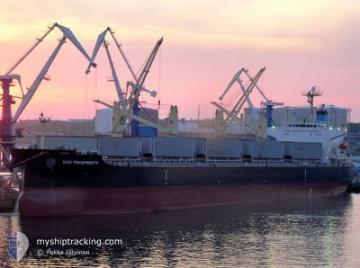
COS PROSPERITY
Bulk Carrier
Current Trip
| Time Travelled | 53 days |
|---|---|
| Remaining Time | 18 h, 36 mins |
| Distance Travelled | 9597.15 nm |
| Remaining Distance | 259.22 nm |
| AVG Speed | 11 Knop |
| MAX Speed | 15.1 Knop |
| AVG Wind | 13.7 knots |
| MAX Wind | 34 knots |
| MIN Temp | 10.7°C / 51.26°F |
| MAX Temp | 29.5°C / 85.1°F |
| Djupgående | 11.3 m |
| Position mottagen | 1 m sen |
Current Position
| Longitud | 1.82062° |
|---|---|
| Latitude | 51.21488° |
| Status | Under way using engine |
| Fart | 13.2 Knop |
| Kurs | 40° |
| Område | North Sea |
| Station | T-AIS |
| Position mottagen | 1 m sen |
Info
Information
The current position of COS PROSPERITY is in North Sea with coordinates 51.21488° / 1.82062° as reported on 2024-05-06 13:34 by AIS to our vessel tracker app. The vessel's current speed is 13.2 Knop and is heading at the port of TEES. The estimated time of arrival as calculated by MyShipTracking vessel tracking app is 2024-05-07 08:11 LT
The vessel COS PROSPERITY (IMO: 9308716, MMSI: 565101000) is a Bulk Carrier that was built in 2006 ( 18 År gammal ). It's sailing under the flag of [SG] Singapore.
In this page you can find informations about the vessels current position, last detected port calls, and current voyage information. If the vessels is not in coverage by AIS you will find the latest position.
The current position of COS PROSPERITY is detected by our AIS receivers and we are not responsible for the reliability of the data. The last position was recorded while the vessel was in Coverage by the Ais receivers of our vessel tracking app.
The current draught of COS PROSPERITY as reported by AIS is 11.3 meters
Weather
| Temperature | 11.8°C / 53.24°F |
|---|---|
| Wind Speed | 9 knots |
| Direction | 144° SE |
| Pressure | 1007.3 hPa |
| Humidity | 97.4 % |
| Cloud Coverage | 100 % |
Featured Company
Events
| Tid | Event | Detaljer | Position / Dest | Information |
|---|---|---|---|---|
| 2024-05-06 12:49 | Byter havsområde | United Kingdom part of the North Sea French part of the North Sea |
51.08004 / 1.65897
North Sea
TEESPORT
|
Fart: 14.1 kn Kurs: 36.7° |
| 2024-05-06 12:32 | Byter havsområde | French part of the North Sea French part of the English Channel |
51.02605 / 1.59536
North Sea
TEESPORT
|
Fart: 14.4 kn Kurs: 36.7° |
| 2024-05-06 11:54 | ETA ändrat | 2024/05/07 18:00 2024/05/07 19:00 |
50.89420 / 1.45766
TEESPORT
|
Fart: 14.7 kn Kurs: 20.2° |
| 2024-05-06 10:17 | Status ändrad | Under way using engine Default |
50.58604 / 1.14770
TEESPORT
|
Fart: 13.5 kn Kurs: 49° |
| 2024-05-06 10:04 | Status ändrad | Default Under way using engine |
50.55592 / 1.08753
TEESPORT
|
Fart: 13.4 kn Kurs: 53.8° |
| 2024-05-06 09:58 | Byter havsområde | French part of the English Channel United Kingdom part of the English Channel |
50.54205 / 1.05902
English Channel
TEESPORT
|
Fart: 13.4 kn Kurs: 53.8° |
| 2024-05-06 09:58 | Status ändrad | Under way using engine Default |
50.54205 / 1.05902
TEESPORT
|
Fart: 13.4 kn Kurs: 52° |
| 2024-05-06 09:56 | I täckningsområde |
50.54205 / 1.05902
English Channel
TEESPORT
|
Fart: 13.4 kn Kurs: 53.8° |
|
| 2024-05-06 08:52 | Status ändrad | Default Under way using engine |
50.46537 / .71313
TEESPORT
|
Fart: 13.3 kn Kurs: 65.9° |
| 2024-05-06 08:45 | UTANFÖR täckningsområde |
50.45525 / .67624
English Channel
TEESPORT
|
Fart: 13.3 kn Kurs: 65.9° |